The first thing Simon Oxley does when he starts packing for a big trip is cut his toothbrush in half. He acknowledges this saves about five grams. He does it anyway, he says, as a psychological signal to himself — a commitment that if he's bothered to do that, he has to pare everything else down too. Every item after that gets considered against the same question: is there a lighter alternative?
He carried 17 kilograms on the Sierra High Route. That is, to put it in the terms he offers, roughly equivalent to the kind of large suitcase you see people rolling through airports — on his back, for 23 days, through terrain with no path, no signposts, and no cairns.
For Simon, it’s clear that this is simply what trips look like.
· · ·
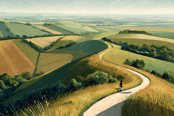
The Sierra High Route runs 195 miles along the crest of California's Sierra Nevada, criss-crossing the main ridge, staying as high as possible, and spending more than half its distance completely off any marked trail. It was devised as an alternative to the John Muir Trail — which Simon had walked a section of in the late 1980s, on a US tour with five days to spare — on the basis that the JMT drops too often into valleys, wandering away from the high terrain where the Sierra is most itself.
At the end of that original JMT section, Simon had cut across to a town called Bishop via a pass called Potluck. The guidebook had one line about it. He scrambled up with a big rucksack and had what he describes, with evident pleasure, as a total epic. He wrote "good!" in the margin of the guide. This is, he explains, shorthand for: worth recommending to someone else so they have a similar epic.
Thirty years later, planning a return to the Sierra, he found that Potluck Pass was on the Sierra High Route. He went back.
Finding the Line
The route crosses the Sierra crest repeatedly over passes that range from straightforward to technically demanding, and the word that comes up repeatedly is "feasible." You're not looking for the easiest way — you're looking for a way that is achievable with a 17-kilogram pack, which is a more specific problem. Simon and his companion Roger would approach each pass, scan the terrain, pick a line, discover it didn't work, backtrack, try another. The guidebook's instructions were typically a sentence or two. Go over that pass. The rest was theirs to solve.
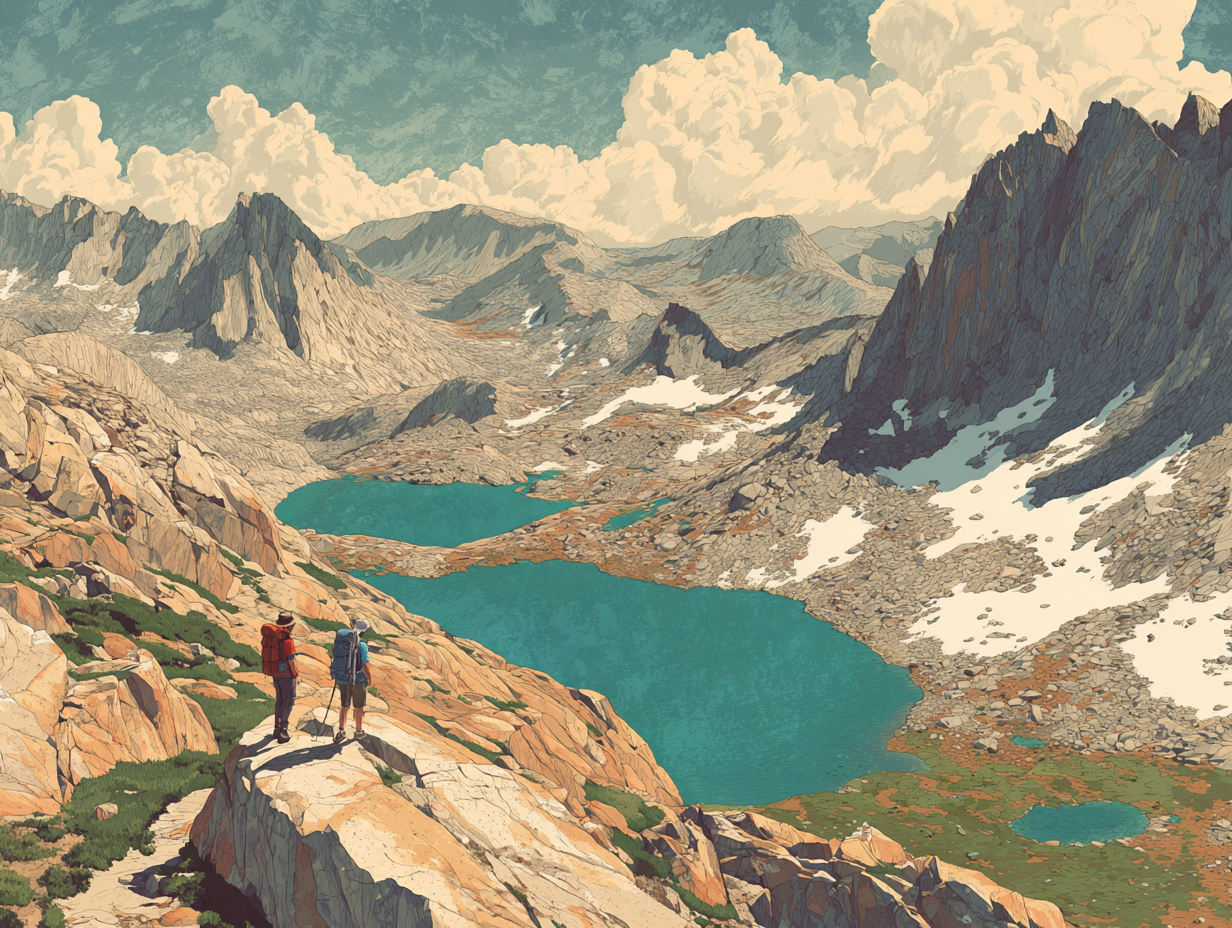
At one pass in particular — he doesn't remember the name, and the name perhaps doesn't matter — they scrambled up through difficult terrain, found the top, and looked down the other side. Below them: turquoise lakes. A small meadow beside the nearest one. They had not seen another person for two or three days.
"Right," Simon thought. "That's our campsite for the night."
There was a lake called Iceberg Lake that he mentions separately, half-frozen even in late June, actual icebergs drifting in it. He tells me about Thousand Island Lake — a very long lake studded with islands, another example of the literal naming conventions of American wilderness topography. He says he wishes they'd had time to swim in it. The water would have been extremely cold but he sounds genuinely regretful about not getting in.

The logistics required serious planning. Seven days was the maximum food they could carry, partly dictated by the bear canister — a polycarbonate cylinder, 40 centimetres tall, a kilogram and a half of its own weight, designed with a diameter too large for a bear's jaw to grip. Everything edible went inside it. At night, it lived 50 metres from the tent. They never had a bear encounter, which Simon notes with slight disappointment.
They resupplied twice in 23 days, hitching down into towns to collect packages they'd mailed ahead. Their food after resupply was mostly commercial dehydrated meals — which he notes have improved enormously since his early backpacking days — plus a batch of homemade flapjacks produced on a production line across two kitchens in the UK and shipped to the States before departure. He never got bored of the flapjacks.
After a resupply, with seven days of food and the full weight of the canister in the pack, the total came to 17 kilograms. At the start of a section, not yet acclimatised to altitude, not yet trail-fit, 17 kilograms on your back is a specific kind of misery. Simon only mentions this misery in passing though, in the same tone he uses for everything else.
What Makes It Hard
The route is sometimes described as the hardest trail in North America. Simon disagrees, on the grounds that the Pacific Crest Trail and the Appalachian Trail are both longer, and he has since found a route called the Hayduke Trail that looks significantly harder. What the Sierra High Route is, he thinks, is navigationally and technically demanding in a way that many long trails simply aren't.
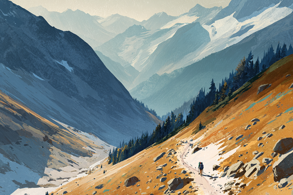
The terrain that slows you most is the talus — immense boulder fields, technically walkable but requiring constant attention to each placement of the foot. A day of 10 miles might take 10 hours. The navigation is its own challenge, not because the Sierra is unclear once you understand it, but because understanding it takes experience — reading the rock, picking feasible lines, accepting that a pass that looks straightforward from below may require two or three attempts to find a route through.

Simon took microspikes and wore them about three times. He took a raincoat and wore it once, for a storm near the end of the trip, after which they had to tackle a soaking wet scramble that was all the more difficult for being wet. He took a three-man tent for two people, which he lists as his main luxury — the extra room, over 23 days, justifying the weight. Water was everywhere, which meant they didn't have to carry much, but did need a filter, because Giardia has become prevalent in the Sierra and the water, however clear it looks, requires treatment.
For safety, they carried a satellite beacon for the first time on this trip. An older model — no messaging capability, just a red button that meant call for help. Simon had never taken one before. He found it quietly reassuring in terrain where a twisted ankle could mean you’re several days from the nearest road.

They passed Pacific Crest Trail hikers regularly — people two months into a four-month trip, trail-hardened and efficient in a way that 23 days doesn't quite produce. Near the end, a group of three passed them on the same route, heading south in nine days. They were doing the trip partly as a recce for a ski traverse of the Sierra High Route — the whole thing, in four or five days, because snow covers the talus and makes it fast rather than slow. This is now on Simon’s own list.
He talks about the John Muir Trail as the right preparation for the High Route — the terrain is similar, the permit system limits the crowds effectively, and the light in the Sierra, which John Muir called the Range of Light, is reason enough to go regardless of which route you choose. The way it falls on the lakes and the granite and the trees is a highlight in itself.
He’d go back and next time he’d swim in Thousand Island Lake, no matter how cold the water is.