Cotswold Way Overview
- Quintessential Lake District landscapes
- Cultural heritage at every turn
- Accessible challenge for most abilities
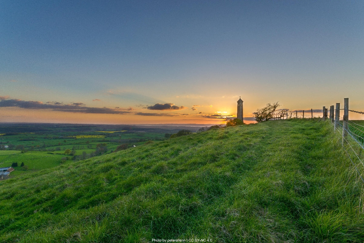
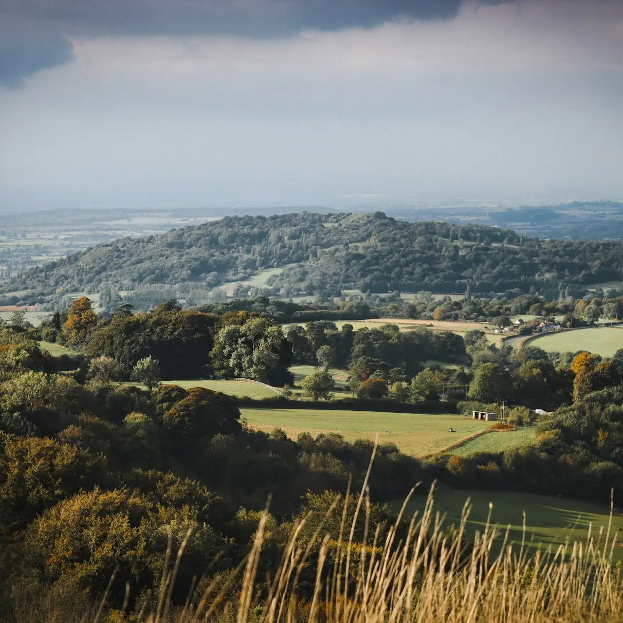
The Cotswold Way, an iconic National Trail established in 2007, weaves through 102 miles (164 km) of England's most picturesque countryside, connecting the market town of Chipping Campden to the historic city of Bath. This meticulously maintained path traverses the Cotswold escarpment, a limestone ridge offering dramatic views across the Severn Vale to the Malvern Hills and, on clear days, as far as Wales. The trail undulates between 100-300 meters elevation, accumulating approximately 4,300m... Read more
| Hilliness | |
| Start Point | Chipping Campden Market Hall |
| End Point | Bath Abbey |
| Activity Type | Walking, Hiking, Trail Running |
| Distance | 164km | 102 miles |
| Ascent | 4,300m | 14,100ft |
| When to go | April-October (peak conditions May-September) |
| Baggage Transfer | Available |
From £624.00
Based on a Standard Package for two people.
Build Your Adventure
Not ready to book?
Call us on 0131 560 2740
or enquire by email
What's included?
-
Custom Adventure Plan
-
Accommodation options for you
-
Door‑to‑door GPX in our app
-
On‑trail support
-
Share with up to four people
Sample Itinerary
Here's what's on the trail. We'll split the stages to each day just right for your pace.
Key Features: Chipping Campden Market Hall, Dover's Hill, Broadway Tower, Fish Hill
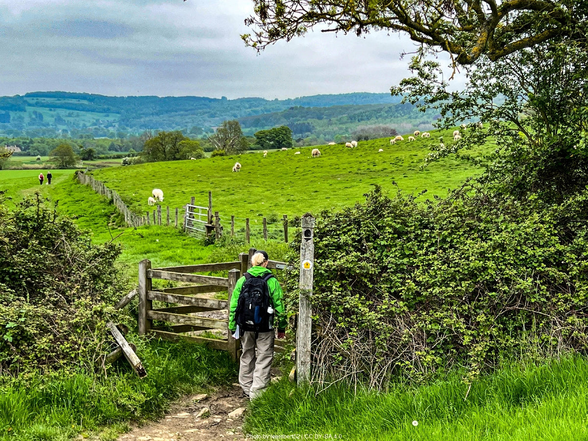
The journey begins in the charming market town of Chipping Campden with its magnificent wool church and historic Market Hall (1627). After leaving the town, the trail immediately climbs to Dover's Hill, offering panoramic views across the Vale of Evesham toward the Malvern Hills. This National Trust site hosts the annual "Cotswold Olimpicks" since 1612. The path continues through a patchwork of fields and woodland to Broadway Tower, a striking 18th-century folly standing at 312m above sea level – the Cotswolds' second-highest point. From this excellent vantage point, visibility can extend to 16 counties on clear days.
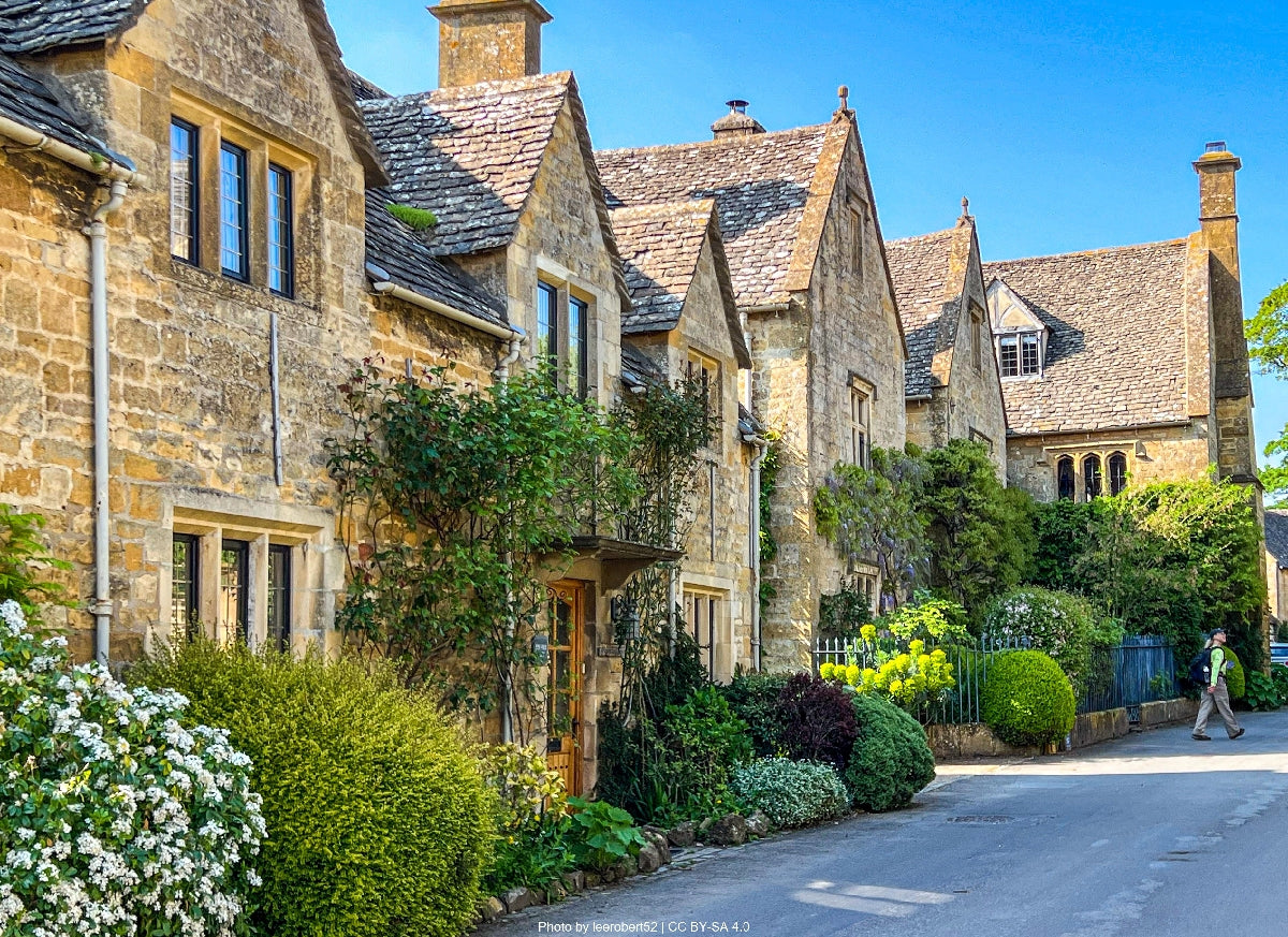
After descending to the village of Broadway with its wide main street lined with horse chestnut trees, the trail climbs back up to the escarpment via Fish Hill. The afternoon walk features ancient woodlands, including patches of rare native box trees at Buckland Wood, before arriving in Stanton. This unspoiled medieval village features traditional Cotswold architecture with houses built from locally quarried oolitic limestone dating from the 16th and 17th centuries. The Mount Inn provides refreshment with spectacular valley views, while St. Michael's Church shows how ecclesiastical architecture evolved from Norman to Perpendicular Gothic.
Water is readily available in villages, with public taps in Chipping Campden, Broadway, and Stanton.
Key Features: Stanway House, Hailes Abbey, Sudeley Castle, Winchcombe, Belas Knap
Leaving picturesque Stanton, the trail passes through the village of Stanway, dominated by Stanway House with its magnificent gatehouse and 14th-century tithe barn. Soon after comes Hailes Abbey, established in 1246 and once a major pilgrimage site due to its "Holy Blood" relic. Though now in ruins following Henry VIII's dissolution of monasteries, the site offers fascinating historical insights with well-preserved foundations and an excellent museum.
The path continues to Winchcombe, a former Saxon capital of Mercia, passing close to Sudeley Castle – the final residence of Katherine Parr, Henry VIII's surviving wife. Winchcombe provides an excellent resupply point with several shops, cafés, and accommodations. Look for the unique gargoyles on St. Peter's Church and the town's folk museum housed in a 17th-century merchant's house.
Leaving Winchcombe, the trail climbs steadily to Belas Knap, an impressive Neolithic long barrow dating from approximately 3000 BCE, which once contained the remains of at least 38 individuals. The final section traverses open grassland rich in wildflowers during spring and summer, culminating at Cleeve Hill – the highest point of both the Cotswold Way and the entire Cotswold range at 330m. The limestone grasslands here constitute a Site of Special Scientific Interest, home to rare butterflies and orchids. Panoramic views extend across Cheltenham, the Severn Vale, and into Wales.
Water sources include public taps in Winchcombe and the Rising Sun pub on Cleeve Hill.
Key Features: Cleeve Common, Dowdeswell Reservoir, Crickley Hill, Leckhampton Hill, Devil's Chimney
This challenging stage begins atop Cleeve Hill, traversing Cleeve Common – the largest area of limestone grassland in the Cotswolds. The ancient grazing traditions here maintain the rare flora, including purple milk-vetch and musk orchids. The path follows the escarpment edge, providing dramatic westward views before descending to Dowdeswell Reservoir, an important waterfowl habitat.
After crossing the A40, the trail climbs steeply through beech woodlands to Crickley Hill Country Park, an important archaeological site occupied from Neolithic to Roman times. Evidence shows violent destruction occurred here around 3900 BCE, possibly representing prehistoric territorial warfare. The adjacent Air Balloon pub provides refreshment before continuing to Leckhampton Hill, known for its quarrying history and distinctive rock formation, the Devil's Chimney – a slender pillar of limestone left by quarrymen.
The trail continues through a mosaic of ancient woodland and grassland plateaus, where you might spot rare Duke of Burgundy butterflies in May and June. After passing near Cowley village, the path descends into woodland before climbing to Birdlip, a small settlement offering accommodation and meals at the Royal George Hotel. Just beyond lies Barrow Wake viewpoint, known for its archaeological significance and exceptional sunset views across Gloucester toward the Forest of Dean.
Water is available at the Air Balloon pub, Leckhampton Hill car park (seasonal), and in Birdlip village.
Key Features: Cooper's Hill, Great Witcombe Roman Villa, Painswick Beacon, Painswick Rococo Garden
Leaving Birdlip, the trail immediately enters ancient beech woodlands, home to breeding populations of marsh tits and nuthatches. After passing the distinctive trig point at Birdlip Hill, the path traverses the famous Cooper's Hill, site of the annual cheese-rolling competition where competitors chase an 8-pound Double Gloucester cheese down the precipitous 1:2 gradient slope – a tradition dating back at least 200 years.
A slight detour (1.5km) leads to Great Witcombe Roman Villa, the remains of a substantial 2nd-century residence with remarkable mosaic floors and bath complex, demonstrating the area's prosperity during Roman occupation. Returning to the main trail, the path traverses mixed woodland before emerging onto Painswick Beacon – the site of an impressive Iron Age hill fort with clearly visible ramparts and extensive views.
The trail descends toward Painswick, known as the "Queen of the Cotswolds," a wonderfully preserved settlement with streets hardly changed since its prosperous 17th-century wooltrading days. St. Mary's churchyard contains 99 meticulously trimmed yew trees (legend claims the devil would destroy the hundredth). The internationally renowned Painswick Rococo Garden, the only complete surviving rococo garden in Britain, sits on the town's edge and showcases the playful, ornate style popular in the 1740s.
Water is available in Painswick, which also offers numerous accommodation options including the historic Falcon Inn and several B&Bs. The town provides good resupply opportunities with bakeries, small shops, and tea rooms.
Key Features: Haresfield Beacon, Standish Woods, Selsley Common, Nympsfield Long Barrow, Coaley Peak
This longer stage begins by climbing from Painswick through mixed woodland to Edge Common, offering views back to Painswick Beacon. The trail continues to Haresfield Beacon with its well-preserved Iron Age hill fort. Here, information boards explain the site's defensive structures and historical significance. The views extend across the Severn Vale to the Forest of Dean and the Black Mountains of Wales.
Traversing Standish Woods, an ancient beech forest carpeted with bluebells in spring, the path passes through King's Stanley and crosses the Stroudwater Canal, an important industrial heritage feature that once transported cloth from Stroud's mills. After climbing to Selsley Common, you'll encounter rare limestone grassland flora including bee orchids and rock rose.
The trail continues to Nympsfield Long Barrow, an accessible Neolithic burial chamber dating from around 2800 BCE that once contained the remains of approximately 20 individuals. Nearby Coaley Peak viewpoint provides an excellent picnic spot with interpretive displays explaining the geological formation of the Cotswold escarpment. The final section descends through woodland to Dursley, a historic market town with buildings spanning medieval to Victorian eras.
The 13th-century St. James Church features an unusual octagonal tower, while the heritage center in the market house explains Dursley's cloth and engineering manufacturing history, including production of Lister engines and early Reliant cars. The town offers various accommodation options and good resupply points including supermarkets and outdoor equipment shops.
Water sources include taps at Coaley Peak car park and comprehensive facilities in Dursley.
Key Features: Cam Long Down, Uley Bury, Owlpen Manor, Tyndale Monument, Wotton-under-Edge
This shorter stage begins with a steep ascent from Dursley to Cam Long Down, a distinctive whale-backed hill offering 360-degree views. The hillside reveals evidence of medieval strip lynchets – terraces created for agriculture on steep slopes. The trail continues to Uley Bury, one of the Cotswolds' largest Iron Age hill forts, enclosing 32 acres with its massive ramparts still rising to 3m in places. Archaeological finds here span from Neolithic to Roman periods.
A short detour leads to Hetty Pegler's Tump (also called Uley Long Barrow), a well-preserved Neolithic burial chamber that can be entered. Continuing along the escarpment, glimpses of Owlpen Manor become visible in the valley below – a Tudor manor house surrounded by terraced gardens and ancient yew trees, considered one of England's most romantic early manor houses.
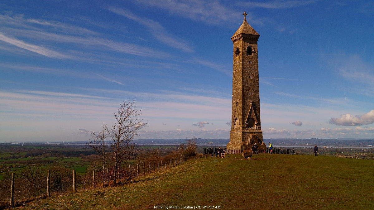
The trail climbs Downham Hill before making the final ascent to the Tyndale Monument, a 34m tower built in 1866 to commemorate William Tyndale, the first translator of the New Testament into English, who was born nearby. From this prominent landmark, the path descends into Wotton-under-Edge, a charming market town with over 350 listed buildings.
Wotton features narrow streets lined with shops, a 13th-century church, and the historic Tolsey Building (former wool market). The town maintains strong arts traditions with an annual arts festival and the country's oldest continuously operated cinema, The Electric Picture House (1913). Accommodation ranges from the 16th-century Swan Hotel to numerous B&Bs, while the town offers good resupply options including bakeries, a supermarket, and outdoor equipment at the Walking Shop.
Water sources include public facilities in Dursley and Wotton-under-Edge, with limited natural sources between settlements.
Key Features: Newark Park, Lower Woods Nature Reserve, Hawkesbury Upton, Dyrham Park, Little Sodbury Hill Fort
This challenging stage begins by climbing from Wotton through Westridge Wood to Newark Park, a Tudor hunting lodge later expanded into a Georgian country home. The National Trust property features terraced gardens with exceptional views. The path then traverses the edge of Lower Woods Nature Reserve, one of England's largest ancient woodlands, home to dormice and greater spotted woodpeckers.
After passing through Alderley with its distinctive steepled church, the trail climbs to the village of Hawkesbury Upton. The Somerset Monument stands prominently here – a 100ft tower commemorating Lord Edward Somerset, a Napoleonic Wars general. The Beaufort Arms provides refreshments before the path continues across farmland to the abandoned village of Dyrham, partially depopulated during 14th-century plagues.
Nearby Dyrham Park is a spectacular National Trust property featuring a late 17th-century baroque mansion set in ancient deer park. Though requiring a detour, its magnificent interiors showcase period furniture and Dutch artworks. The trail continues to Little Sodbury Hill Fort, an Iron Age settlement later occupied by Romans, with evidence of a villa within its ramparts. The manor house below (private) hosted William Tyndale as chaplain before his Bible translation work.
The final section crosses open farmland to Tormarton, a small village with distinctive limestone architecture. St. Mary Magdalene Church combines Norman and Perpendicular Gothic elements with an unusual centrally-positioned tower. The Major's Retreat pub offers meals and limited accommodation.
Water sources include taps in Hawkesbury Upton and Tormarton, with natural springs marked on OS maps between settlements.
Key Features: Tormarton Court, Battle of Lansdown site, Freezing Hill, Pennsylvania Castle
This shorter stage begins at Tormarton Court, a 16th-century manor house with later additions representing the evolution of domestic architecture over four centuries. The trail follows quiet country lanes before joining bridleways across rolling farmland. This section follows ancient tracks used since prehistoric times, evidenced by Bronze Age barrows visible on nearby ridges.
The path climbs Freezing Hill to reach the site of the Battle of Lansdown (1643), a significant Civil War engagement where Royalist forces under Prince Rupert faced Parliamentarian troops led by Sir William Waller. A monument commemorates Sir Bevil Grenville, killed while leading a decisive Royalist cavalry charge. Interpretation boards explain the battle's progress and significance in the wider conflict.
The trail continues along the limestone ridge with expansive views southward toward Bath. On clear days, glimpses of the Bristol Channel appear to the west. Pennsylvania Castle, an 18th-century folly built to resemble medieval ruins, makes a distinctive landmark before the path descends to Cold Ashton.
This small village, mentioned in the Domesday Book, features a cluster of stone buildings around the 13th-century Holy Trinity Church, noted for its medieval wall paintings and unusual stone pulpit. The Manor Farm offers farm-stay accommodation by prior arrangement, while the nearby Countryside Centre provides information about local flora and fauna. The surrounding meadows are managed traditionally, supporting rare butterfly species including marbled whites and common blues.
Water is available at the Cold Ashton parish hall and from a spring near the church (marked with a stone trough). The village has no shops, so hikers should carry supplies from Tormarton.
Key Features: Hanging Hill, Battlefields, Prospect Stile, Weston, Royal Crescent
The penultimate stage begins with a climb from Cold Ashton to Hanging Hill, where prehistoric field systems remain visible as subtle undulations across the pastureland. The trail follows ancient tracks that once formed part of the Salt Road, transporting this valuable commodity from Bristol to London. After traversing the northern edge of Lansdown Golf Course (England's highest), the path reaches Prospect Stile viewpoint, offering the first panoramic view of Bath nestled in its valley.
The route continues past Bath Racecourse, established in 1811 and England's highest flat racing venue at 238m above sea level. Nearby, the Grenville Monument commemorates the Civil War's Battle of Lansdown. The trail descends gradually through Weston, a former village now absorbed into Bath's suburbs, passing the early 19th-century Beckford's Tower – a 120ft neoclassical folly built for eccentric millionaire William Beckford to house his art collection.
The path continues through mature beech woodland before emerging near Bath's iconic Royal Crescent. This magnificent curve of 30 terraced houses, designed by John Wood the Younger in 1767-1774, represents Georgian architecture at its most impressive. The adjacent Royal Victoria Park, opened in 1830 by Princess Victoria, features formal gardens and the Great Dell Aerial Walkway through mature redwoods and cedars.
This stage introduces hikers to Bath's UNESCO World Heritage architecture while providing historical context for its development as a fashionable spa town. The Cleveland Pools, Britain's oldest outdoor swimming facility (1815), offers seasonal bathing if you wish to rest weary legs before the final stage.
Water sources include taps at Lansdown Golf Club (ask permission), public facilities in Weston, and throughout Bath's northern neighborhoods.
Key Features: Prior Park, Claverton Down, Sham Castle, Kennet & Avon Canal, Roman Baths, Bath Abbey
The final stage forms a semicircular route around Bath's eastern perimeter before culminating at the historic abbey. Beginning near the Royal Crescent, the path climbs to Sham Castle, an 18th-century folly built for Ralph Allen to improve the view from his townhouse. The trail continues across Claverton Down, passing the University of Bath campus with its distinctive brutalist architecture.
Soon after comes Prior Park Landscape Garden, designed by poet Alexander Pope and landscape architect Capability Brown for entrepreneur Ralph Allen. The National Trust property features one of only four surviving Palladian bridges in the world. The path descends into the Limpley Stoke Valley, crossing the impressive Dundas Aqueduct (1800) which carries the Kennet & Avon Canal over the River Avon.
After following the canal towpath, with excellent opportunities for spotting kingfishers and herons, the trail begins its final approach to Bath along the River Avon. This section passes the remains of Roman waterworks before entering the city center. The final kilometers provide a fitting architectural finale, passing Georgian crescents, Assembly Rooms where Jane Austen once socialized, and the Pump Room where 18th-century visitors "took the waters."
The trail officially ends at Bath Abbey, a magnificent example of Perpendicular Gothic architecture built between 1499-1616 on the site of an earlier Norman cathedral. The west front features a remarkable stone ladder of angels inspired by the founder's dream. Adjacent lies the Roman Baths complex, one of Northern Europe's finest Roman remains, where you can see the sacred spring that has drawn visitors for over 2,000 years.
Water and all facilities are readily available throughout Bath, with numerous accommodation options ranging from budget hostels to luxury spa hotels.
How long will it take?
Everyone has a different approach to trails. Here are our suggested times for the Cotswold Way for different types of adventurers.
Here we have assumed that you will be out on the trail for around 8 hours per day, including regular breaks but not extended lunch stops.

9
Days
For walkers who love the journey as much as the destination.
You enjoy full days on the trail, moving steadily, soaking up the scenery — with plenty of time for food and drink stops along the way!

7
Days
For long-distance walkers who enjoy the challenge of a steady pace over varied terrain.
You’ve got the fitness to cover strong distances over several days — this is where most keen hikers will find themselves.

5
Days
The first of our faster categories — built for those who prioritise pace.
You move quickly with minimal stops, carry just the essentials, and have the fitness to handle long days and tough terrain.

3
Days
Our fastest pace – ideal for those used to ultramarathons.
You mix fast hiking with running on flats and descents, even over mountains. Speed and efficiency matter most, with minimal stops as you aim to complete each route as quickly as possible.
Build Your Adventure
Book by phone
Essential Travel Information
The Cotswold Way is hikeable year-round, though conditions vary significantly by season. May through September offers the most reliable weather, with average temperatures of 15-22°C (59-72°F) and longer daylight hours (15+ hours in June). Spring (April-May) brings spectacular wildflower displays, including bluebells carpeting ancient woodlands and rare orchids on limestone grasslands. Autumn (late September-October) provides rich woodland colors and excellent visibility after harvest when fields are freshly plowed.
Winter hiking:
- November-March presents challenges including shorter daylight hours (8 hours in December), temperatures averaging 3-8°C (37-46°F), and frequently muddy conditions, particularly on clay sections.
- However, winter offers solitude and crisp, clear views after frosty nights. The trail rarely experiences snow accumulation, but ice can make steep sections hazardous.
Seasonal hazards:
- Summer: Limited water sources during drought periods; occasional thunderstorms
- Spring/Autumn: Fog can descend rapidly on higher sections, reducing visibility
- Winter: Muddy conditions add difficulty and slipping hazards; daylight limitations require careful planning
Facilities:
- All facilities operate year-round, though some attractions (Dyrham Park, Newark Park) have reduced winter hours.
- Accommodation booking is essential during peak summer weekends and holiday periods.
The Cotswold Way offers diverse accommodation options spaced at comfortable hiking intervals:
Hotels/Inns (£80-200/night):
- Historic coaching inns in market towns (The Swan in Wotton, The Falcon in Painswick)
- Boutique hotels in Bath (prices rise to £150-300/night)
- Booking advisable 2-3 months ahead for summer weekends
B&Bs/Guesthouses (£60-120/night):
- Most numerous option, available in all settlements
- Range from simple farmhouse accommodation to luxury guesthouses
- Often include substantial English breakfast
- Book 1-2 months ahead in peak season
Self-Catering Cottages (£350-800/week):
- Good option for rest days or group bases
- Minimum stays often apply (3+ nights)
- Book 3-6 months ahead for summer periods
Hostels/Bunkhouses (£20-40/night):
- Limited options: YHA hostels in Stanton, Dursley, and Bath
- Dormitory and private rooms available
- Advance booking recommended but not always essential
Camping (£8-25/night):
- Established campgrounds near Chipping Campden, Winchcombe, Dursley, and Wotton
- Limited wild camping possibilities (technically not permitted without landowner permission)
- Some farms offer basic camping by arrangement
Popular stopover points:
- Stanton, Winchcombe, Cleeve Hill, Painswick, Dursley, and Wotton-under-Edge, all offering multiple accommodation types.
The Cotswold Way benefits from good transportation connections:
Airports:
- Birmingham International (75 minutes from Chipping Campden by car)
- Bristol Airport (50 minutes from Bath by Airport Express bus)
- London Heathrow (2 hours from Bath by direct bus; 2.5 hours from Chipping Campden by train/bus)
Train Services:
- Nearest stations to Chipping Campden: Moreton-in-Marsh (9 miles, taxi required) or Honeybourne (6 miles)
- Intermediate access points: Cheltenham (for Cleeve Hill), Stroud (for Painswick), Cam & Dursley station
- Bath: Direct trains to London (90 minutes), Bristol (15 minutes), and South Wales
Bus Services:
- Regular services connect market towns to regional hubs
- Stagecoach 606 serves villages near the northern section
- First Bus services cover the southern section
- Reduced weekend and holiday schedules
Trailhead Access:
- Chipping Campden: Public car park at Dovers Hill (£5/day), limited on-street parking
- Bath: Park & Ride facilities recommended; city center parking expensive (£15-25/day)
Trail Exit/Evacuation Points:
Major road crossings provide potential exit points approximately every 5-8 miles, including:
- A46 (Broadway/Fish Hill)
- B4632 (Cleeve Hill)
- A417 (Birdlip)
- A46 (near Painswick)
- B4066 (Dursley)
- A46 (Cold Ashton)
Most villages along the route have bus connections to larger towns at least on weekdays.
Typical Daily Costs (per person):
Budget Option:
- Accommodation: £25-40 (hostels/camping)
- Food: £15-25 (self-catering/pub meals)
- Transportation: £5-10 (occasional buses)
- Total: £45-75/day
Standard Option:
- Accommodation: £70-100 (B&Bs/guesthouses)
- Food: £30-45 (café lunches, pub dinners)
- Transportation: £5-10 (occasional taxis/buses)
- Total: £105-155/day
Premium Option:
- Accommodation: £120-200 (boutique hotels/luxury B&Bs)
- Food: £50-80 (restaurant dining)
- Transportation: £15-30 (regular taxis)
- Total: £185-310/day
Additional Expenses:
- Baggage transfer services: £8-12 per bag per stage
- Attraction entrance fees: £8-15 per site (National Trust/English Heritage properties)
- Equipment rental (if needed): £20-40/day
- Rest day activities: £30-100 depending on activities
The Cotswold Way has no permit fees or mandatory expenses beyond accommodation and food. Self-guided hikers should budget approximately £700-1,500 for the complete 8-10 day journey (mid-range accommodation).
The Cotswold Way experiences varying levels of traffic throughout the year:
Peak Season (June-August):
- Approximately 100-150 hikers begin the full trail weekly
- Day sections near Bath, Painswick, and Broadway can be busy with 200+ walkers on summer weekends
- Accommodation requires advance booking (1-3 months)
- Highest concentration around honeypot villages (Broadway, Stanton, Painswick)
Shoulder Seasons (April-May, September-October):
- 50-80 through-hikers weekly
- More even distribution of walkers
- Weekdays offer relative solitude on most sections
- Booking accommodation 2-4 weeks ahead usually sufficient
Off-Season (November-March):
- 10-30 through-hikers weekly
- Excellent solitude on northern sections
- Weekend day-walkers still frequent sections near towns
For Seeking Solitude:
- Tuesday-Thursday hiking offers the quietest experience
- Northern sections (Chipping Campden to Cleeve Hill) generally less crowded
- Early morning starts (before 8:30 AM) avoid day-walker peaks
Cultural Considerations:
- Most hikers are British (60%), with increasing international visitors (German, American, Dutch)
- Age demographic skews 45+ for through-hikers, more diverse for day sections
- Greeting fellow walkers is customary
- English hiking etiquette includes closing gates, respecting private property boundaries
- Small villages appreciate quiet after 10 PM
The trail offers good opportunities for social interactions at pubs and B&Bs, particularly at popular overnight stops like Winchcombe and Wotton-under-Edge, where hiking groups naturally converge in the evenings.

