Dales Way Big Trail Adventures
Dales Way

Your walk from
Ilkley to
Bowness-on-Windermere

You'll walk 129 kilometres through the Yorkshire Dales and into Cumbria, taken along riverside meadow and limestone dale rather than open fell, with the priory ruins at Bolton Abbey beside you and the Howgills coming up ahead. A route often called the gentlest of England's long-distance paths.

Distance
129 km · 80 mi
Ascent
1,670 m
Duration
3–6 days
Trips from £609pp See packages →
From per person
Plan your trip
Yorkshire Dales & Lake District UK
Trail Essentials
Start
IlkleyWest Yorkshire
End
Bowness-on-WindermereCumbria
Distance
129 km80 miles
Total Ascent
1,670 m5,479 ft
Difficulty
Moderate
Hilliness
Rolling
Time to Complete
Explorer
6 days ~21 km/day
Hiker
5 days ~25 km/day
Fastpacker
4 days ~32 km/day
Trail Runner
3 days ~43 km/day

When to Walk

Best Good Avoid
JanFebMarAprMayJunJulAugSepOctNovDec
The Dales Way runs 80 miles from the Victorian spa town of Ilkley to the lake-edge town of Bowness-on-Windermere — up the Wharfe past Bolton Abbey and the Strid, through the limestone country of upper Wharfedale, over a high crossing into Dentdale and Sedbergh — England's official Book Town — and out across the Howgill Fells into the Lake District. You walk valleys and rivers more than ridges, and the river is rarely out of hearing. The character is gentle for a long-distance trail — though the watershed crossing between Wharfedale and Dentdale earns its day, and the Howgills remind your legs what hills feel like.
Walking the Dales Way

How The Trail Unfolds

Your trail divides naturally into three parts — not by day, but by country. You follow the Wharfe north through Yorkshire's limestone dales; you cross high ground into Dentdale and Sedbergh; and from there, you walk the Howgill flanks down into the Lakes.

Up the Wharfe
Ilkley to Buckden

Up the Wharfe

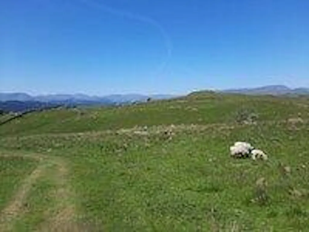
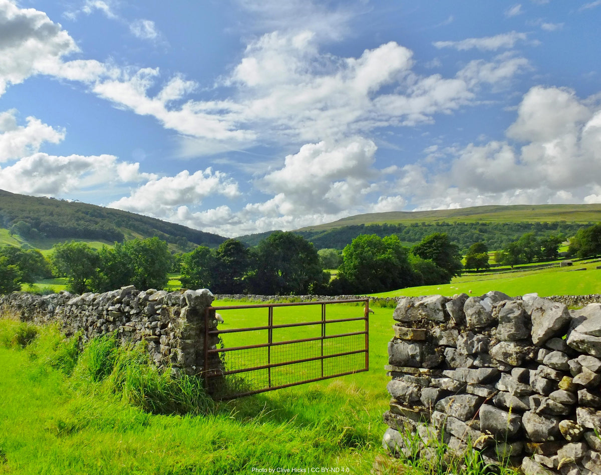
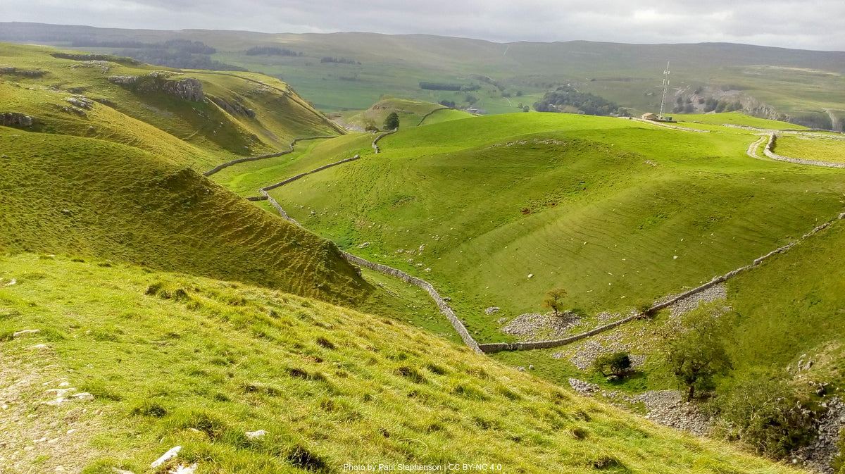
Limestone country and riverside meadow, with the Wharfe always to your left or right and the dales narrowing as you go.

Your opening stretch is the gentlest of the trail. From Ilkley you head north along the Wharfe, past the 12th-century Augustinian ruins at Bolton Priory and the Strid — a chasm where the river is forced into a six-foot gap and runs deep and dangerous. Meadows, drystone walls, the occasional farm. By Grassington you've crossed Linton Falls and the dales tighten. Kilnsey Crag looms above the road as you turn for Kettlewell, and the young Wharfe runs beside you to Buckden — where Buckden Pike sits east and the country begins to lift.

The Watershed
Buckden to Sedbergh

The Watershed

The trail's high crossing, then a different valley altogether — Dent's cobbles, Sedbergh's bookshops, the Howgills already showing themselves to the west.

You climb out of Buckden toward Cam Houses — a remote farm at the watershed between Wharfedale and Dentdale — and find yourself, briefly, on the trail's highest ground. Ingleborough and Whernside stand to the south. There's no village for hours, and the water is scarce. Then you drop into Dentdale, following the River Dee. Dent is small and cobbled, with a granite memorial fountain to the geologist Adam Sedgwick in the centre. You walk on to Sedbergh — England's official Book Town — where the Howgills start to show themselves to the west.

Toward the Lakes
Sedbergh to Bowness-on-Windermere

Toward the Lakes

Howgill grass under your boots, the River Kent for company, and Lake Windermere coming closer with each stage.

After Sedbergh you skirt the western flanks of the Howgill Fells — smooth, grassy whaleback hills very different from the limestone you've been walking through. You cross into Cumbria proper, with stone changing colour underfoot and field walls thinning. You pick up the River Kent at Burneside and follow it through Staveley — where the Hawkshead Brewery and Wilf's Café mark the trail's last working village. You drop through woodland into Bowness-on-Windermere, with Lake Windermere widening below. You finish at the water, eighty miles from Ilkley, with the Dales behind you and the Lakes around you.

— Now Make It Yours —

Find Your Dales Way

Most people walk it in 5 days. Some want longer to take it all in. Others want the challenge of doing it quicker. Pick the trip that suits you — or customise yours below.

ABTOT 5690 · Financially protected Guidebook authors on every trail 72-hour confirmation or no charge Refund promise if we can't deliver
Your personalised Trail Book — trip overview, day by day itinerary and accommodation details

Included with every trip

Your personalised
Trail Book

Everything you need for every day of your trail — built around your exact itinerary. Your route, your accommodation, your packing list. Ready before you leave, works offline when you're out there.

Tonight's accommodation

Check-in time, room type, phone number and directions — all in one place

Day-by-day trail description

Route map, elevation profile and written description for each stage

Packing list and pre-trip checklist

Everything you need, nothing you don't. Tick items off as you go

Works offline

Open it once with data and it's yours — no signal needed on the trail

Included with every trip

Your route on every device you use

Your custom GPX file is built around your exact itinerary — day by day, door to door. Load it onto any device or app before you set off and navigate with confidence.

Works with

GPX route on Komoot iPhone app and Garmin watch
Past the M6

Hear it from the trail

Jessica Mather

Jessica Mather walked the Dales Way in four days last summer. She's still thinking about a man fishing in his eighties and a seventeen-year-old with a sketchbook.

“You've got all these doubts in your head, but as soon as you get walking, everything's all right anyway.”
Read Jessica’s story →
Craig, Trail Specialist at Big Trail Adventures
Talk to a Specialist

Knows the trail. Plans yours.

Craig Trail Specialist
The Dales Way is the trail I usually point people to when they've done a coastal walk or Hadrian's Wall and want something quieter. Walk it slow — five or six days, not three — and let the river do most of the work. Prettiest in late spring, before the bracken takes over.

Craig has spent over ten years in adventure travel — most of it talking walkers through trails like this one. He's helped hundreds of people plan their Dales Way, knows where they typically underestimate the watershed crossing between Wharfedale and Dentdale, and has the calls in his pocket from people who've walked it the week before.

Ask Craig about the Dales Way

If you want to talk through your timing, your fitness, your pace, or anything the planner can't answer — call. Most of our customers do, and Craig's the one who'll answer.

The Practical Side

Before You Book

The things walkers ask us most often — answered plainly, so you don't have to ring to find out.

How fit do I need to be?

You'll want to be comfortable walking around 25 km a day with a daypack on rolling, well-graded terrain — most of it valley floor or low ridge. The single hard day is the watershed crossing between Buckden and Gearstones, where the climb out of Wharfedale catches people who've been lulled by the gentler stages. If 25 km feels steep, the Explorer pace stretches the trail to six days at around 21 km a day.

When should I walk it?

May to September is the trail's best window. June and early July balance long days, dry paths, and meadows still in flower. August is the busiest month, especially around Bolton Abbey and Bowness — accommodation books up early. Late September and early October bring autumn colour and quieter trails but shorter days. November to March we don't recommend: the watershed stage gets boggy, the rivers swell, and many of the smaller B&Bs close.

Do you include luggage transfer?

Yes — your bag is moved between accommodations every walking day, up to 20 kg per bag. You walk with a daypack carrying the day's essentials. The single tricky leg is the watershed crossing into Gearstones, where the road route is longer than the walking route — bags get there reliably, just expect an earlier morning drop-off so the driver has time.

What kind of accommodation do you book?

Family-run inns and B&Bs, with the occasional small guesthouse or country hotel — never chains. Every stay is en-suite, with breakfast included and drying space for wet boots. On the Dales Way that means places like the Red Lion at Burnsall, the Buck Inn at Buckden, and the Dalesman at Sedbergh. Some villages on the route have only one or two options — when those fill, we look slightly off-route, but always with onward transport sorted.

Can I walk it solo?

Yes — the Dales Way is one of the most solo-friendly long-distance paths in England. The route is well signposted, the villages are close together, and you'll meet other walkers most days, especially in summer. We book single-occupancy rooms (with a single supplement for the smaller B&Bs that don't have singles). The watershed stage is the only one where you might walk a few hours without seeing anyone — fine in good weather, worth checking the forecast.

What's the realistic total cost?

Our Classic package starts at £609 per person for the five-day Hiker pace, based on two people sharing. That covers accommodation, breakfast every morning, baggage transfer, a route pack with maps and notes, and 24-hour support. On the trail, budget around £25–35 a day per person for lunches, drinks, and an evening meal — pubs along the Dales Way are fair-priced by long-distance walking standards, and most do a packed lunch for £10 or so.

Still not sure? Ring us on 0131 560 2740 — Craig usually answers.

Still Thinking?

Speak to Craig

If you've scrolled this far, we need to help you get onto this trail. The bit the planner can't help with — "is the pace right for me?", "is August really that busy?", "can we add a rest day in Keswick?" — that's a two-minute phone call. Most people who book the Dales Way ring first.