GR221: Mallorca's Dry Stone Route Overview
- Mediterranean coastal magnificence
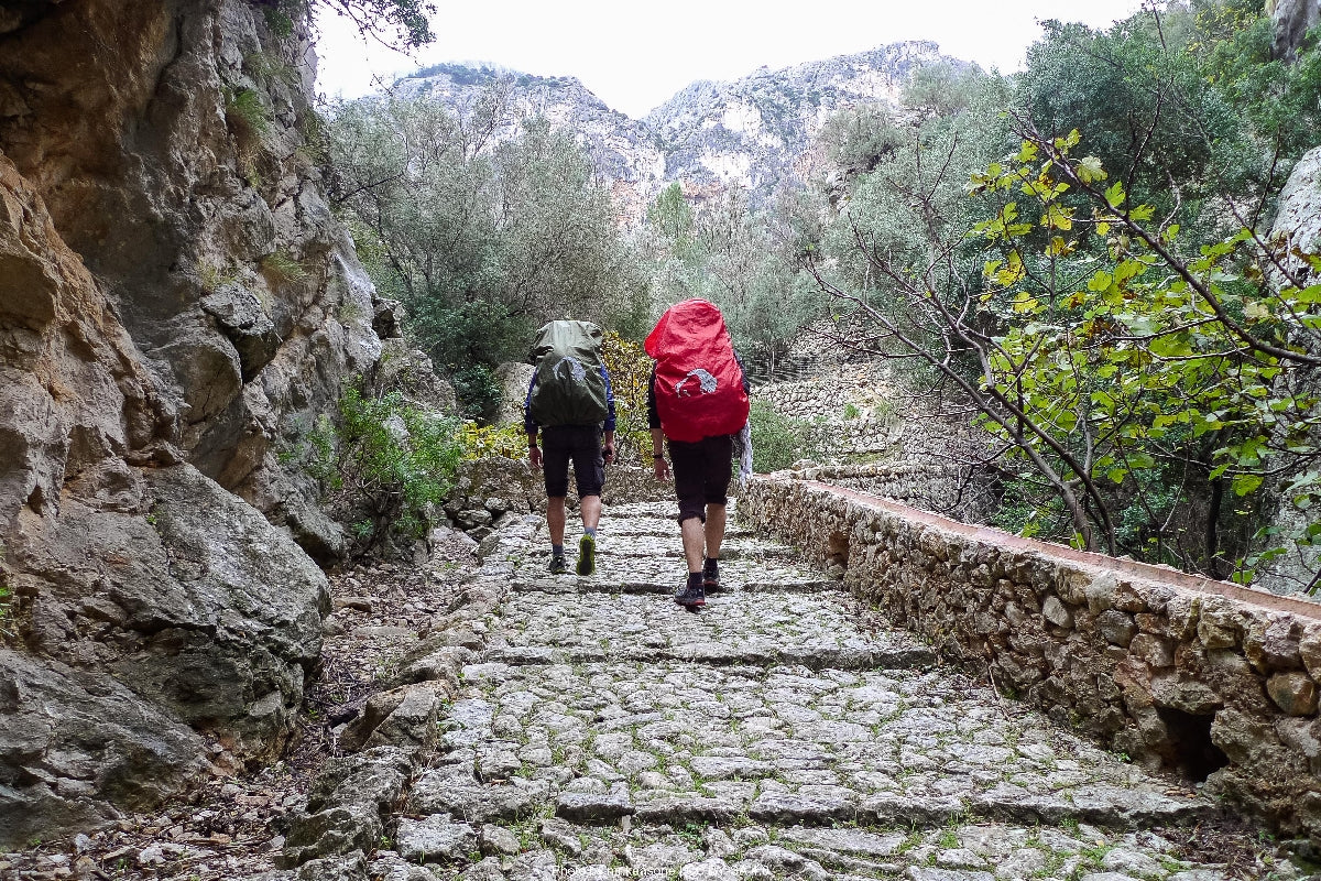
- Ancient dry stone engineering marvels
- Authentic Mallorcan mountain villages
The GR221, known as the "Ruta de Pedra en Sec" (Dry Stone Route), spans approximately 140 kilometers through the dramatic Serra de Tramuntana mountain range on the Spanish island of Mallorca. This UNESCO World Heritage Site offers one of the Mediterranean's most spectacular hiking experiences, combining rugged limestone mountains with sweeping sea views. The trail follows ancient pathways built with traditional dry stone techniques that have been used on the island for centuries, connecting h... Read more
| Hilliness | |
| Start Point | Port d'Andratx |
| End Point | Port de Pollença |
| Activity Type | Walking, Hiking, Trail Running |
| Distance | 140km | 87 miles |
| Ascent | 5,500m | 18,045ft |
| When to go | March-May, September-November |
| Baggage Transfer | Available |
From £390.00
Based on a Standard Package for two people.
Build Your Adventure
Not ready to book?
Call us on 0131 560 2740
or enquire by email
What's included?
-
Custom Adventure Plan
-
Accommodation options for you
-
Door‑to‑door GPX in our app
-
On‑trail support
-
Share with up to four people
Sample Itinerary
Here's what's on the trail. We'll split the stages to each day just right for your pace.
Key Features: Coastal cliffs, Mediterranean pine forests, views of Dragonera Island
Cultural Notes: Ancient watchtowers used to spot Barbary pirates
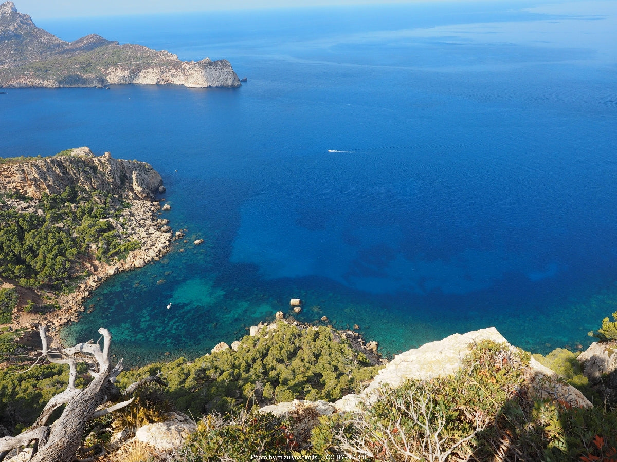
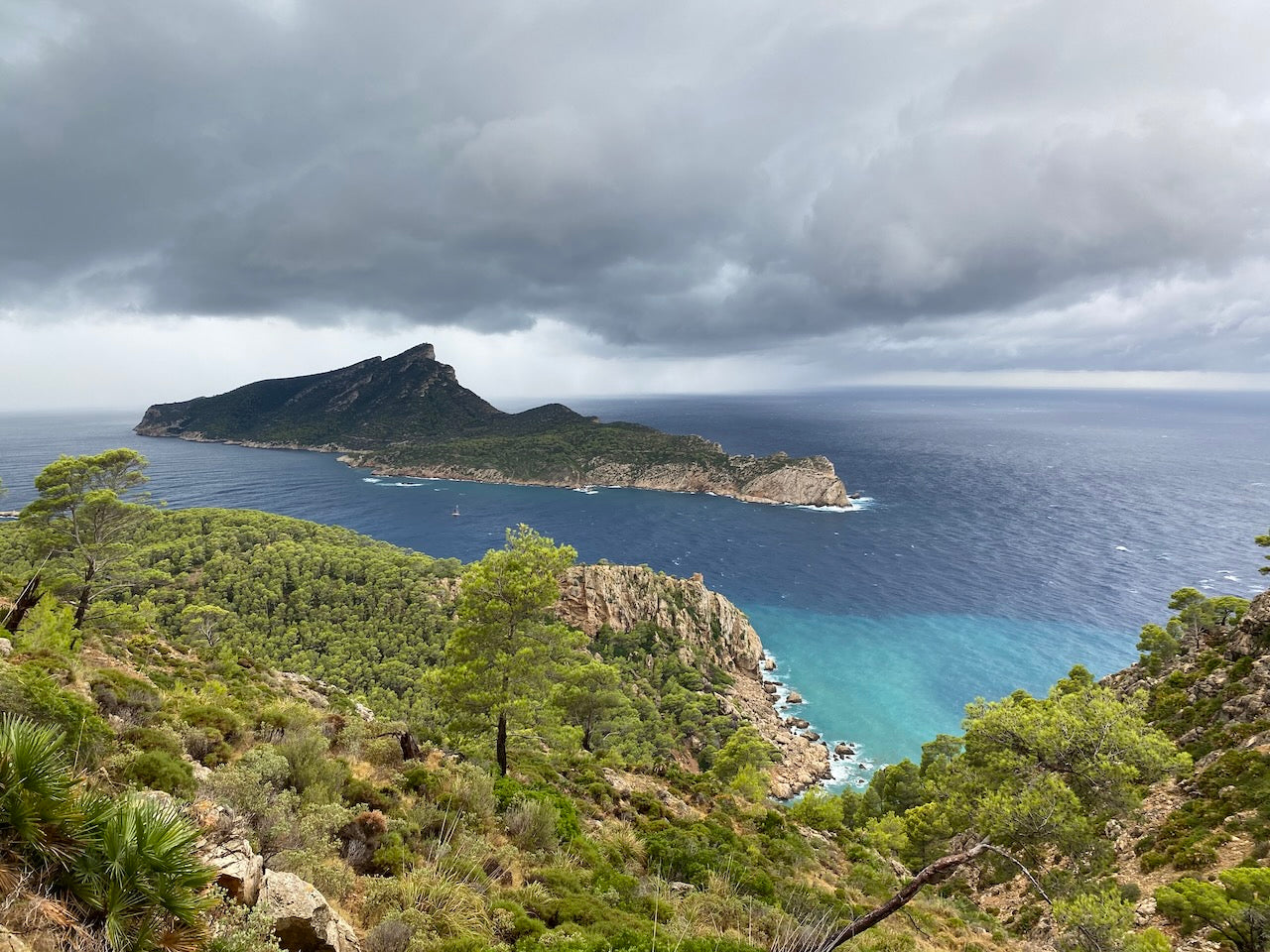
The inaugural stage of the GR221 serves as a gentle introduction to what lies ahead, beginning in the picturesque fishing village of Port d'Andratx. The trail climbs steadily through fragrant Mediterranean pine forests interspersed with rosemary and thyme, offering frequent glimpses of the turquoise sea below. After approximately 4km, you'll reach a ridge offering spectacular views of Sa Dragonera Island Nature Reserve, a dragon-shaped uninhabited island that serves as an important bird sanctuary.
The path continues along limestone paths that showcase the first examples of the dry stone masonry that gives the route its name. These walls, built without mortar, have stood for centuries and represent a traditional Mallorcan craft recognized by UNESCO. As you descend toward Sant Elm, you'll pass Torre de Cala en Basset, a 16th-century watchtower built to spot approaching Barbary pirates.
The final kilometers wind through terraced hillsides cultivated with olive trees before reaching Sant Elm, a small coastal village with several restaurants serving fresh seafood. The village has a small grocery store for resupplying and a public fountain near the main square. Accommodation is limited but includes a small hotel and rental apartments.
Key Features: La Trapa monastery ruins, dramatic cliff paths, Mediterranean scrubland
Cultural Notes: Historic La Trapa monastery with innovative water management systems
Leaving Sant Elm, the path immediately begins a challenging ascent toward La Trapa, an abandoned 19th-century monastery set in a dramatic valley. The climb offers increasingly expansive views of Sa Dragonera Island and the Mediterranean coastline. The monastery itself, though in ruins, provides fascinating insights into how Trappist monks created an ingenious hydraulic system to collect and distribute water in this arid environment.
After exploring La Trapa, the route continues along exposed ridgelines with panoramic views in all directions. This section features classic Mediterranean garrigue vegetation – drought-resistant plants including wild lavender, rock roses, and dwarf palms. The trail then enters dense pine forest before beginning a traverse of the dramatic cliffs of the western Serra de Tramuntana.
This section represents some of the most remote hiking on the entire GR221, with no water sources between La Trapa and Estellencs. The path demonstrates exceptional examples of dry stone engineering, with perfectly balanced stones creating staircases and retaining walls along precipitous drops. The final descent into Estellencs follows an ancient cobbled path through olive groves, eventually reaching this small mountain village with its distinctive square bell tower. The village has a small grocery store, two restaurants, and accommodation ranging from a small rural hotel to a municipal refuge.
Key Features: Ancient terraced hillsides, coastal views, agricultural landscapes
Cultural Notes: Historic irrigation systems and terraced farming dating to Moorish period
Though relatively short, this stage offers some of the most spectacular agricultural landscapes on the route. Leaving Estellencs, the path climbs through traditional terraced fields supported by elaborate dry stone walls. These impressive terraces, some dating back to the Moorish period (10th-13th centuries), have been cultivated for over a thousand years and showcase remarkable engineering.
The trail alternates between coastal paths with sweeping sea views and inland sections through ancient olive groves. Many olive trees along this section are over 500 years old, their twisted trunks testament to centuries of harsh mountain conditions. Around the halfway point, you'll encounter a restored lime kiln (forn de calç), once used to produce lime for construction and agricultural purposes.
The approach to Banyalbufar reveals its most distinctive feature – cascading agricultural terraces that descend dramatically to the sea. These terraces, primarily used for growing Malvasia grapes for wine production, are irrigated using a system of channels and pools designed during the Islamic period. Banyalbufar itself is a picturesque village perched above the Mediterranean, with several restaurants specializing in local cuisine. The village has a small grocery store, and accommodation options include a boutique hotel in a restored manor house and several guesthouses. Don't miss tasting the local Malvasia wine, produced in limited quantities from the surrounding vineyards.
Key Features: Wild coastal scenery, Planicia Estate, oak and pine forests
Cultural Notes: Traditional charcoal production sites and lime kilns
This diverse stage begins with a spectacular cliff-top traverse offering uninterrupted Mediterranean views. After about 3km, the path veers inland, climbing steadily through pine forests until reaching the historic Planicia Estate. This large agricultural estate features a manor house dating to the 14th century and extensive grounds that were once a model of self-sufficient mountain agriculture.
Beyond Planicia, the trail enters one of the most pristine forested sections of the entire route, featuring holm oak woodlands that provide welcome shade. These ancient forests were historically important for charcoal production, and you'll pass several restored charcoal production sites (sitges) where wood was slowly burned to produce charcoal for heating and cooking. The forest floor here is covered with endemic plant species, including cyclamen and wild orchids in spring.
The route then begins a gentle descent toward the Superna Valley, passing several restored lime kilns and small agricultural holdings. The final approach to Esporles follows a historic bridle path lined with dry stone walls. Esporles itself is a larger town with more facilities than previous stops, including multiple restaurants, bakeries, and a well-stocked supermarket. Accommodation options range from rural hotels to private rentals. The town is known for its textile heritage, and the Museum of Mallorcan Life in a restored mansion offers insights into traditional island culture. The main square has several water fountains for refilling bottles.
Key Features: Son Morroig estate, dramatic karst formations, views of La Foradada
Cultural Notes: Archduke Ludwig Salvator's conservation legacy and engineering projects
This stage traverses landscapes once owned by Archduke Ludwig Salvator of Austria, a 19th-century conservationist who preserved much of this coastline. Leaving Esporles, the trail climbs steadily through mixed woodland before emerging at viewpoints overlooking the dramatic Ses Puntes cliffs. The path eventually reaches Son Morroig, the Archduke's estate, which now functions as a museum showcasing his contributions to documenting and preserving Mallorcan nature and traditions.
Beyond Son Morroig, the trail follows the "Camí de s'Arxiduc," a remarkably engineered path built under the Archduke's direction specifically to showcase the dramatic coastal scenery. This section features exceptional dry stone work and offers views of La Foradada – a peninsula with a distinctive natural stone arch that has become an iconic image of Mallorca.
The route continues through limestone karst landscapes with unusual rock formations before beginning its descent toward Valldemossa through terraced olive groves. Approaching the town, you'll glimpse its most famous landmark – the Royal Carthusian Monastery where Chopin and George Sand spent a controversial winter in 1838-39.
Valldemossa is one of the most picturesque villages in Mallorca, with cobbled streets lined with flowering plants and cafés serving local specialties including coca de patata (potato sponge cake). The village has several small grocery stores, bakeries, and restaurants. Accommodation options include boutique hotels in historic buildings and rental apartments. The monastery itself offers cultural context through exhibitions about Chopin's stay and traditional Mallorcan life. Water is available from public fountains in the main square.
Key Features: Literary landscapes, ancient olive groves, coastal viewpoints
Cultural Notes: Connection to artists and writers including Robert Graves
This stage connects two villages with rich artistic and literary heritage. Leaving Valldemossa, the path climbs through ancient olive groves before reaching a high saddle offering dual views: inland toward central Mallorca and outward to the Mediterranean. The route follows old mule tracks that once served as the main transportation routes between coastal settlements before modern roads were built.
After approximately 5km, you'll pass Son Marroig, another former residence of Archduke Ludwig Salvator featuring a distinctive marble temple with some of the most photographed views on the island. The path continues along dramatic coastal cliffs before descending through terraced fields toward Deià, providing postcard-perfect views of this village clutching the hillside above the sea.
Deià has inspired countless artists and writers, most notably the English poet Robert Graves who lived here for decades. The village has retained its creative atmosphere with numerous art galleries and cultural events. Despite its small size, Deià offers several high-quality restaurants (including a Michelin-starred establishment), a small but well-stocked grocery store, and accommodation ranging from luxury hotels to more modest guesthouses. Graves' former home, Ca n'Alluny, is now a museum worth visiting for literary enthusiasts. The village has public water fountains near the main church square.
Key Features: Coastal path to Cala Deià, Son Mico estate, citrus orchards
Cultural Notes: Maritime trading history and agricultural transitions
The path initially descends from Deià toward Cala Deià, a small rocky cove with crystal-clear water – a perfect spot for a refreshing swim in warmer months. From the cove, the trail climbs steeply up the headland, traversing rugged terrain with scattered pine trees providing occasional shade. This section offers spectacular views back toward Deià and forward to the Muleta lighthouse.
After approximately 5km, you'll reach Son Mico, a traditional finca (country estate) where you can observe traditional farming methods. The path continues through mixed Mediterranean forest before beginning its descent into the Sóller Valley, famous for its citrus orchards. The landscape transforms dramatically here, with dense orange and lemon groves replacing the more rugged coastal vegetation.
The final approach to Sóller passes through these fragrant orchards before reaching the outskirts of this prosperous town. Sóller represents one of the largest settlements on the route and offers the widest range of services. The impressive main square (Plaça Constitució) is surrounded by modernist buildings reflecting the wealth generated by the citrus trade with France in the 19th century.
Sóller offers numerous restaurants, cafés, bakeries, and several supermarkets. Accommodation options are plentiful, ranging from upscale hotels to budget hostels. The town also has banks, pharmacies, and a medical center. Don't miss sampling fresh orange juice or the local ice cream made with citrus from surrounding orchards. Multiple water sources are available throughout the town.
Key Features: Barranc de Biniaraix gorge, high mountain terrain, spectacular viewpoints
Cultural Notes: Historic pilgrimage route to Lluc Monastery begins in this area
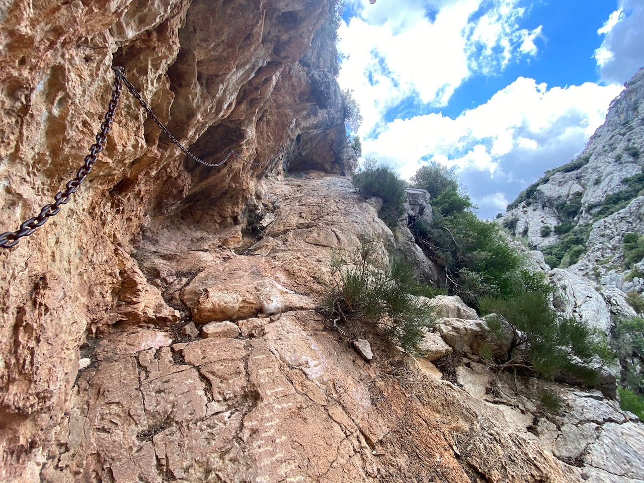
This stage represents the most challenging section of the entire GR221, with significant elevation gain and more remote mountain terrain. Leaving Sóller, the trail quickly enters the dramatic Barranc de Biniaraix, a steep rocky gorge featuring over 2,000 stone steps constructed over centuries. This remarkable example of dry stone craftsmanship creates a cobbled pathway rising steadily through the narrowing canyon.
After emerging from the gorge, the trail traverses more open terrain with expanding views of the central Serra de Tramuntana, including Puig Major (Mallorca's highest peak). The path passes the small settlement of Biniaraix before continuing upward through holm oak forests and rocky outcrops. Around the halfway point, you'll reach Coll de l'Ofre, a mountain pass offering panoramic views of the Cúber Reservoir and surrounding peaks.
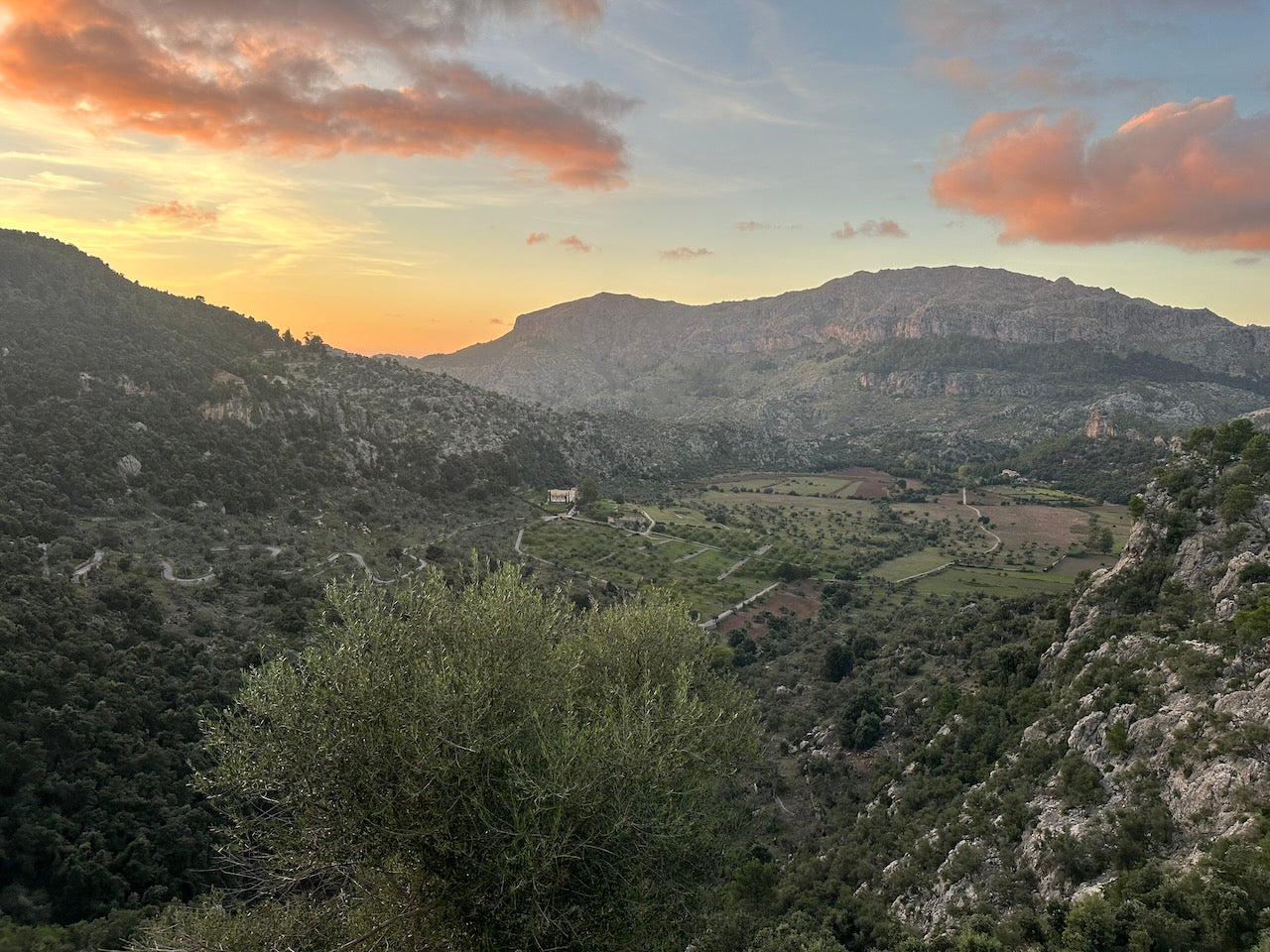
The route continues past the reservoir, traversing high mountain terrain that feels dramatically different from the coastal sections. The landscape here is more reminiscent of mainland Spain's mountain ranges, with sparse vegetation and dramatic rock formations. The final section follows a water canal to Tossals Verds refuge, an isolated mountain hut operated by the local government.
This stage has no villages or resupply points between Sóller and Tossals Verds. The refuge offers dormitory accommodation (reservation essential), prepared meals, and drinking water. The refuge is solar-powered with basic facilities, providing an authentic mountain experience. For those continuing onward, carrying sufficient water for the next day is essential as the next reliable source is several hours away.
Key Features: Remote mountain landscape, Massanella peak views, ancient pilgrim path
Cultural Notes: Lluc Monastery as spiritual center of Mallorca for over 800 years
This demanding but rewarding stage traverses the highest terrain of the entire route. From Tossals Verds refuge, the path immediately begins climbing toward the Font des Prat, a reliable mountain spring. The trail continues upward through scattered pine forest before reaching the dramatic Massanella Valley, dominated by Puig de Massanella (1,365m), Mallorca's second-highest peak and the highest accessible to hikers.
Around the halfway point, you'll reach Coll des Prat, a windswept mountain pass offering exceptional views in clear weather – to the north, you can see all the way to Menorca, while southward views extend across central Mallorca to the distant Mediterranean. The path then follows the contours beneath imposing limestone cliffs, passing through areas rich with endemic plant species, including the Balearic St. John's wort and several orchid varieties.
The approach to Lluc follows an ancient pilgrim route that has connected this sacred site with surrounding villages for centuries. Stone markers with ceramic tiles depicting religious scenes guide the way through increasingly lush vegetation as the path descends. Finally, the monastery complex comes into view, its golden stone buildings nestled in a protected valley.
Lluc Monastery is the spiritual heart of Mallorca, housing the venerated Black Madonna statue. The complex includes the monastery itself, basilica, museum, botanical garden, and extensive accommodation facilities. Options range from simple pilgrim cells to more comfortable hotel-style rooms. The monastery restaurant serves traditional Mallorcan cuisine, and there's a small shop selling basic supplies. The complex includes several water fountains, and the monastery museum provides fascinating insights into Mallorca's religious and cultural history.
Key Features: Ancient oak forest, Romani cemetery, coastal approaches to Pollença Bay
Cultural Notes: Historic connections between mountain communities and coastal trade
The final stage begins in the tranquility of Lluc, passing the Monastery's botanical gardens showcasing Mallorca's endemic plant species. The trail initially climbs through one of the island's most pristine oak forests, home to numerous bird species including the rare Balearic warbler. After approximately 4km, you'll reach a viewpoint offering the first glimpses of Pollença Bay, your final destination.
The path then begins a long, gradual descent through increasingly Mediterranean vegetation, with rosemary, cistus, and wild olive becoming more prevalent. At around the halfway point, you'll pass a small, ancient Romani cemetery – evidence of the diverse cultural influences that have shaped Mallorca over centuries.
As the trail descends further, cultivated land begins to replace wild forest, with olive and carob groves dominating the landscape. The final section follows an ancient bridle path that once connected mountain settlements with coastal trading posts. This well-preserved route features some of the finest examples of dry stone walls on the entire trail, with perfectly fitted stones creating structures that have endured for centuries without mortar.
The approach to Port de Pollença offers expanding views of the bay's crystalline waters and the distant Cap de Formentor peninsula. The trail finally reaches sea level at the outskirts of Port de Pollença, a resort town that retains much of its traditional fishing village charm. The seafront promenade provides a fitting conclusion to the journey, with numerous cafés and restaurants where you can celebrate your achievement.
Port de Pollença offers extensive facilities including numerous accommodation options from luxury hotels to budget apartments, supermarkets, pharmacies, banks, and transportation connections to Palma. The town is known for its seafood restaurants, particularly along the Pine Walk promenade. Several public fountains are available for refilling water bottles.
How long will it take?
Everyone has a different approach to trails. Here are our suggested times for the GR 221 for different types of adventurers.
Here we have assumed that you will be out on the trail for around 8 hours per day, including regular breaks but not extended lunch stops.

9
Days
For walkers who love the journey as much as the destination.
You enjoy full days on the trail, moving steadily, soaking up the scenery — with plenty of time for food and drink stops along the way!

7
Days
For long-distance walkers who enjoy the challenge of a steady pace over varied terrain.
You’ve got the fitness to cover strong distances over several days — this is where most keen hikers will find themselves.

5
Days
The first of our faster categories — built for those who prioritise pace.
You move quickly with minimal stops, carry just the essentials, and have the fitness to handle long days and tough terrain.

3
Days
Our fastest pace – ideal for those used to ultramarathons.
You mix fast hiking with running on flats and descents, even over mountains. Speed and efficiency matter most, with minimal stops as you aim to complete each route as quickly as possible.
Build Your Adventure
Book by phone
Essential Travel Information
Summer (June-August) brings intense heat (often exceeding 30°C/86°F), water scarcity on remote sections, and crowded villages. Winter hiking (December-February) is possible but carries risks of heavy rainfall, especially in the mountains where flash flooding can occur. The higher sections may experience occasional snow and ice, particularly on north-facing slopes.
Most facilities, including refuges and smaller restaurants in mountain villages, operate from March through October. Some close or offer reduced services during winter months. Weather patterns can bring sudden changes year-round – the tramuntana wind that gives the mountains their name can produce strong gusts, particularly on exposed ridges.
Accommodation Costs:
- Refuges: €15-25 per person per night
- Budget hotels/guesthouses: €50-80 per room per night
- Mid-range hotels: €80-150 per room per night
- Luxury accommodations (especially in Deià and Valldemossa): €150-300+ per night
Transportation Expenses:
- Airport to Port d'Andratx by public transport: approximately €10
- Port de Pollença to Airport by public transport: approximately €12
- Local buses between villages: €3-8 per journey
- Taxi from trailhead to Palma: approximately €60
Food and Supplies:
- Breakfast at local cafés: €5-8
- Set lunch menu (menu del día): €12-18
- Dinner at mid-range restaurants: €20-35 per person
- Self-catering grocery costs: approximately €15-20 per day
- Water refill: free at public fountains in most villages
Additional Fees:
- Museum entries (Valldemossa Monastery, Robert Graves House, etc.): €5-10 each
- Guided tours (optional): €25-60
- Vintage train from Sóller to Palma (optional scenic route): €25 return
A typical 10-day trek with mixed accommodation (3 nights in refuges, 7 nights in mid-range hotels), mostly eating at restaurants, and using public transportation would cost approximately €900-1,200 per person. Budget-conscious hikers staying primarily in refuges and self-catering could complete the route for approximately €500-700.
Airports/Major Cities:
Palma de Mallorca Airport is the main gateway, located approximately 30km from Port d'Andratx (trailhead) and 60km from Port de Pollença (trail end).
Public Transportation:
- From Palma Airport to Port d'Andratx: Bus #102 to Palma city center, then bus #102 to Port d'Andratx (total journey approximately 1.5 hours)
- From Port de Pollença to Palma Airport: Bus #340 to Palma, then airport shuttle (total journey approximately 1.5 hours)
- Circular connections: Bus service connects most major towns on the route (Andratx, Estellencs, Banyalbufar, Valldemossa, Deià, Sóller, and Pollença), though frequency is limited in smaller villages
Trailhead Access:
The official start in Port d'Andratx is accessible by bus from Palma. No permits are required to begin hiking.
Evacuation/Bail-out Points:
- Estellencs (bus service to Palma)
- Banyalbufar (bus service to Palma)
- Valldemossa (frequent bus service to Palma)
- Deià (bus service to Sóller and Palma)
- Sóller (bus and historic train service to Palma)
- Lluc Monastery (bus service to Inca, connecting to Palma)
In emergencies, the Guardia Civil mountain rescue service operates throughout the Serra de Tramuntana. Cell phone coverage is generally good except in deep gorges and remote mountain sections.
The GR221 offers diverse accommodation options, making it more comfortable than many European long-distance trails:
Refuges:
Six official mountain refuges operate along the route (Ses Fontanelles, La Trapa, Muleta, Tossals Verds, Son Amer, and Pont Romà). These basic hostels provide dormitory accommodation, cooking facilities, and sometimes prepared meals. Prices range from €15-25 per night. Advance booking is essential through the Consell de Mallorca website, especially from April to October. Refuges typically require bookings 3-6 months ahead during peak season.
Hotels and Guesthouses:
Most villages offer accommodations ranging from simple pensions to boutique hotels. Smaller villages (Estellencs, Banyalbufar) have limited options (€60-120/night), while larger towns (Sóller, Pollença) offer greater variety (€40-200+/night). Valldemossa and Deià, being popular tourist destinations, have higher average prices.
Monasteries:
Lluc Monastery offers unique accommodation in converted cells (€45-70/night), providing an authentic cultural experience.
Camping:
Wild camping is prohibited throughout the Serra de Tramuntana. The only official campsite near the route is in Port de Sóller, approximately 2km from the main trail.
Popular stopover points include Valldemossa, Deià, Sóller, and Lluc Monastery. These locations offer the best combination of services, cultural interest, and accommodation options. During peak hiking season (April-May, September-October), booking accommodation at least 2-3 months in advance is recommended.
The GR221 has gained significant popularity over the past decade, particularly among European hikers seeking Mediterranean alternatives to Alpine routes. Peak seasons (April-May and September-October) see moderate trail traffic, with most popular sections (Valldemossa-Deià-Sóller) experiencing the highest visitor numbers.
Peak Season Crowding:
- The sections between Valldemossa, Deià, and Sóller can be busy year-round due to day-hikers
- Refuges routinely fill to capacity during spring and autumn weekends
- Popular villages (especially Valldemossa and Deià) can be crowded with tour groups during daytime hours
Quieter Alternatives:
- The western sections (Port d'Andratx to Estellencs) see significantly fewer hikers
- The high mountain stages between Tossals Verds and Lluc offer more solitude
- Hiking midweek rather than weekends reduces encounters with local day-hikers
- Winter months (with appropriate preparation) offer near-solitude, though with weather risks
Cultural Considerations:
- Mallorcan culture combines Catalan and Spanish influences with unique island traditions
- Respect for private property is essential – many trail sections cross working farms and estates
- Water conservation awareness is appreciated – Mallorca faces increasing water scarcity
- Basic Catalan phrases are appreciated by locals, though most speak Spanish and English
Typical Hiker Demographics:
- Predominantly European (German, British, and Scandinavian hikers are most common)
- Broad age range, with strong representation from experienced hikers in the 40-65 age bracket
- Mix of thru-hikers completing the entire route and section-hikers focusing on favorite segments
- Growing popularity among solo hikers due to the route's safety and good facilities
Opportunities for Solitude:
- Early morning starts (before 8am) offer tranquil hiking even on popular sections
- The remote sections between Tossals Verds and Lluc provide genuine wilderness experience
- Alternative side-trails and variants can provide more solitude (maps available from local tourism offices)
- Winter hiking offers solitude but requires careful planning for accommodation as many places close
The GR221's unique combination of cultural richness, natural beauty, and good infrastructure makes it an excellent introduction to Mediterranean long-distance hiking, striking a balance between comfort and adventure that few other European trails can match.

