Hadrian's Wall Path Big Trail Adventures
Hadrian's Wall Path

Your walk from
Wallsend to
Bowness-on-Solway

You'll walk 135 kilometres from the Tyne to the Solway Firth, taken along the line of Hadrian's frontier — through Newcastle suburbs, Whin Sill crags in the centre, pastoral Cumbria, and salt marsh at the end. A route where the wall comes and goes, but the country always tells you what's underneath.

Distance
135 km · 84 mi
Ascent
2,130 m
Duration
3–6 days
Trips from £609pp See packages →
From per person
Plan your trip
Northern England UK
Trail Essentials
Start
WallsendNewcastle upon Tyne
End
Bowness-on-Solway
Distance
135 km84 miles
Total Ascent
2,130 m6,988 ft
Difficulty
Moderate
Hilliness
Hilly
Time to Complete
Explorer
6 days ~22 km/day
Hiker
5 days ~27 km/day
Fastpacker
4 days ~33 km/day
Trail Runner
3 days ~45 km/day

When to Walk

Best Good Avoid
JanFebMarAprMayJunJulAugSepOctNovDec
Hadrian's Wall Path runs 84 miles from Wallsend at the mouth of the Tyne to Bowness-on-Solway on the Cumbrian coast — past Segedunum's east-end fort, up onto the Whin Sill volcanic ridge, through Housesteads and Sycamore Gap, down into Carlisle and out across the salt-flat country of Burgh Marsh to the Firth. Most British long-distance trails run with the grain of the country — a coast, a ridge, a chain of valleys. This one runs against it. It walks the line of a Roman empire's edge for 84 miles, taking you through three completely different countries — industrial Tyne, volcanic upland, pastoral Cumbria — joined only by the wall itself.
Walking the Hadrian's Wall Path

How The Trail Unfolds

Your trail divides naturally into three parts — not by day, but by what's underneath. The wall starts on the river-flat of the Tyne, climbs onto a 30-metre slab of volcanic rock for its dramatic centre, and falls away into Cumbrian pasture and salt marsh on the way to the Solway.

The Tyne Country
Wallsend to Chollerford

The Tyne Country

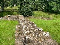
You leave the river behind by the time the first wall stones appear, and the country starts to feel Roman in earnest.

You start at Segedunum Roman Fort in Wallsend — the eastern terminus, with a museum that frames the empire before you walk it. The first miles are urban, the Tyne to your left, the seven bridges of Newcastle overhead. After Newburn the city thins, and at Heddon-on-the-Wall you meet the first substantial standing wall. From here, rolling Northumbrian fields. The Military Road, built on the wall's foundations in the 1750s, shadows you to Chesters cavalry fort. By the time you cross the river at Chollerford the ground is starting to climb.

The Whin Sill
Chollerford to Gilsland

The Whin Sill

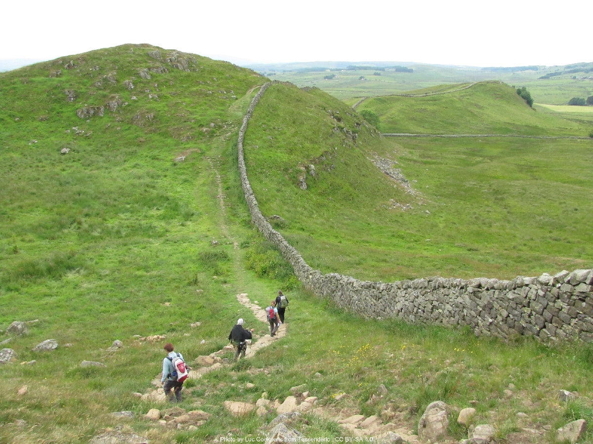
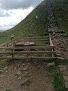
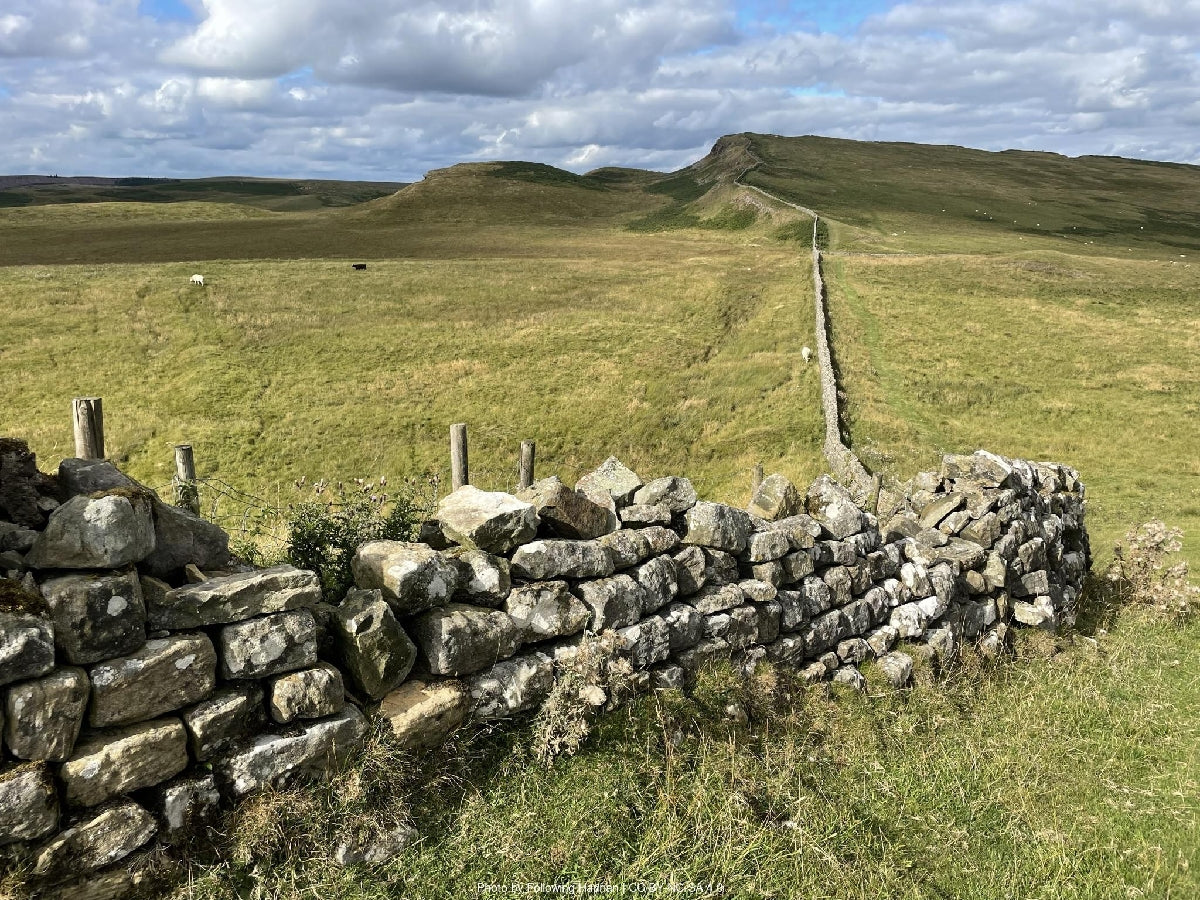
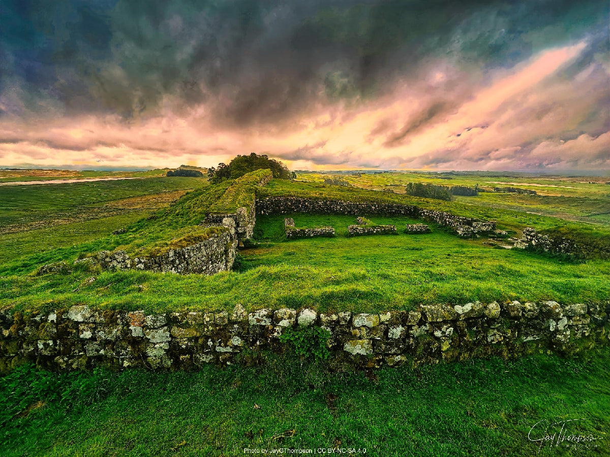
The wall climbs onto a slab of volcanic rock and walks the spine of the empire's northern edge.

This is the chapter the trail is famous for. The wall climbs onto the Whin Sill — a 295-million-year-old dolerite ridge running across Northumberland — and the next two days walk its north-facing scarp. You pass Brocolitia's Temple of Mithras and Housesteads, one of the most complete Roman forts in Britain, with its preserved granaries and barracks. The dip at Sycamore Gap, where the tree was felled in September 2023, is the one most walkers stop for. Beyond Steel Rigg, the country stays high through Walltown Crags. At Gilsland the ridge ends and you cross into Cumbria.

Down to the Solway
Gilsland to Bowness-on-Solway

Down to the Solway

The crags fall away, the wall fades, and the trail finishes on a salt-marsh coast looking across to Scotland.

The crags fall into farmland. The wall thins, but the vallum — the earthwork that ran behind it — stays visible, rippling across the fields. You cross the Irthing at Willowford on Roman bridge abutments and reach Carlisle, a medieval border city built on the Roman fort's footprint. From there the trail follows the Eden out to the Solway. The final miles are salt marsh and tide-watching — Drumburgh Castle, built from wall stones, the bird flats of Burgh Marsh, and Bowness-on-Solway, where the Roman fort Maia sits under the village and a pavilion on the cliff marks the end.

— Now Make It Yours —

Find Your Hadrian's Wall Path

Most people walk it in 5 days. Some want longer to take it all in. Others want the challenge of doing it quicker. Pick the trip that suits you — or customise yours below.

ABTOT 5690 · Financially protected Guidebook authors on every trail 72-hour confirmation or no charge Refund promise if we can't deliver
Your personalised Trail Book — trip overview, day by day itinerary and accommodation details

Included with every trip

Your personalised
Trail Book

Everything you need for every day of your trail — built around your exact itinerary. Your route, your accommodation, your packing list. Ready before you leave, works offline when you're out there.

Tonight's accommodation

Check-in time, room type, phone number and directions — all in one place

Day-by-day trail description

Route map, elevation profile and written description for each stage

Packing list and pre-trip checklist

Everything you need, nothing you don't. Tick items off as you go

Works offline

Open it once with data and it's yours — no signal needed on the trail

Included with every trip

Your route on every device you use

Your custom GPX file is built around your exact itinerary — day by day, door to door. Load it onto any device or app before you set off and navigate with confidence.

Works with

GPX route on Komoot iPhone app and Garmin watch
Craig, Trail Specialist at Big Trail Adventures
Talk to a Specialist

Knows the trail. Plans yours.

Craig Trail Specialist
The Wall is the trail I recommend to walkers who've done the West Highland Way or the Coast to Coast and want something with more history under their feet. People underestimate the central crags — they're not long but they're properly up and down. Plan a softer day either side.

Craig has spent over ten years in adventure travel, most of it talking walkers through trails like this. He's helped hundreds of customers plan their Hadrian's Wall Path, knows where people typically misjudge the Whin Sill central section after a flat opening day, and has the calls in his pocket from those who walked it last week.

Ask Craig about the Hadrian's Wall Path

If you want to talk through your timing, your fitness, your pace, or anything the planner can't answer — call. Most of our customers do, and Craig's the one who'll answer.

The Practical Side

Before You Book

The things walkers ask us most often — answered plainly, so you don't have to ring to find out.

How fit do I need to be?

You should be comfortable walking around 27 km / 17 miles a day for five consecutive days, with some short steep sections in the middle. The Whin Sill central stages have several short ascents in succession — not high (the trail's highest point is 345 metres) but they come one after another. If you'd rather walk shorter days, the Explorer pace gives you six days instead of five and eases the harder middle. Most people can build the fitness with a few longer training walks in the months before.

When should I walk it?

May to September is the settled stretch. The trail is mostly under 350 metres, so high-summer heat and storms don't shut it down — but the central crags are exposed and any wet day on the Whin Sill is rougher than the same weather on a low stage. April and October work if you're flexible with weather. Winter is technically open but the days are short and the central section becomes hard work in cold rain. June and September are the sweet spot — long days, settled weather, fewer people than July and August.

Do you include luggage transfer?

Yes — your luggage is moved between accommodation each day, with a 20 kg allowance per bag. You walk with a daypack containing whatever you need until evening. The whole route has reliable transfer service except occasional remote sections where the carrier swaps providers — we handle the booking and timing. Most walkers carry around 5–7 kg in their daypack: water, lunch, layers, waterproofs, and a small first-aid kit.

What kind of accommodation do you book?

Family-run B&Bs, traditional inns, and the occasional small guesthouse — never chains. All en-suite, with breakfast included and drying space for wet kit. On the central Whin Sill section the village of Once Brewed is the obvious overnight, with the Twice Brewed Inn and the youth hostel. Gilsland and Walton have fewer options, so we book those well ahead — they fill up in summer and you don't want to be three miles off-route looking for a bed.

How do I get to the start and finish?

Wallsend at the start is a 10-minute Metro ride from Newcastle Central Station — Newcastle is on the East Coast Mainline, around three hours from London King's Cross. The finish at Bowness-on-Solway is rural: a seasonal 93A bus runs to Carlisle (about an hour, infrequent — check the timetable before you walk), and Carlisle is on the West Coast Mainline. If you're flying, Newcastle International Airport is the most convenient. Travel back from Bowness needs a little planning — we'll talk you through it when we book.

What's the realistic total cost?

The Hiker package starts at £609 per person for the five-day route — that covers all accommodation with breakfast, daily luggage transfer, planning, route notes, and our support line while you walk. On top, expect £15–20 a day for lunches, plus dinner and drinks (£25–35 for a pub meal in this part of the country). Optional fort entries — Chesters, Housesteads, Vindolanda — are around £10–15 each. Most walkers spend roughly £200–300 on top of the package across the trip.

Still not sure? Ring us on 0131 560 2740 — Craig usually answers.

Still Thinking?

Speak to Craig

If you've scrolled this far, we need to help you get onto this trail. The bit the planner can't help with — "is the pace right for me?", "is August really that busy?", "can we add a rest day in Keswick?" — that's a two-minute phone call. Most people who book the Hadrian's Wall Path ring first.