Fort William to Fort Augustus
Telford's Country
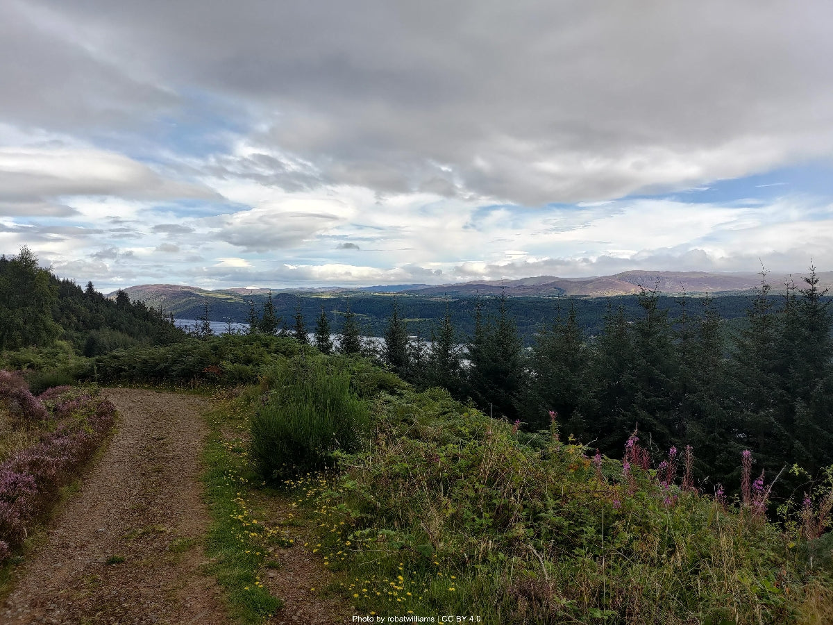
Eight locks, three lochs, fifty-four kilometres of towpath and forestry track before Loch Ness opens out at Fort Augustus.

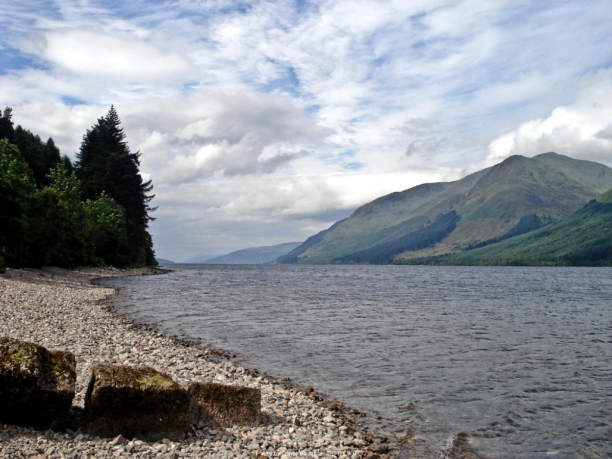
You'll walk 125 kilometres through the Scottish Highlands along the Great Glen Fault, taken by canal towpath and lochside path rather than by fell ridge, with three lochs underfoot and the high routes above Loch Ness. A route that finishes at a castle, in a city.
Your Great Glen Way divides naturally into three parts — not by day, but by what's underfoot. Canal towpath gives way to a high traverse above Loch Ness, and the traverse falls away into one long forest descent to Inverness.
Eight locks, three lochs, fifty-four kilometres of towpath and forestry track before Loch Ness opens out at Fort Augustus.
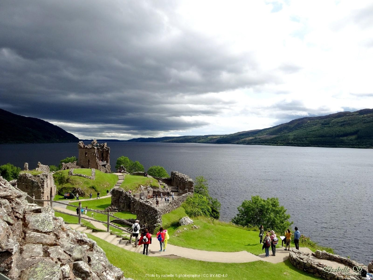
Two demanding days of forestry tracks high above Loch Ness, with Urquhart Castle as the long-distance reward.
The trail's longest day. You climb above Drumnadrochit, walk through community-owned forest, and descend slowly out of the Highlands.
Most people walk it in 5 days. Some want longer to take it all in. Others want the challenge of doing it quicker. Pick the trip that suits you — or customise yours below.

Included with every trip
Everything you need for every day of your trail — built around your exact itinerary. Your route, your accommodation, your packing list. Ready before you leave, works offline when you're out there.
Tonight's accommodation
Check-in time, room type, phone number and directions — all in one place
Day-by-day trail description
Route map, elevation profile and written description for each stage
Packing list and pre-trip checklist
Everything you need, nothing you don't. Tick items off as you go
Works offline
Open it once with data and it's yours — no signal needed on the trail
Included with every trip
Your custom GPX file is built around your exact itinerary — day by day, door to door. Load it onto any device or app before you set off and navigate with confidence.
Works with


Hear it from the trail
Jennifer Stevens
Jennifer Stevens walked the Great Glen Way alone in late September — wild camping, reading geology boards, and getting caught in the kind of weather Scotland reserves for people who check their phone too late. She also found a mouse in her tent. It smelled of strawberries.
“"It felt so comfortable. So safe. You're not there to push yourself too much — you're just there to enjoy it."”Read Jennifer’s story →

The Great Glen Way is the trail I recommend to people who've done the West Highland Way and want a trail they can think on. Less climbing, more lochside, more time to look at things. Just don't underestimate the two days above Loch Ness — that's where it bites.
Craig has spent over ten years in adventure travel — most of it talking walkers through trails like this one. He's helped hundreds of customers plan their Great Glen Way, knows where people typically underestimate the high routes above Loch Ness, and has the calls in his pocket from people who've walked it the week before.
If you want to talk through your timing, your fitness, your pace, or anything the planner can't answer — call. Most of our customers do, and Craig's the one who'll answer.
The things walkers ask us most often — answered plainly, so you don't have to ring to find out.
Still not sure? Ring us on 0131 560 2740 — Craig usually answers.
If you've scrolled this far, we need to help you get onto this trail. The bit the planner can't help with — "is the pace right for me?", "is August really that busy?", "can we add a rest day in Keswick?" — that's a two-minute phone call. Most people who book the Great Glen Way ring first.