South Downs Way
Winchester, Hampshire (Cathedral City) → Eastbourne, East Sussex (Beachy Head)
- Ancient paths through stunning chalk landscapes
- Accessible sections for weekend warriors
- Rich historical sites dot entire route
Prefer to call? Speak to our experts in the UK: 0131 560 2740
8am to 6pm, every day
Why people love the South Downs Way
This well-maintained path traverses Britain's newest national park, established in 2011, following routes that have been in use for over 8,000 years. The trail's unique charm lies in its combination of easily accessible terrain and rich historical significance, making it an ideal long-distance path for both novice and experienced hikers. Unlike many long-distance trails, it offers a gentle but rewarding journey through one of England's most diverse landscapes.
The path's defining characteristics include its chalk ridges, offering firm footing even in wet weather, panoramic views stretching for miles in all directions, and an incredible density of archaeological sites, from Iron Age hill forts to Norman churches. This is one of the few National Trails that can be tackled on foot, by bike, or on horseback throughout its entire length.
Build Your South Downs Way Adventure
Choose your pace and group size — we'll do the rest.
Your Adventure
What's Included:
- Hotels with breakfast at each overnight stop
- Custom Door-to-Door Route
- Big Trail Adventures App
- Your own personalised Trail Book
- On-trail support
Your Adventure
What's Included:
- Hotels with breakfast at each overnight stop
- Custom Door-to-Door Route
- Big Trail Adventures App
- Your own personalised Trail Book
- On-trail support
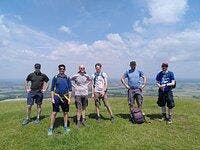
The Journey in Pictures


The stages on this trail
Here's what's on the trail. We'll split the stages to each day just right for your pace.
Stage 1: Winchester to Exton
Water sources are available in Winchester and Exton, with several pubs offering refreshments. The Beacon Hill Nature Reserve presents excellent wildlife spotting opportunities, particularly for butterflies in summer months. Historical points of interest include the medieval church of St. Peter's in Chilcomb and various ancient burial mounds dotting the downland.
Stage 2: Exton to Queen Elizabeth Country Park
Water and supplies are available at Meon Springs and Mercury Park. The highlight of this stage is the spectacular Iron Age fort at Old Winchester Hill, offering views across the Meon Valley. The route passes through ancient woodlands before reaching Queen Elizabeth Country Park, which provides visitor facilities and a café.
Stage 3: Queen Elizabeth Country Park to Cocking
Water sources are available at South Harting village, slightly off-trail. The route passes the impressive Vandalian Tower ruins and crosses several ancient track ways. The descent into Cocking provides welcome relief after a day of ridge walking, with the village offering accommodation and resupply options.
Stage 4: Cocking to Amberley
Water is available at Graffham and Amberley. The highlight is the Roman villa at Bignor, just off the trail. The descent into Amberley offers stunning views of the River Arun valley and the Amberley Wild Brooks wetlands. The village itself is picturesque with its thatched cottages and medieval castle.
Stage 5: Amberley to Upper Beeding
Water sources are found in Washington and Upper Beeding. Historical highlights include the Iron Age hill fort at Chanctonbury Ring and numerous burial mounds. The Devil's Dyke, one of the longest, deepest, and widest dry valleys in Britain, provides a spectacular conclusion to the day.
Stage 6: Upper Beeding to Housedean Farm
Water is available at Pyecombe and Housedean Farm. The Clayton Windmills provide excellent photo opportunities, while the church at Clayton features rare medieval wall paintings. The stage ends at Housedean Farm, where the A27 provides access to Brighton.
Stage 7: Housedean Farm to Alfriston
Water sources are found in Southease and Alfriston. Historical highlights include the restored YHA at Southease and its ancient church with round tower. The approach to Alfriston through the Cuckmere Valley provides stunning views of the meandering river.
Stage 8: Alfriston to Eastbourne
Water is available at Birling Gap and Eastbourne. The Seven Sisters Country Park provides stunning photo opportunities, while Beachy Head lighthouse is an iconic sight. The stage concludes with a descent into Eastbourne, where the trail officially ends at the western end of the promenade.
Essential Travel Information
Seasonal Highlights and Trail Conditions:
- Peak season runs from April to October
- Spring offers wildflowers and mild temperatures
- Summer provides longest daylight hours but can be hot
- Autumn offers crisp weather and fall colors
- Winter walking possible but challenging due to mud and short days
- Trail generally remains open year-round
- Chalk surface provides good grip even in wet conditions
- High winds can be challenging on exposed sections
Budget Options (£15-30 per night):
- Camping at designated sites
- YHA hostels in Winchester, Southease, and Eastbourne
- Camping barns and bunkhouses
Mid-Range Options (£50-100 per night):
- B&Bs in villages along the route
- Guesthouses in major towns
- Small hotels
Luxury Options (£100+ per night):
- Historic hotels in Winchester and Eastbourne
- Boutique countryside hotels
- Converted manor houses
Popular Stopover Points:
- Winchester
- Exton
- South Harting
- Amberley
- Alfriston
- Eastbourne
Nearest Airports:
- Southampton (for Winchester)
- Gatwick (for middle sections)
- London Heathrow (requires additional transport)
Public Transportation:
- Regular trains to Winchester from London Waterloo
- Various railway stations near the trail (Amberley, Southease)
- Regular trains from Eastbourne to London Victoria
- Local bus services connect various points along the trail
Trailhead Access:
- Winchester Cathedral easily reached from the train station
- Eastbourne terminus accessible by public transport
- Various car parks along the route for section hikers
Evacuation Points:
- Major road crossings every 5-10 miles
- Villages with transport links throughout
- Emergency services accessible throughout via mobile phone
Daily Expenses (approximate):
- Budget: £50-70 per day
- Mid-range: £80-120 per day
- Luxury: £150+ per day
Breakdown:
- Accommodation: £15-100+ per night
- Food: £20-40 per day
- Transport: £10-30 per day
- Equipment rental (if needed): £20-50 per day
Additional Costs:
- No permits required
- Optional guides or maps: £10-20
- Baggage transfer services: £8-12 per bag per stage
- Busiest during summer weekends and bank holidays
- Popular with day hikers near urban areas
- Quieter sections between Cocking and Alfriston
- Mix of international and domestic hikers
- Family-friendly sections near major towns
- Remote sections offer solitude
- Strong walking community with local groups
- Cultural emphasis on countryside preservation
- Friendly locals accustomed to hikers
- Good mix of social interaction at overnight stops while maintaining solitude on trail