Round Anglesey Coastal Path Big Trail Adventures
Round Anglesey Coastal Path

Your walk
around
Anglesey

You'll walk 200 kilometres around Wales's largest island — cliffs and lighthouses on the wild north shore, the twelfth-century priory at Penmon on the east, and the dunes of Llanddwyn and Newborough on the south.

Distance
200 km · 124 mi
Ascent
4,174 m
Duration
4–11 days
Trips from £1169pp See packages →
From per person
Plan your trip

Visiting From Australia

A lot of the people on this trail have flown a long way to be here, and the trail is one part of a longer trip.

We store the luggage you don't want on the walk, move what you need ahead of you each day, and shape the days around what else you've planned.

North Wales UK
Trail Essentials
Start
HolyheadAnglesey
End
HolyheadAnglesey
Distance
200 km124 miles
Total Ascent
4,174 m13,694 ft
Difficulty
Moderate
Hilliness
Hilly
Time to Complete
Explorer
11 days ~18 km/day
Hiker
9 days ~22 km/day
Fastpacker
6 days ~33 km/day
Trail Runner
4 days ~50 km/day

When to Walk

Best Good Avoid
JanFebMarAprMayJunJulAugSepOctNovDec
The Round Anglesey Coastal Path runs 124 miles around the coast of Wales's largest island, beginning and ending in Holyhead — past South Stack Lighthouse, the Porth Wen brickworks ruin, the twelfth-century priory at Penmon, the Menai bridges, the chapel on Llanddwyn, and the dunes of Newborough before climbing once more over Holyhead Mountain. The country changes shape four times — wild northern cliffs, eastern bays, the bridges over the strait, dune-and-beach country on the south — but the sea is alongside you for almost every step. A long trail that never strays far from water.
Walking the Round Anglesey Coastal Path

How The Trail Unfolds

Your trail divides naturally into three parts — not by day, but by which coast the path is following. The cliffs of the north give way to easier bays and the Menai Strait, then the strait opens onto dune country before climbing back to Holyhead Mountain.

The North Cliffs
Holyhead to Amlwch

The North Cliffs

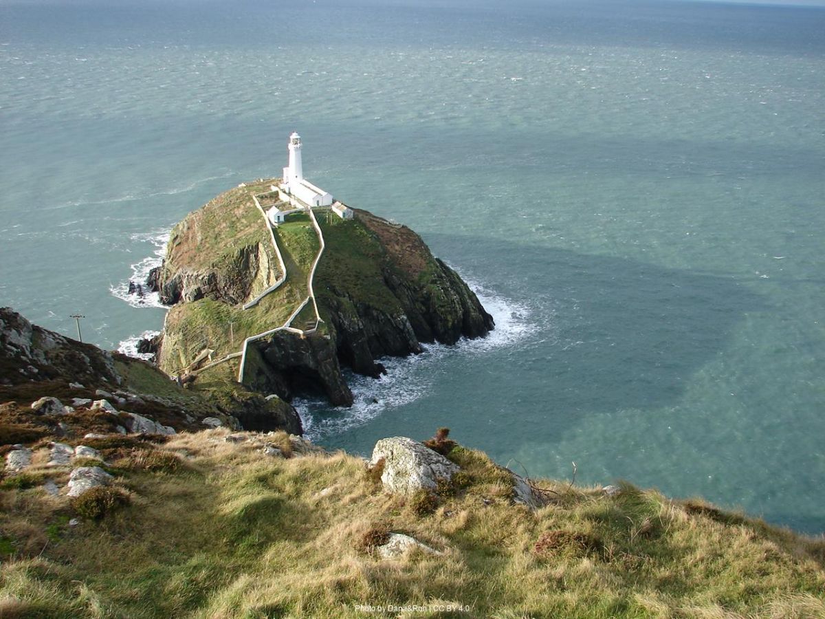
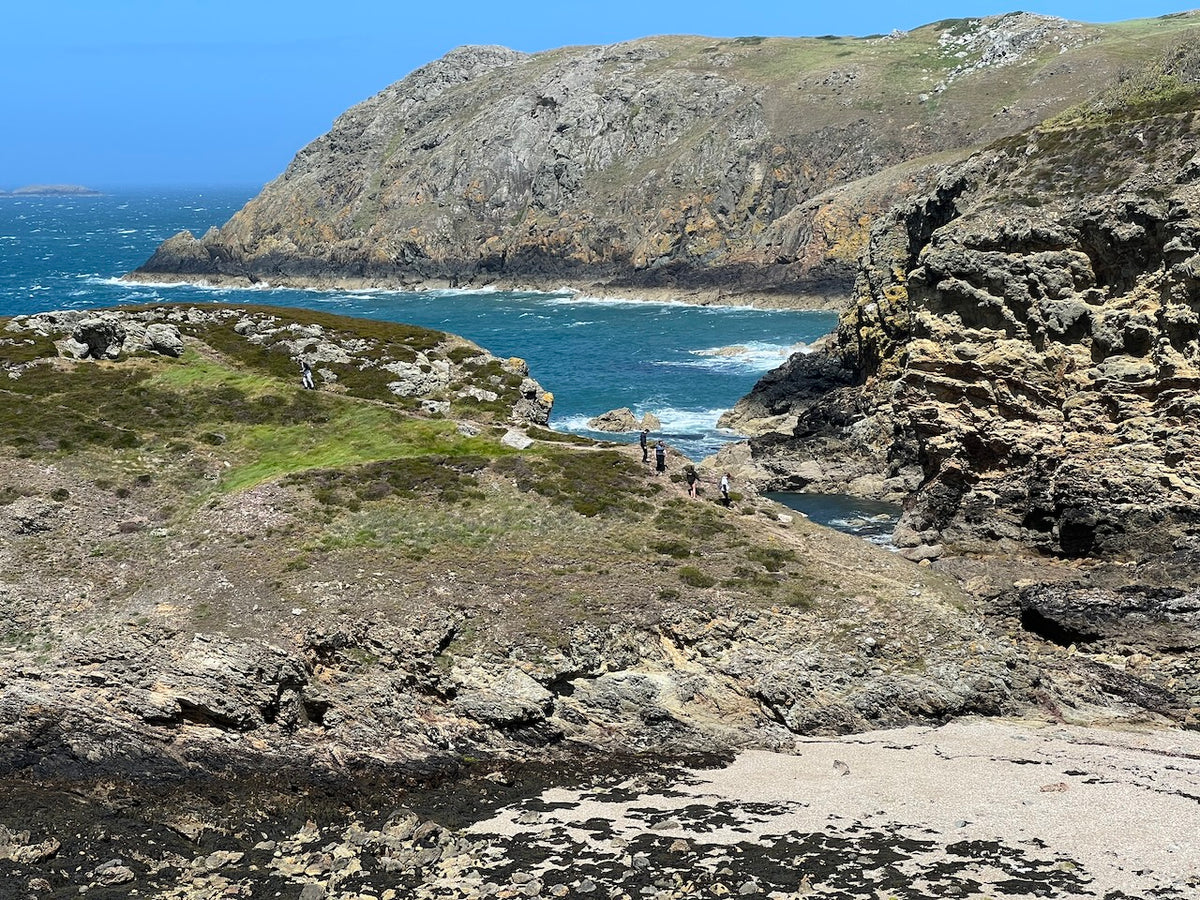
Cliffs, lighthouses, and the brickworks ruin at Porth Wen — the trail's most exposed and most visually loaded stretch.

You start on Holy Island — strictly a separate island, connected by causeway — and climb almost immediately past South Stack Lighthouse, reached by a long stairway down the cliff face. The path skirts Holyhead Mountain before turning east along a coast that gets steadily wilder. Past Cemlyn Bay's tern lagoon and the bulk of Wylfa headland, the cliffs harden. Bull Bay, the Porth Wen brickworks ruin standing in the bracken, Llanlleiana Head. The northern coast feels older than the rest of the island — old industry, old rocks, weather coming in directly off the Irish Sea — and Amlwch's sheltered harbour, when you reach it, is a relief.

Round to the Strait
Amlwch to Menai Bridge

Round to the Strait

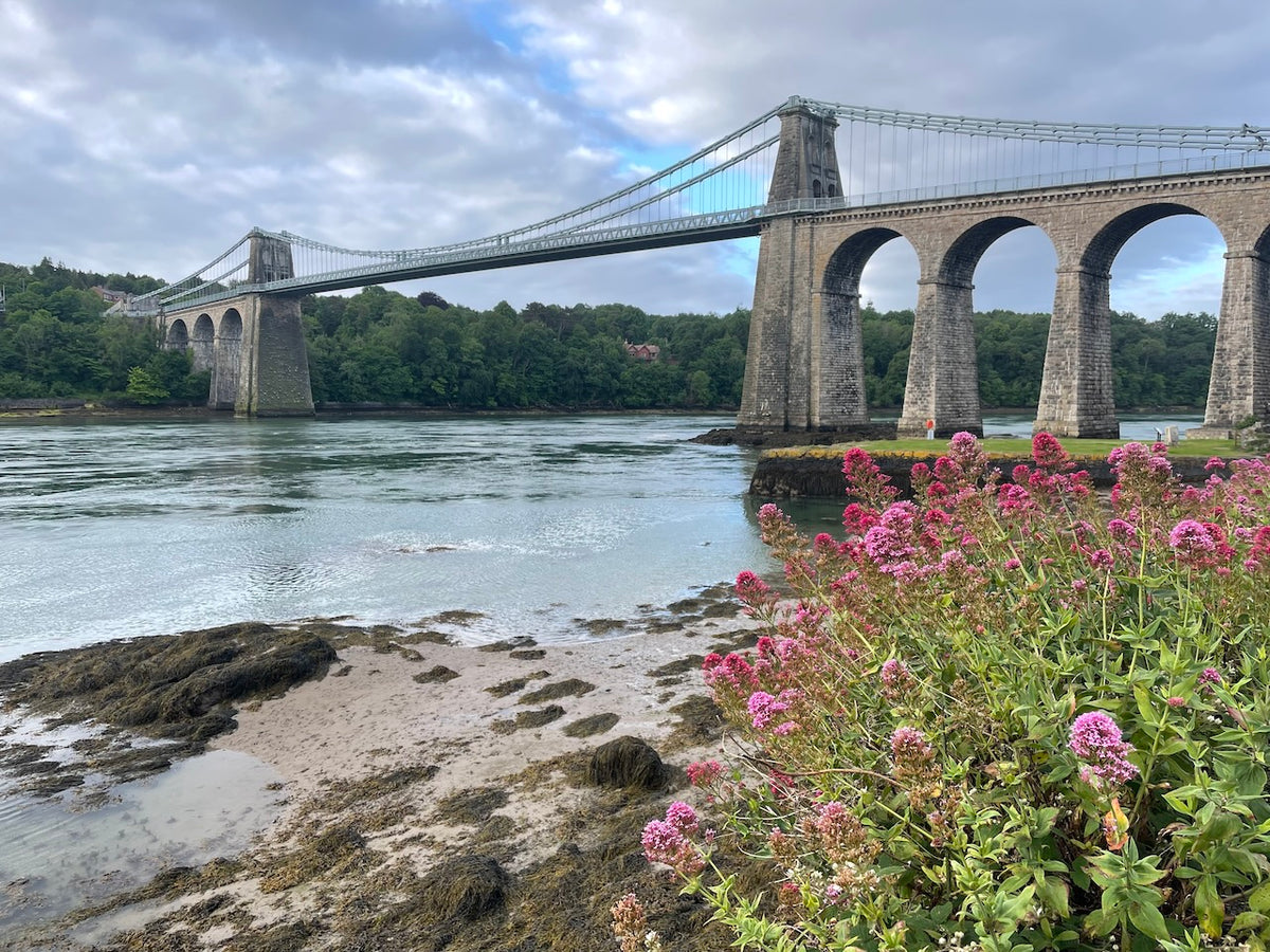
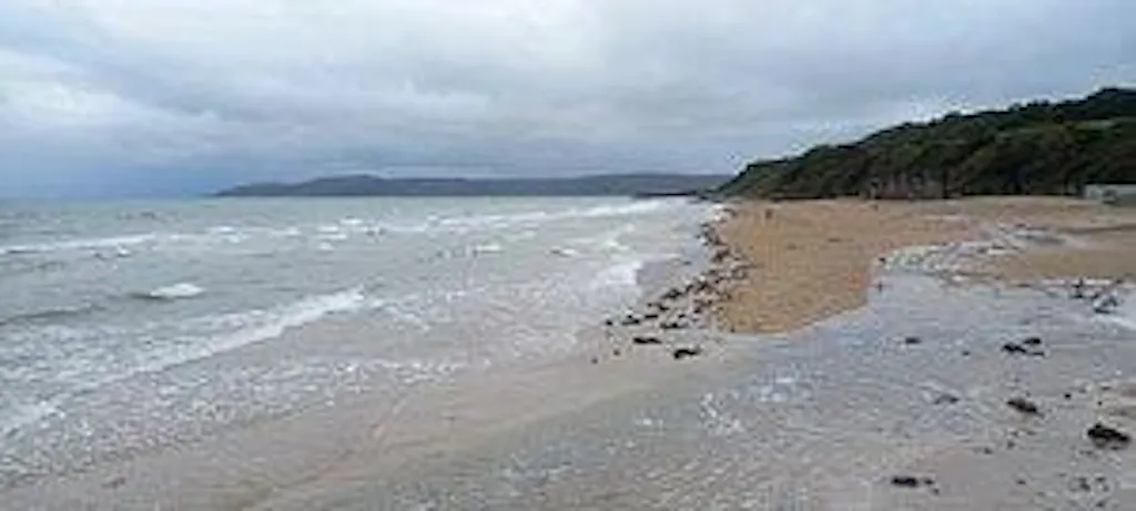
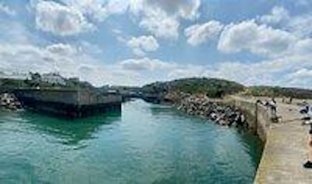
Beaches soften into headlands, the priory at Penmon turns the corner, and the Menai bridges arrive overhead.

From Amlwch the trail softens. Point Lynas Lighthouse sits on a low promontory, then the coast opens into Dulas Bay and the long sand of Traeth Lligwy. By Red Wharf Bay you've turned the corner into bay-and-headland country — broad tidal flats, a few low woods. Penmon Priory, twelfth-century and standing alone at the island's eastern tip, looks across to Puffin Island. Beaumaris's castle and Georgian seafront, then a slow approach to Telford's Menai Suspension Bridge and the strait pulling tight.

Sands and Holy Island
Menai Bridge to Holyhead

Sands and Holy Island

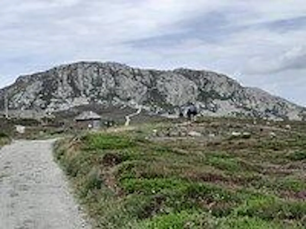
The long western sands, the chapel on Llanddwyn, and Holyhead Mountain rising again at the close.

You leave the strait through farmland and the Neolithic chamber at Bryn Celli Ddu, then drop into Newborough Forest and the long causeway out to Llanddwyn Island, where St Dwynwen's ruined chapel sits at the seaward end. From there the western coast broadens — Aberffraw's dunes, RAF Valley's airfield inland, then beach after beach. The crossing back to Holy Island returns you to where you started, and a final climb along the southern flank of Holyhead Mountain before the path drops to the harbour and closes the loop.

— Now Make It Yours —

Find Your Round Anglesey Coastal Path

Most people walk it in 9 days. Some want longer to take it all in. Others want the challenge of doing it quicker. Pick the trip that suits you — or customise yours below.

ABTOT 5690 · Financially protected Guidebook authors on every trail 72-hour confirmation or no charge Refund promise if we can't deliver
Your personalised Trail Book — trip overview, day by day itinerary and accommodation details

Included with every trip

Your personalised
Trail Book

Everything you need for every day of your trail — built around your exact itinerary. Your route, your accommodation, your packing list. Ready before you leave, works offline when you're out there.

Tonight's accommodation

Check-in time, room type, phone number and directions — all in one place

Day-by-day trail description

Route map, elevation profile and written description for each stage

Packing list and pre-trip checklist

Everything you need, nothing you don't. Tick items off as you go

Works offline

Open it once with data and it's yours — no signal needed on the trail

Included with every trip

Your route on every device you use

Your custom GPX file is built around your exact itinerary — day by day, door to door. Load it onto any device or app before you set off and navigate with confidence.

Works with

GPX route on Komoot iPhone app and Garmin watch
Something in the Air

Hear it from the trail

Nicola Whitbread

Nicola Whitbread walked the Anglesey Coast Path solo, sleeping on clifftop ledges, watching the tide creep to within four feet of her sleeping bag, and talking to the army about her laundry. She'd describe the island as magical. She's not wrong.

“"It's my favourite part of the entire Wales Coast Path. It stands out for its wildness, its quiet, its peace. It's just magical." — Nicola Whitbread”
Read Nicola’s story →
Craig, Trail Specialist at Big Trail Adventures
Talk to a Specialist

Knows the trail. Plans yours.

Craig Trail Specialist
The Anglesey is the kind of trail I always end up recommending to people who've done a Hadrian's Wall or a Cleveland Way and want sea on three sides instead of one. Plan around the tides at Red Wharf, leave a flexible day for Llanddwyn, and you'll be fine.

Craig has spent over ten years in adventure travel — most of it talking walkers through trails like this one. He's helped hundreds of customers plan their Round Anglesey, knows where people typically misjudge the tidal flats around Red Wharf and the timing of the Holy Island causeway, and has the calls in his pocket from people who've walked it the week before.

Ask Craig about the Round Anglesey Coastal Path

If you want to talk through your timing, your fitness, your pace, or anything the planner can't answer — call. Most of our customers do, and Craig's the one who'll answer.

The Practical Side

Before You Book

The things walkers ask us most often — answered plainly, so you don't have to ring to find out.

How fit do I need to be?

You should be comfortable walking 22 kilometres a day with a daypack, on coastal terrain that includes a cumulative ascent of 4,174 metres over the full circuit. The Hiker pace assumes that level. The Explorer pace stretches the trail to 11 days at around 18 km a day, which suits anyone wanting easier days or building fitness as they go.

When should I walk it?

May to September is the window. The peak summer months are the busiest — Anglesey is a popular Welsh destination and beach towns like Beaumaris and Trearddur fill up — so book accommodation early. April and October are workable shoulder seasons, but expect wind. The northern cliffs are exposed, and weather drives the experience more than crowds.

Do you include luggage transfer?

Yes — door-to-door bag transfer is included on the Standard and Premium packages, with a 20 kg allowance per bag. It works across every stage of the route, including the more remote sections of the north coast. Each morning your bag travels to that night's accommodation while you walk with a daypack.

What kind of accommodation do you book?

Family-run B&Bs, guesthouses, and traditional inns wherever possible — en-suite rooms, breakfast included, drying facilities for wet days. Anglesey has a good spread of small accommodation around the coast, though the northern stages have fewer options and we book further ahead in summer. We avoid chain hotels.

Can I walk it solo?

Yes — Anglesey suits solo walkers well. The path is part of the Wales Coast Path and is well-signed, you'll meet other walkers on the busier eastern and southern sections, and there's mobile coverage across most of the route. We can book single-occupancy rates and share emergency contacts with the accommodation along the way.

What's the realistic total cost?

Standard package starts at £1,169 per person for the Hiker pace (eight nights), which covers your accommodation booking, custom route, and on-trail support. Add £25–35 per day for lunches and drinks. Bus and rail to Holyhead is straightforward — the station is a few minutes from the trailhead. Total trip cost typically lands between £1,400 and £1,700 per person depending on pace and food choices.

Still not sure? Ring us on 0131 560 2740 — Craig usually answers.

Still Thinking?

Speak to Craig

If you've scrolled this far, we need to help you get onto this trail. The bit the planner can't help with — "is the pace right for me?", "is August really that busy?", "can we add a rest day in Keswick?" — that's a two-minute phone call. Most people who book the Round Anglesey Coastal Path ring first.