Across the Lakes Experience Overview
- The most spectacular section of the Coast to Coast Walk
- Stunning mountain scenery and tranquil lake views
- Challenging trails with rewarding summit experiences
The Lake District section of the UK’s renowned Coast to Coast Walk is widely regarded as one of the most scenic and rewarding stretches of the entire route. Originally devised by Alfred Wainwright, the trail carries a strong reputation for showcasing the very best of England’s natural beauty, blending rugged mountain passes with serene lakeshores. Geographically, this section lies within the boundaries of the Lake District National Park, a UNESCO World Heritage Site.
The terrain is f...
Read more
| Hilliness | |
| Start Point | St Bees, Cumbria (Western coastline of England) |
| End Point | Kirkby Stephen |
| Activity Type | Walking, Hiking, Trail Running |
| Distance | 129km | 80 miles |
| Ascent | 3,728m | 12,231ft |
| When to go | May through September |
| Baggage Transfer | Available |
Custom Adventure Plan: $213.00
Book Now
Not ready to book?
Call us on 0131 560 2740
or enquire by email
What's included?
-
Custom Adventure Plan
-
Accommodation options for you
-
Door‑to‑door GPX in our app
-
On‑trail support
-
Share with up to four people
Gallery

Sample Itinerary
Here's what's on the trail. We'll split the stages to each day just right for your pace.
Key Features: Irish Sea coastline, St Bees Head, Cleator Moor
Your Coast to Coast walk begins at St Bees, where tradition calls for dipping your boots in the Irish Sea. From the village, the trail climbs steeply up St Bees Head, past the lighthouse and dramatic cliffs, before easing into grassy coastal paths. Following the clifftops north, you’ll enjoy sweeping sea views and pass the RSPB reserve, home to England’s only colony of black guillemots. Turning inland, the route leads through Sandwith village, where the Dog and Partridge pub makes a welcome stop. The path then winds through farmland and quiet country lanes, offering a gentle transition from coast to countryside. Rolling fields gradually give way to wider views, with the western Lake District fells coming into sight. The final stretch crosses more farmland before reaching Cleator, where the Three Tuns pub awaits for well-earned refreshments at the end of this opening stage.
Key Features: Dent Hill, Ennerdale Water, Nannycatch Beck valley
Leaving Cleator, the route climbs Dent Hill (352m), the first real ascent, with sweeping views of the Irish Sea and the Lake District fells. A steep descent leads into the quiet Nannycatch Beck valley, winding through woodland and pastures. After crossing the beck, the trail reaches Ennerdale Bridge, where pubs and a village shop provide food, drink, and supplies.
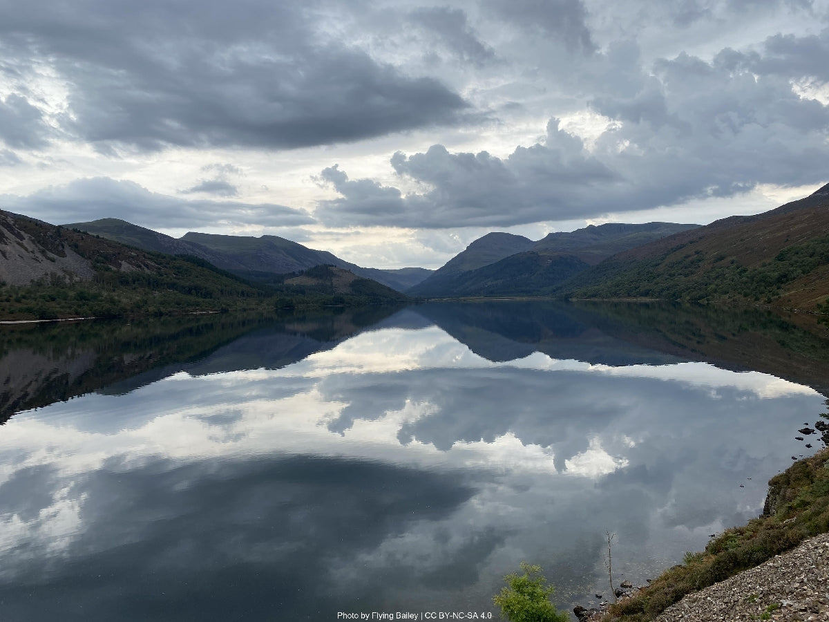
From here, the path follows the southern shore of Ennerdale Water, with striking views of Pillar and Steeple. The terrain varies between rocky lakeside sections and shaded forest tracks. At the lake’s end, the route crosses the River Liza before reaching YHA Ennerdale, a welcome stop for rest.
Key Features: Honister Pass, Greenup Edge, Far Easedale, Helm Crag (optional)
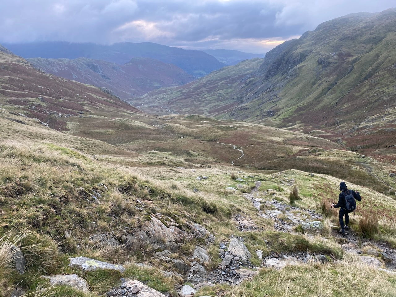
The trail continues 6km up the valley to the remote YHA Black Sail hostel (seasonal refreshments). From here, a steep climb up Loft Beck reveals views of Great Gable and Buttermere before descending along Moses Trod to the Honister Pass road. The Honister Slate Mine visitor center offers a café and facilities. The route then winds through Borrowdale’s ancient woodland beside the River Derwent, passing Longthwaite YHA and reaching Rosthwaite with its pubs, hotel, and local store.
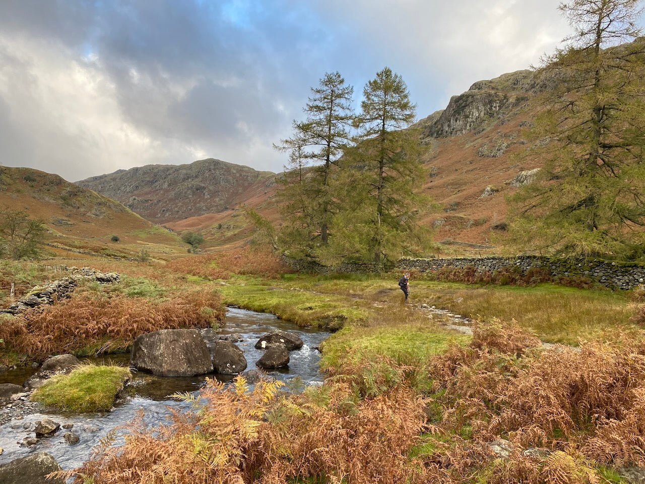
From Rosthwaite, follow the Cumbria Way through lush meadows and farmland to Stonethwaite, home to the Langstrath Country Inn. The path climbs beside Greenup Gill, becoming rocky before the steep ascent to Greenup Edge (620m), rewarding walkers with expansive Borrowdale views. The trail then descends Far Easedale valley towards Grasmere, where a short detour leads to numerous cafés, shops, and accommodation—including the famous Gingerbread Shop—in the village closely tied to Wordsworth.
Key Features: Grisedale Pass, Grisedale Tarn, Brothers Water view
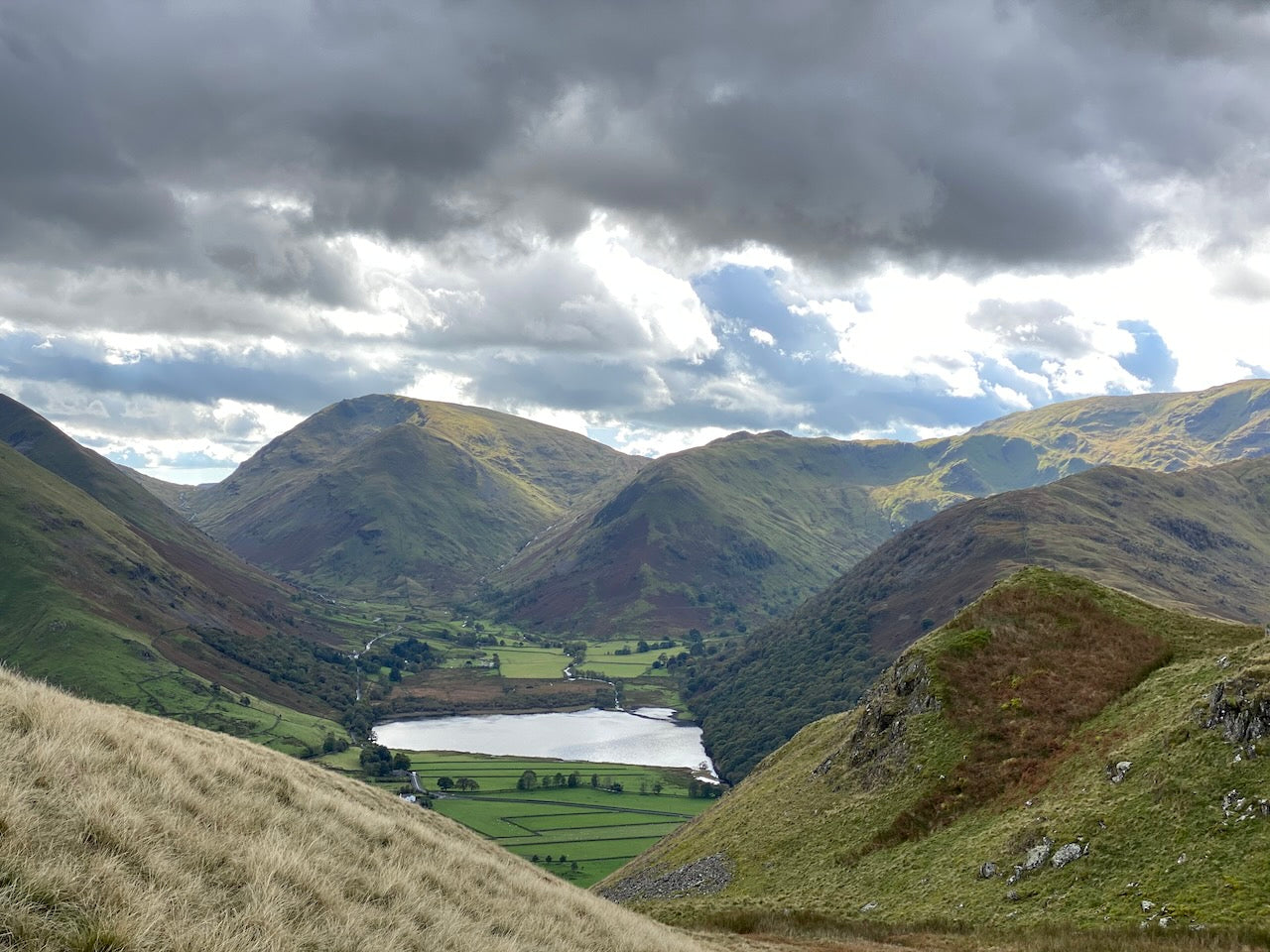
Despite being the shortest stage, this section includes substantial climbing and varying route options. From Grasmere, take the path past the Youth Hostel and begin climbing toward Great Tongue. The ascent continues steadily to Grisedale Tarn (538m), a stunning mountain lake nestled between Fairfield and Seat Sandal. Here, adventurous walkers have three options: the main route continues directly down Grisedale Valley; a high-level alternative climbs St Sunday Crag (841m); or the challenging route ascends Helvellyn (950m), England's third-highest peak. The main valley route provides the easiest passage, following Grisedale Beck down beautiful Grisedale Valley with views of the imposing eastern face of Fairfield. Reaching Patterdale and neighboring Glenridding offers access to Ullswater Lake. These twin villages provide good services, including a well-stocked store, hotels, and guesthouses. The area around Brotherswater on the approach offers excellent photographs of classic Lakeland scenery. Reliable water sources are available throughout, with Grisedale Beck following most of the descent route.
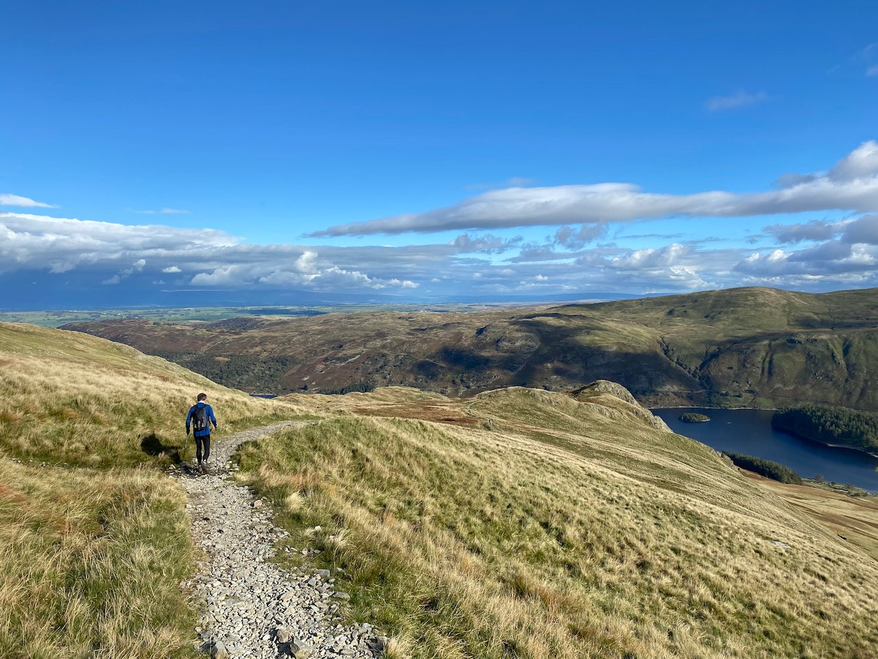
Key Features: Angle Tarn, Kidsty Pike, Haweswater Reservoir
This challenging stage marks the final – and highest – section of the Lake District, crossing the eastern fells before descending into the limestone landscape of Cumbria's Eden Valley. Leaving Patterdale, a sustained climb leads past beautiful Angle Tarn to The Knott and then onto Kidsty Pike (780m), the highest point of the entire Coast to Coast route. The descent to Haweswater Reservoir requires careful navigation on steep terrain. The path then follows the reservoir shoreline for approximately 6km, an occasionally undulating and rocky section with glimpses of golden eagles that nest in the area. After Burnbanks, the landscape transitions dramatically from Lakeland fells to the gentler terrain of the Eden Valley. The final approach to Shap passes prehistoric Kemp Howe stone circle and the imposing ruins of Shap Abbey before reaching the village itself, which stretches along the A6 road. Shap offers several accommodation options, a supermarket, and pubs. Water sources are plentiful until after Burnbanks, where streams become less frequent across the limestone terrain.
Key Features: Limestone pavement, Orton village, Smardale Bridge
This lengthy but less strenuous stage transitions fully from Lakeland terrain to the finish in the Yorkshire Dales. From Shap, the route crosses the M6 motorway and railway line before traversing limestone uplands characterized by expansive scenery and limestone pavements. The pretty village of Orton makes an excellent refreshment stop, known for its chocolate factory and monthly farmers' market. Beyond Orton, the route crosses Crosby Ravensworth Fell and Ravenstonedale Moor, offering vast horizons and a sense of solitude rare on the earlier stages. The scenery becomes increasingly pastoral as you descend toward Smardale Bridge, a beautiful ancient structure spanning Scandal Beck. The final approach to Kirkby Stephen passes through meadows and farmland. Kirkby Stephen itself is the largest settlement since St Bees, offering all services including banks, outdoor shops, supermarkets, and a range of accommodation. Water sources become more intermittent across this limestone terrain – carry sufficient supply between settlements. This stage showcases how the geology underpinning the landscape transforms the character of the walking experience.
How long will it take?
Everyone has a different approach to trails. Here are our suggested times for the Across the Lakes Experience for different types of adventurers.
Here we have assumed that you will be out on the trail for around 8 hours per day, including regular breaks but not extended lunch stops.

7
Days
For walkers who love the journey as much as the destination.
You enjoy full days on the trail, moving steadily, soaking up the scenery — with plenty of time for food and drink stops along the way!

6
Days
For long-distance walkers who enjoy the challenge of a steady pace over varied terrain.
You’ve got the fitness to cover strong distances over several days — this is where most keen hikers will find themselves.

4
Days
The first of our faster categories — built for those who prioritise pace.
You move quickly with minimal stops, carry just the essentials, and have the fitness to handle long days and tough terrain.

3
Days
Our fastest pace – ideal for those used to ultramarathons.
You mix fast hiking with running on flats and descents, even over mountains. Speed and efficiency matter most, with minimal stops as you aim to complete each route as quickly as possible.
Essential Travel Information
The Coast to Coast Walk is best undertaken between May and September when weather conditions are generally most favorable and daylight hours longest. Early May offers spectacular spring flowers in the dales, while late August showcases purple heather across the moors. July and August provide the most reliable weather but coincide with peak tourist season and school holidays.
Weather patterns vary significantly across the route's three national parks. The Lake District receives the highest rainfall (average 200+ days per year), while the North York Moors can experience extended dry periods but sudden heavy storms. Winter attempts are not recommended due to short daylight hours and potential snow cover on higher sections.
Seasonal hazards include:
- Spring: Lingering snow patches on high Lake District fells, river crossings after heavy rain
- Summer: Overcrowding in popular areas, limited accommodation availability
- Autumn: Decreasing daylight hours, increasing chance of mist and fog
- Winter: Snow and ice on high routes, potentially dangerous conditions
Most facilities operate fully from Easter through October, with limited operation during winter months. Some remote pubs and guesthouses close completely in winter or operate reduced hours.
The Coast to Coast offers varied accommodation options:
- B&Bs/Guesthouses: £70-120 per night (double room), most common option
- Hotels: £100-180 per night, available in larger settlements
- Hostels: £20-35 per night (dormitory bed), located in key points including Black Sail, Grasmere, Patterdale, Kirkby Stephen
- Bunkhouses: £25-40 per night, basic dormitory-style accommodation
- Camping: £8-15 per night at designated sites, wild camping permitted only in certain areas of Lake District with restrictions
Advance booking is essential during peak season (June-August), particularly in smaller settlements with limited options like Keld, Ingleby Cross, and Clay Bank Top (requiring transportation to accommodation). Book at least 3-6 months ahead for summer trips, especially for weekend dates.
Popular stopover points often include:
- Rosthwaite or Grasmere (splitting Lake District section)
- Patterdale (before the challenging Kidsty Pike stage)
The Coast to Coast Lake District Stage route is accessible via public transportation at the start and end point, plus several mid-points:
Nearest major airports:
- Manchester International (3-4 hours to St Bees by train)
- Newcastle International (3 hours to St Bees by train)
- Leeds-Bradford (4 hours to St Bees by train/bus)
St Bees is accessible by train on the Cumbrian Coast Line from Carlisle or Lancaster. Kirkby Stephen is on the Leeds-Carlisle train line.
Key public transportation hubs along the route:
- Richmond (bus connections to Darlington train station)
For emergencies or schedule adjustments, major bail-out points with transportation links include:
- Grasmere (bus to Windermere train station)
- Patterdale (bus to Penrith train station)
Many hikers use baggage transfer services (approximately £10-15 per bag per stage) to carry their main luggage between accommodation points, walking with just a daypack.
A comprehensive 6-day Coast to Coast Lake District Stage trip budget estimate:
Accommodation costs (mid-range):
- B&B/guesthouse: £85-120 per night (£510-£720 total)
- Mixed accommodation (some hostels): £60-100 per night (£360-£600 total)
- Camping with occasional indoor stays: £30-50 per night (£180-£300 total)
Transportation expenses:
- Return train fare to/from London: £120-200
- Local buses/taxis to accommodation off-route: £50-100
- Baggage transfer service (optional): £100-150
Food and supplies:
- Breakfast (usually included in accommodation): £0-10 per day
- Packed lunch: £5-10 per day (£30-£60 total)
- Evening meal: £15-30 per day (£90-£150 total)
- Snacks and drinks: £10-15 per day (£60-£90 total)
Additional expenses:
- Guidebook and maps: £25-40
- Equipment purchases/rentals: varies significantly
- Emergency fund: £150-200 recommended
Total estimated budget range:
- Comfort option (B&Bs, baggage transfer, restaurant meals): £1,000-£1,200
- Standard option (mixed accommodation, some baggage transfer): £800-£1000
- Budget option (mostly camping, carrying own pack): £300-£400
The Coast to Coast ranks among Britain's most popular long-distance routes despite its unofficial status (until Spring 2026 when it becomes a National Trail). The Lake District section is widely regarded as the highlight of the route.
Peak season (mid-June through August) sees the highest traffic, with popular accommodation filling months in advance. May, early June, and September offer excellent alternatives with moderate traffic and good weather odds.
For maximum solitude, consider:
- Hiking mid-week rather than starting on weekends
- Visiting in April/early May or late September/October
- Taking alternative high route variants where possible
Cultural considerations include respecting local farming communities by following the Countryside Code, particularly regarding gates, livestock, and local facilities. Many small villages along the route depend on walker income while managing the impact of tourism.
Typical hiker demographics show a broad age range with particularly strong representation of retired walkers (60+) and those in the 40-55 age bracket. International walkers (particularly from Netherlands, Germany, USA, and Australia) comprise approximately 30% of hikers of the trail.
Social opportunities abound at overnight stops, with walkers typically gathering in local pubs to share experiences. Many form impromptu walking groups after meeting on early stages. The shared challenge creates a unique camaraderie.
Let our app guide you
-
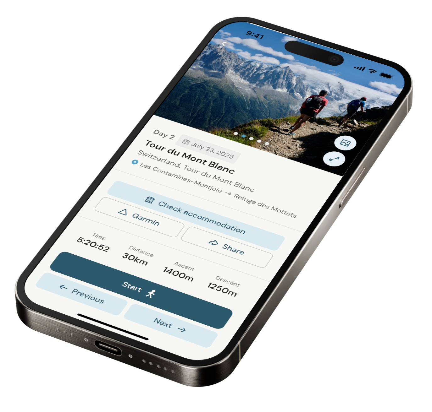
Our app for going off-grid
Know what to expect. Navigate with confidence. See all your details in one place.
-
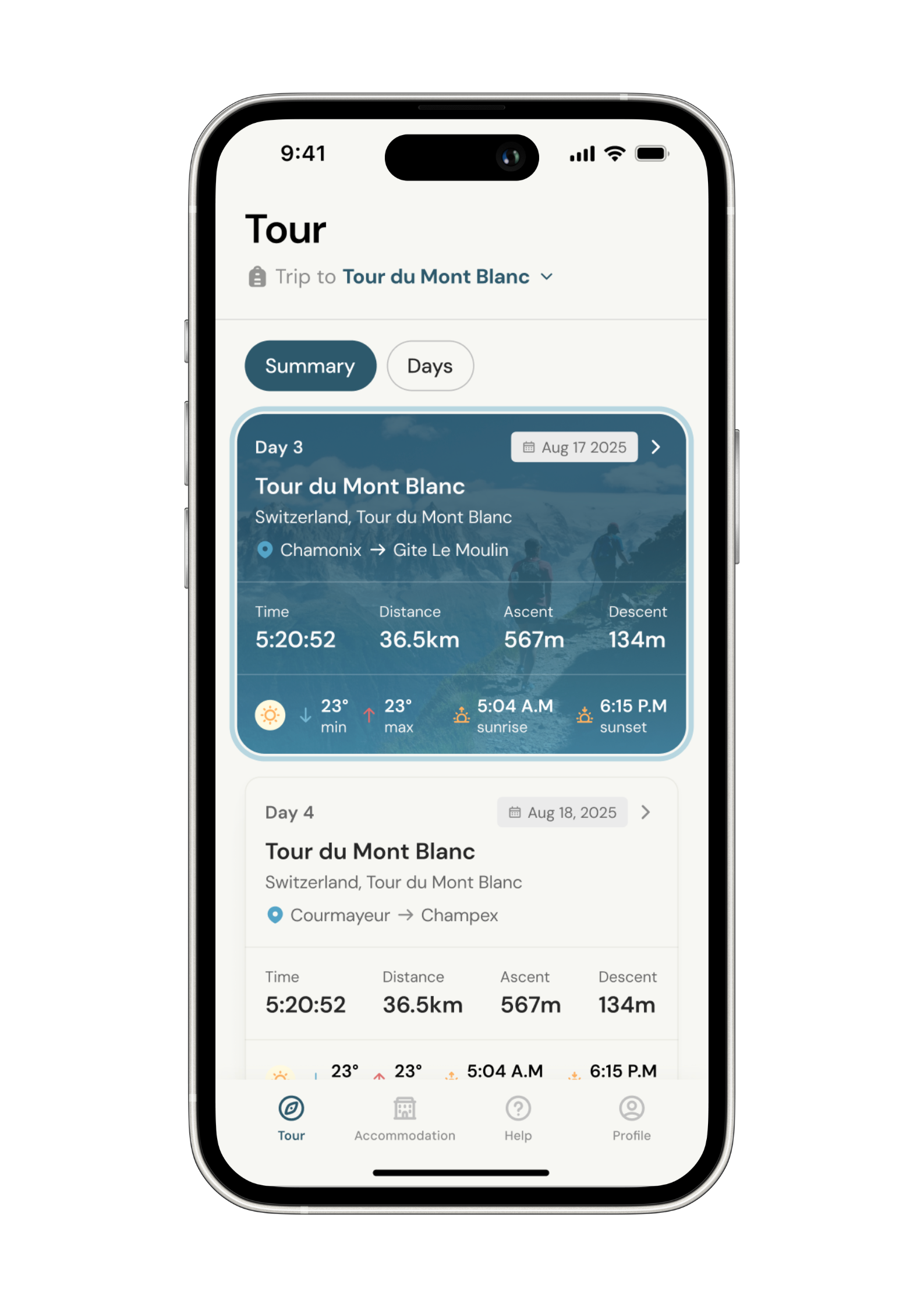
Know what to expect
See al the details of your adventure in one place so you can plan each stage with confidence.
- Distance
- Ascent & descent
- The time it will take you.
- The weather forecast for each day
-
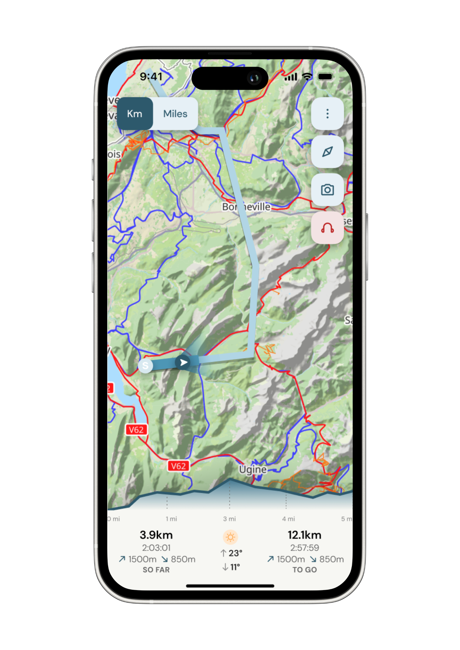
Navigate with confidence
Follow your trail on maps specifically chosen for walkers on the trail. Track your progress and get weather updates.
Need re-routing? Support is available at the click of a button.
-
Admin. In once place.
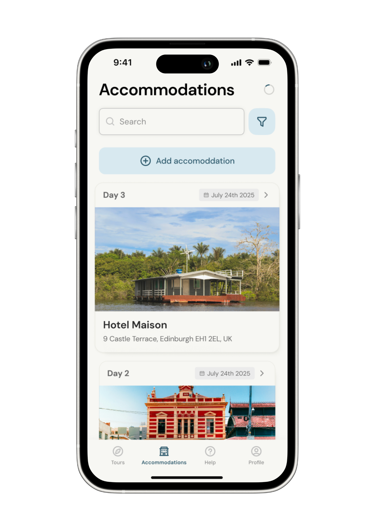
Store all the details of your accommodation in the app alongside each stage of your adventure.
No signal, no problem. Everything is stored locally.