Cumbria Way Experience Overview
- Quintessential Lake District landscapes
- Cultural heritage at every turn
- Accessible challenge for most abilities
The Cumbria Way threads through the heart of England's celebrated Lake District National Park, connecting the historic market town of Ulverston with the vibrant border city of Carlisle. The Cumbria Way Compact takes in the best part of the route in a journey through the Lakes to Keswick. This 70-kilometer section showcases the highlights, through valleys and past stunning lakes to finish in the vibrant market town of Keswick.
It's accessible enough to fit into a short trip to Cumbri...
Read more
| Hilliness | |
| Start Point | Ulverston, Cumbria |
| End Point | Keswick, Cumbria |
| Activity Type | Walking, Hiking, Trail Running |
| Distance | 70km | 44 miles |
| Ascent | 1,441m | 1,390ft |
| When to go | May, June, September, early October |
| Baggage Transfer | Available |
Custom Adventure Plan: $131.00
Book Now
Not ready to book?
Call us on 0131 560 2740
or enquire by email
What's included?
-
Custom Adventure Plan
-
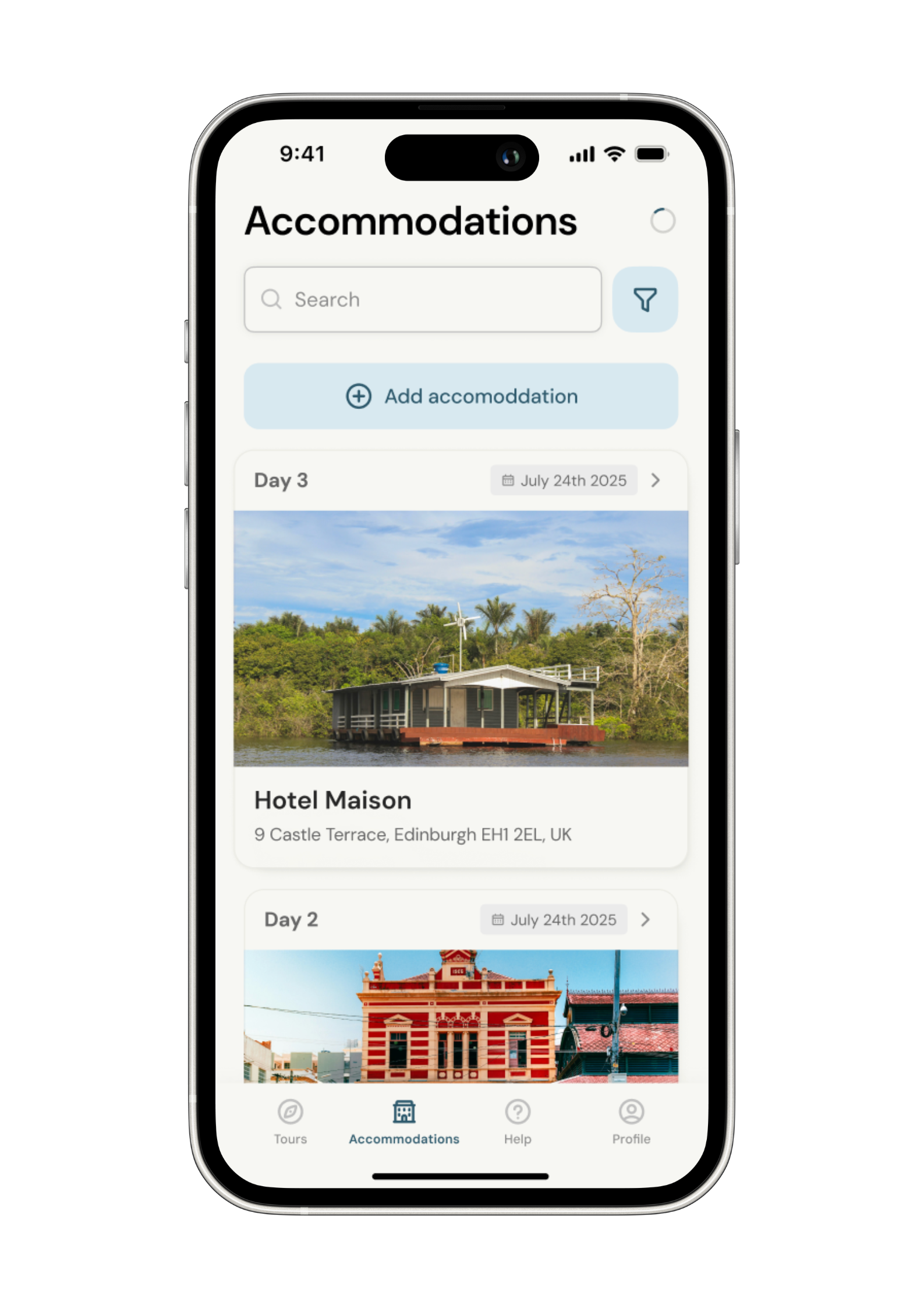
Accommodation options for you
-
Door‑to‑door GPX in our app
-
On‑trail support
-
Share with up to four people
Gallery

Sample Itinerary
Here's what's on the trail. We'll split the stages to each day just right for your pace.
Key Features: Ulverston Canal, Beacon Tarn, Coniston Water
Cultural Notes: Hoad Monument, Swarthmoor Hall (Quaker history)
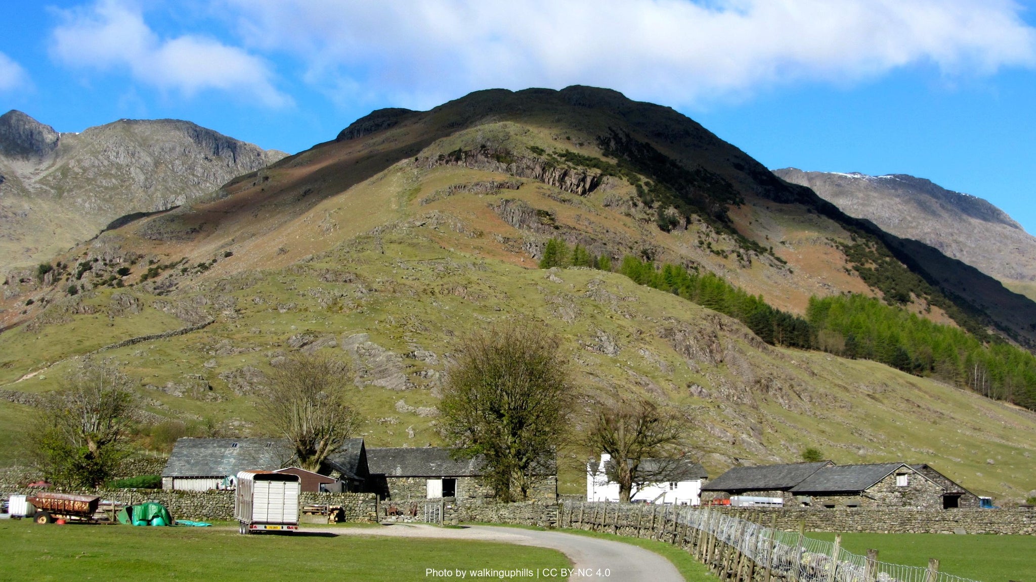
The Cumbria Way begins at the stone monument in Ulverston's Market Street, quickly transitioning from town streets to gently rolling countryside. After passing the Sir John Barrow Monument (locally known as Hoad Monument) atop Hoad Hill, the trail continues northward through pastoral landscapes dotted with sheep farms and drystone walls. This stage offers a gentle introduction to Lake District walking, traversing low fells and countryside that gradually becomes more dramatic as you proceed northward.
The route passes near historic Swarthmoor Hall, an important site in Quaker history, before climbing through Blawith Fells. Here, hikers catch their first proper mountain views as the imposing Coniston Fells come into sight. A highlight is Beacon Tarn, a small mountain lake offering a perfect lunch spot with expansive views. The final stretch descends toward Coniston Water, one of the Lake District's most picturesque lakes, before arriving in the village of Coniston itself, nestled beneath the imposing Old Man of Coniston mountain.
Coniston offers multiple accommodation options and has strong connections to John Ruskin and Arthur Ransome (of "Swallows and Amazons" fame). Water sources are plentiful throughout this section, and the Bluebird Café on Coniston's lakefront provides a welcome refreshment opportunity before your overnight stay.
Key Features: Tarn Hows, Elterwater, Skelwith Force, Great Langdale Valley
Cultural Notes: Beatrix Potter connections, traditional slate mining landscapes
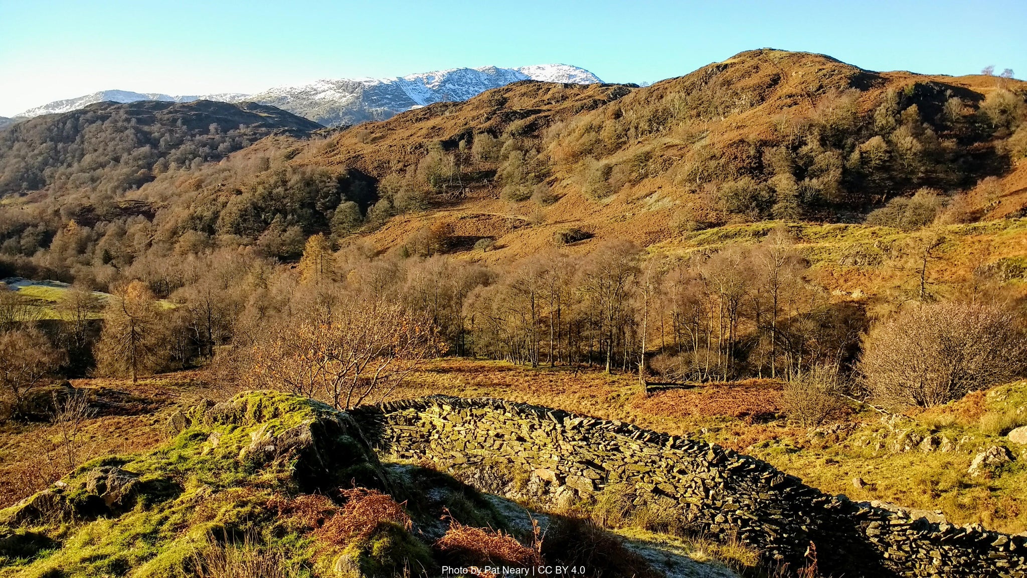
Leaving Coniston, the path climbs steadily through Yewdale before reaching Tarn Hows, one of the Lake District's most visited beauty spots – an artificial yet stunning lake surrounded by mixed woodland and mountains. The morning light here can be spectacular, illuminating the tarn and surrounding hills. After circling the tarn, the route continues through coniferous plantation and native woodland toward Little Langdale.
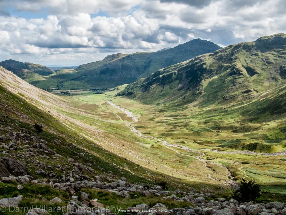
A steep descent leads to Skelwith Force, a thunderous waterfall on the River Brathay, before following the river through Elterwater village. Here, the scenery transforms dramatically as you enter Great Langdale, one of the Lake District's most iconic valleys. Dominated by the Langdale Pikes – a jagged skyline of distinctive peaks – this glacial valley showcases classic Lake District topography at its most impressive.
Water is abundant throughout this section, with numerous streams and the River Brathay providing reliable sources. The hamlets of Chapel Stile and Elterwater offer welcome refreshment stops, with the Britannia Inn in Elterwater providing exceptional local ales. This stage concludes at the head of Great Langdale, where the New Dungeon Ghyll Hotel and Old Dungeon Ghyll pub provide accommodation and hearty meals. The National Trust campsite nearby offers an excellent budget option within sight of the magnificent Langdale Pikes.
Key Features: Stake Pass, Langstrath Valley, Derwentwater
Cultural Notes: Borrowdale's mining heritage, Greta Hall (Coleridge's home)
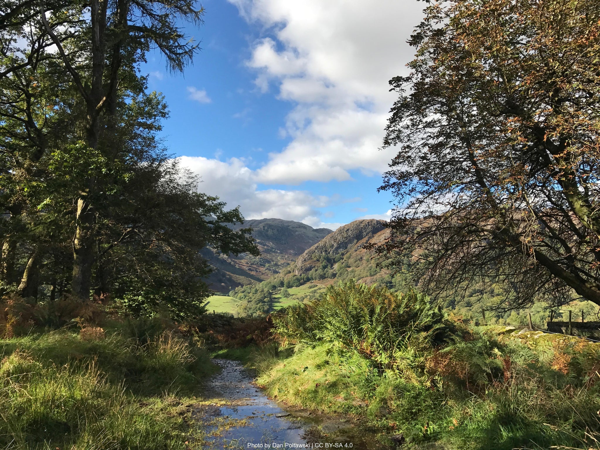
This challenging stage begins with the route's highest and most demanding section – the ascent of Stake Pass (481m). From Great Langdale, the path climbs steadily through Mickleden before tackling the zigzagging ascent to the pass. Weather conditions can change rapidly here, so proper navigation skills are essential in poor visibility. Once over Stake Pass, the trail descends into the remote Langstrath Valley, following the bubbling Langstrath Beck through a landscape that feels distinctly more wild and secluded than previous sections.
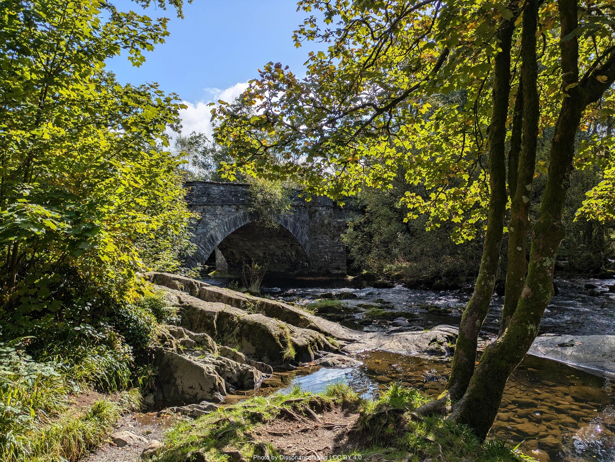
After passing the hamlet of Stonethwaite, the route enters beautiful Borrowdale, often described as England's prettiest valley. Here, verdant woodland, crystalline streams, and traditional farms create a pastoral idyll. The trail follows the River Derwent to Grange, where the Borrowdale Tea Room offers welcomed refreshment. The final stretch skirts the shores of Derwentwater, one of the Lake District's most beautiful lakes, with views across to the distinctive profile of Catbells fell.
Reliable water sources include Langstrath Beck and numerous streams in Borrowdale. The path concludes in Keswick, the Lake District's adventure capital, where numerous accommodation options, outdoor shops, and restaurants await. Keswick's position makes it an ideal resupply point, with several supermarkets and a twice-weekly market (Thursdays and Saturdays). Consider visiting Greta Hall, once home to poet Samuel Taylor Coleridge, which overlooks the town center.
How long will it take?
Everyone has a different approach to trails. Here are our suggested times for the Cumbria Way Experience for different types of adventurers.
Here we have assumed that you will be out on the trail for around 8 hours per day, including regular breaks but not extended lunch stops.

4
Days
For walkers who love the journey as much as the destination.
You enjoy full days on the trail, moving steadily, soaking up the scenery — with plenty of time for food and drink stops along the way!

3
Days
For long-distance walkers who enjoy the challenge of a steady pace over varied terrain.
You’ve got the fitness to cover strong distances over several days — this is where most keen hikers will find themselves.

2
Days
The first of our faster categories — built for those who prioritise pace.
You move quickly with minimal stops, carry just the essentials, and have the fitness to handle long days and tough terrain.

2
Days
Our fastest pace – ideal for those used to ultramarathons.
You mix fast hiking with running on flats and descents, even over mountains. Speed and efficiency matter most, with minimal stops as you aim to complete each route as quickly as possible.
Essential Travel Information
The Cumbria Way is best hiked between May and early October, with June and September offering ideal conditions – warm temperatures, longer daylight hours, and typically more stable weather patterns. Mid-summer (July-August) brings the advantages of long daylight hours but coincides with school holidays, resulting in busier trails and accommodations.
Spring (April-May) rewards hikers with vibrant wildflowers and new foliage, while autumn (September-October) offers spectacular color changes and atmospheric misty mornings. Winter hiking (November-March) is possible for experienced trekkers but requires proper equipment and advanced navigation skills, as waymarking may be obscured by snow and daylight hours are significantly reduced.
The Lake District's weather is notoriously changeable in all seasons. Rain is possible year-round (the region receives an average of 200+ rainy days annually), with extended periods of settled weather more likely in late spring and early autumn. Summer thunderstorms can develop quickly, particularly in the afternoon. Always check mountain weather forecasts before departing each morning.
Seasonal hazards include:
- Spring: Snowmelt can create boggy conditions, particularly on Stake Pass
- Summer: Heat exhaustion on exposed sections; limited water on northern fells
- Autumn: Earlier nightfall requires careful timing; river crossings may become problematic after heavy rain
- Winter: Short daylight hours, snow/ice on higher sections, limited accommodation availability
All facilities along the route operate year-round, though some accommodation providers may reduce service during winter months.
The Cumbria Way offers diverse accommodation options at each traditional stopping point:
Hotels/Inns (£80-£150/night):
- The Black Bull Inn, The Crown Inn in Coniston
- New Dungeon Ghyll Hotel in Great Langdale
- Numerous options across all price ranges in Keswick
B&Bs/Guesthouses (£60-£100/night):
- Present in all overnight stops plus smaller settlements
- Typically include hearty breakfasts perfect for hikers
- Often family-run with local knowledge
Hostels/Bunkhouses (£20-£35/night):
- YHA Coniston Holly How
- Great Langdale National Trust Campsite (camping pods)
- YHA Keswick
- Independent bunkhouses in most locations
Camping (£8-£15/night):
- Formal campsites in Coniston, Great Langdale and Keswick
- Wild camping technically requires landowner permission but is tolerated in remote areas above the highest fell wall if practiced responsibly
Booking recommendations:
- Reserve accommodation 2-3 months in advance for summer hiking
- 4-6 weeks advance booking sufficient for shoulder seasons
- Weekend availability is limited year-round
- Keswick and Coniston accommodations book particularly quickly
Popular stopover points:
- Coniston, Great Langdale and Keswick, though alternative stopping places can be arranged for those preferring shorter or longer daily stages.
Nearest airports:
- Manchester International Airport (2.5 hours by train to Ulverston)
- Glasgow International Airport (2 hours by train to Penrith)
- Newcastle International Airport (1.5 hours by train to Penrith)
Train connections:
- Ulverston: On the Cumbrian Coast Line (connections from Manchester, Preston)
- Penrith: On the West Coast Main Line (direct trains to London, Glasgow, Edinburgh)
- Connection time between trailheads: Approximately 2 hours by rail
Local transportation:
- Bus services connect most villages along the route (Stagecoach Cumbria)
- Taxi services available in larger settlements (pre-booking essential)
- The Keswick Launch provides boat services on Derwentwater (useful for accessing accommodation on the lake's eastern shore)
Trailhead access:
- Ulverston start point: 15-minute walk from train station
- Keswick end point: 40-minute bus ride to Penrith train station
Evacuation points and bail-out options:
- Stage 1: A5084 road crossing (midway) for transport to Ulverston/Coniston
- Stage 2: Elterwater village has bus connections to Ambleside
- Stage 3: Rosthwaite village has limited bus service to Keswick
Accommodation costs (per person per night):
- Budget: £30-£45 (hostels, camping)
- Mid-range: £60-£100 (B&Bs, guesthouses)
- High-end: £100-£150+ (hotels, country inns)
Transportation expenses:
- Return train ticket London-Ulverston/Penrith - London: £85-£150 (advance booking)
- Local buses: £4-£8 per journey
- Taxi transfers (when necessary): £20-£40 depending on distance
Food and supplies:
- Pub/café meals: £12-£20 per main course
- Supermarket supplies for self-catering: £10-£15 per day
- Packed lunches from accommodation: £7-£10
Additional costs:
- No permits required for the trail itself
- Maps/guidebooks: £15-£25
- Weather/equipment considerations: Quality waterproofs essential (£100+ if purchasing)
Total budget guidelines (excluding gear):
- Budget approach (camping/hostels, self-catering): £45-£60 per day
- Standard approach (B&Bs, mix of eating out/self-catering): £90-£120 per day
- Comfort approach (hotels, eating out): £150-£200+ per day
The Cumbria Way experiences moderate traffic compared to other Lake District routes, with distinct patterns throughout the year:
Peak seasons:
- July-August: Busiest period, coinciding with school holidays
- Weekends year-round, particularly bank holiday weekends
Quieter alternatives:
- Mid-week hiking outside school holidays
- May and late September/early October offer excellent conditions with fewer fellow hikers
Cultural considerations:
- Respect for farming activities – close gates, keep dogs leashed during lambing season (March-June)
- "Right to roam" in England gives access to open country, but respect private land
- Traditional Lake District customs include friendly greetings to fellow walkers
Typical hiker demographics:
- Predominantly 40+ age group, though increasing numbers of younger hikers
- Mix of British trekkers and international visitors (particularly German, Dutch, and American)
- Approximately 60% independent hikers, 40% guided groups
Opportunities for solitude:
- Early morning departures (before 8am) typically offer quieter trail conditions
- Detours to higher ground away from the main path often reward with solitude
- Winter months offer near-solitude but require appropriate experience and equipment
The Cumbria Way strikes an excellent balance between sociability and solitude. Village stops provide opportunities to meet fellow trekkers and locals alike, while long stretches of open countryside allow for peaceful reflection amid some of England's finest landscapes.
Let our app guide you
-
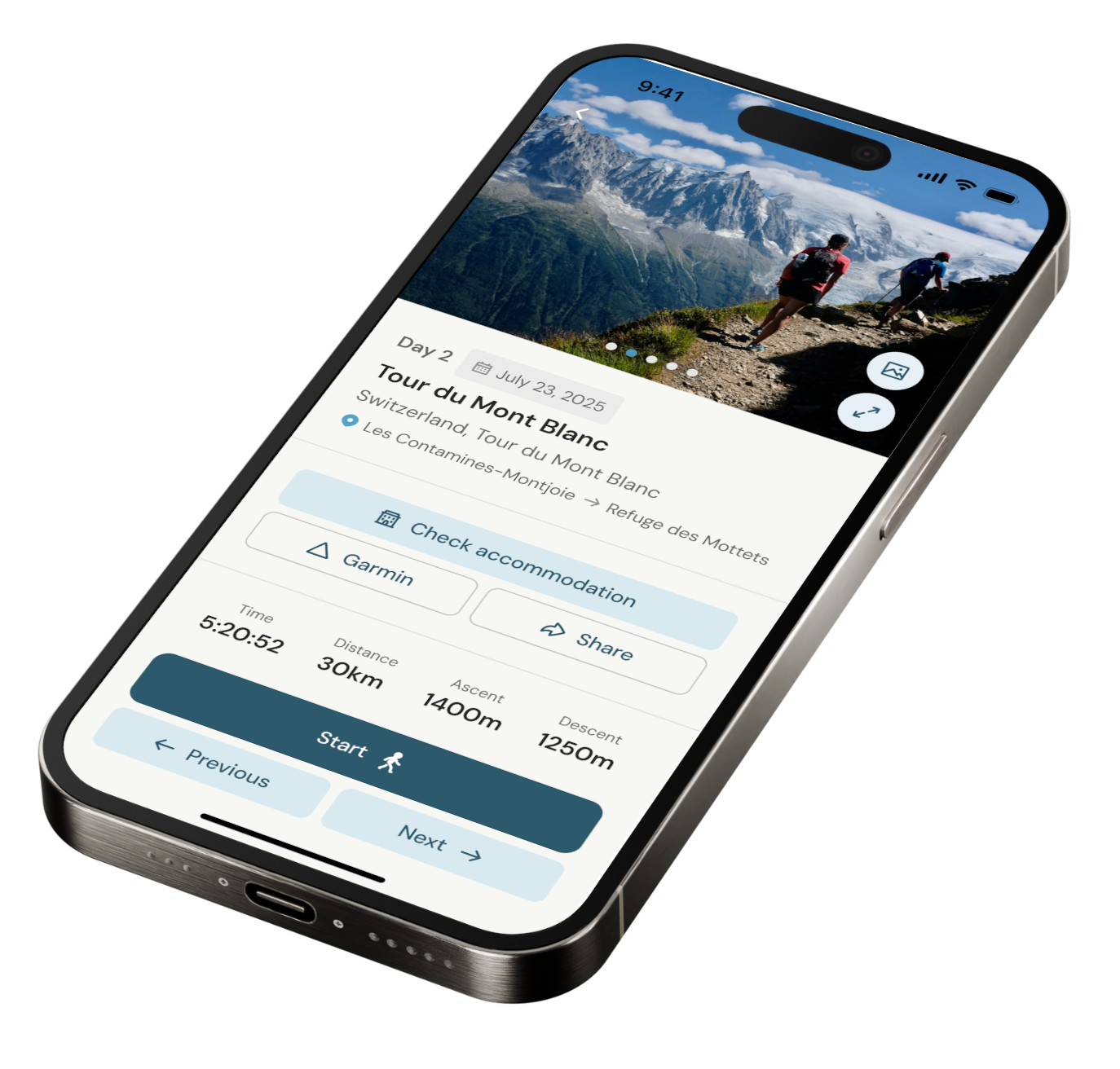
Our app for going off-grid
Know what to expect. Navigate with confidence. See all your details in one place.
-
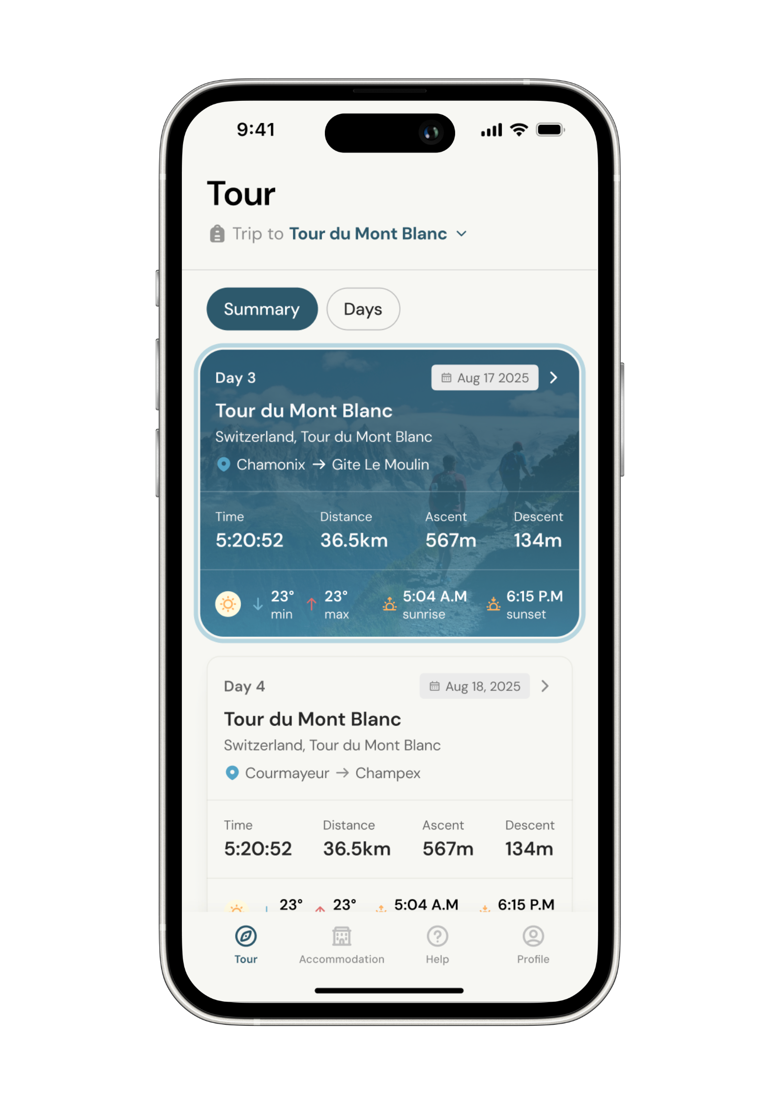
Know what to expect
See al the details of your adventure in one place so you can plan each stage with confidence.
- Distance
- Ascent & descent
- The time it will take you.
- The weather forecast for each day
-
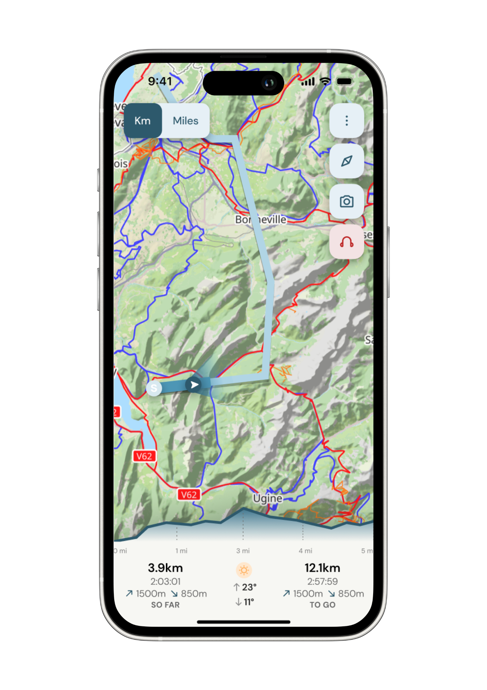
Navigate with confidence
Follow your trail on maps specifically chosen for walkers on the trail. Track your progress and get weather updates.
Need re-routing? Support is available at the click of a button.
-
Admin. In once place.
Store all the details of your accommodation in the app alongside each stage of your adventure.
No signal, no problem. Everything is stored locally.