Wee West Highland Way Overview
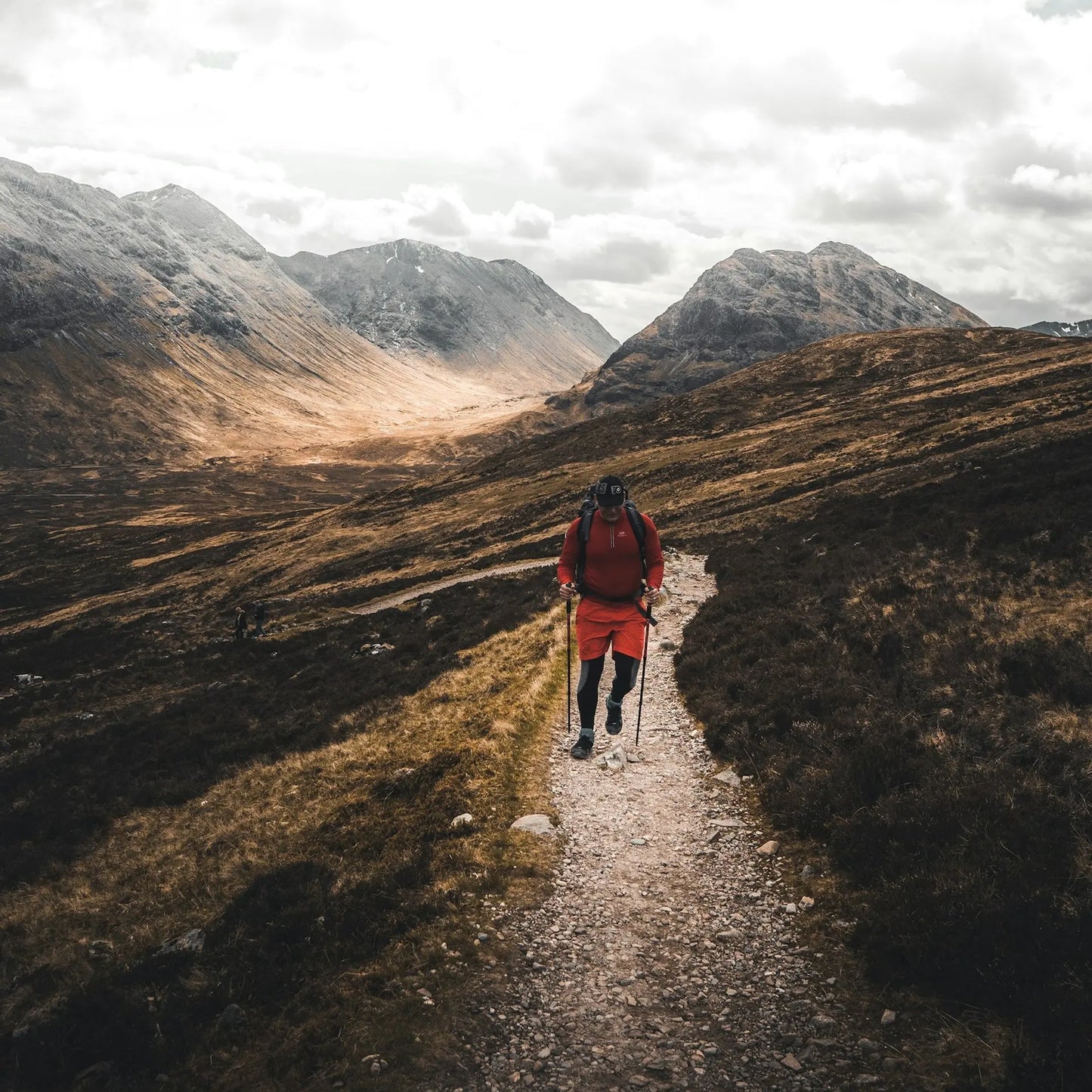
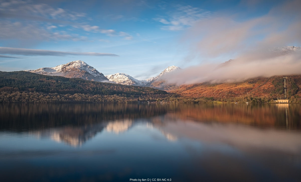
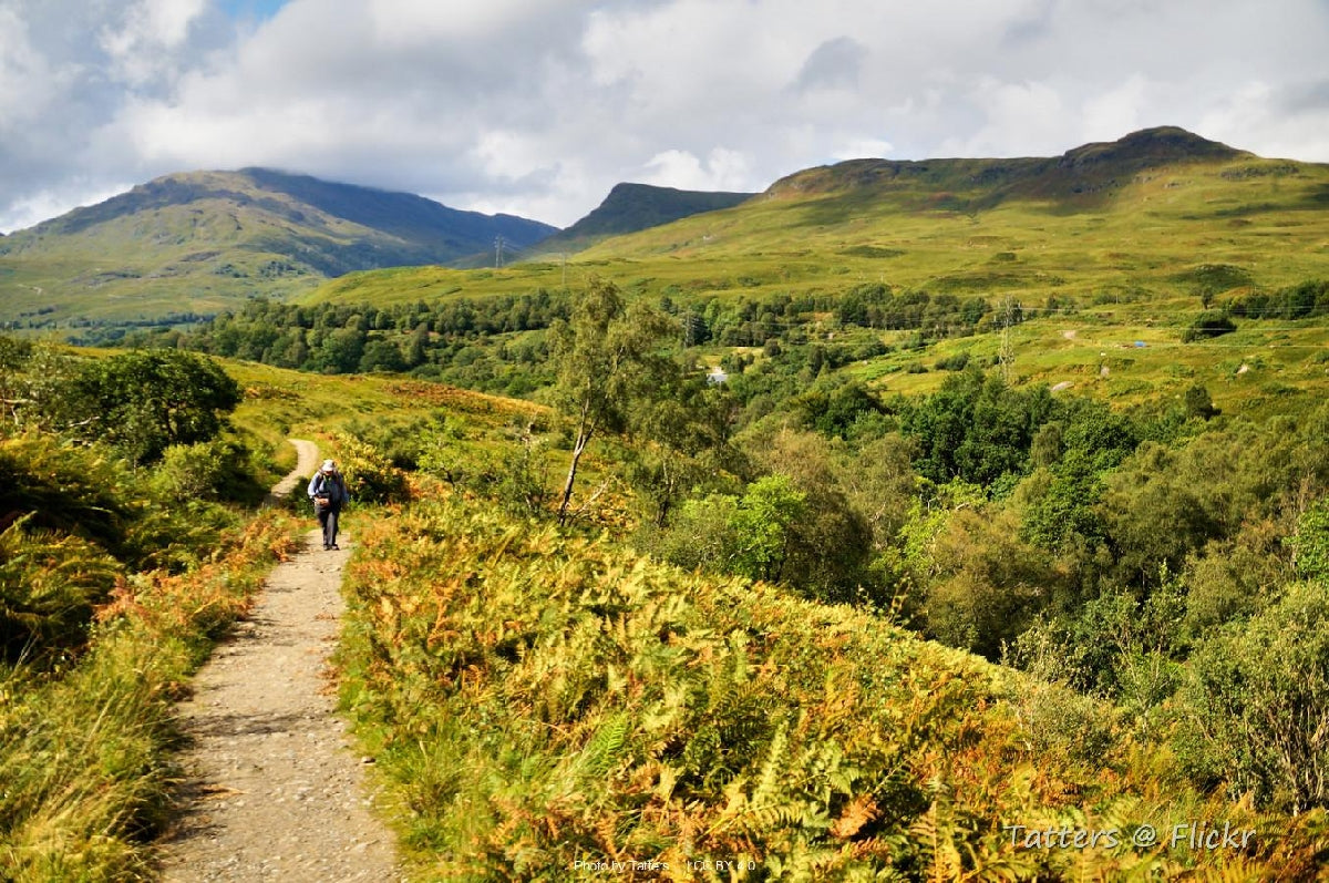
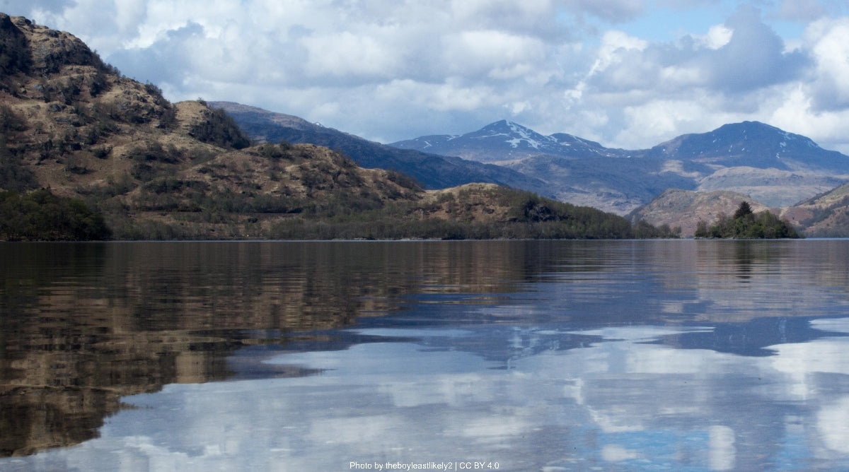
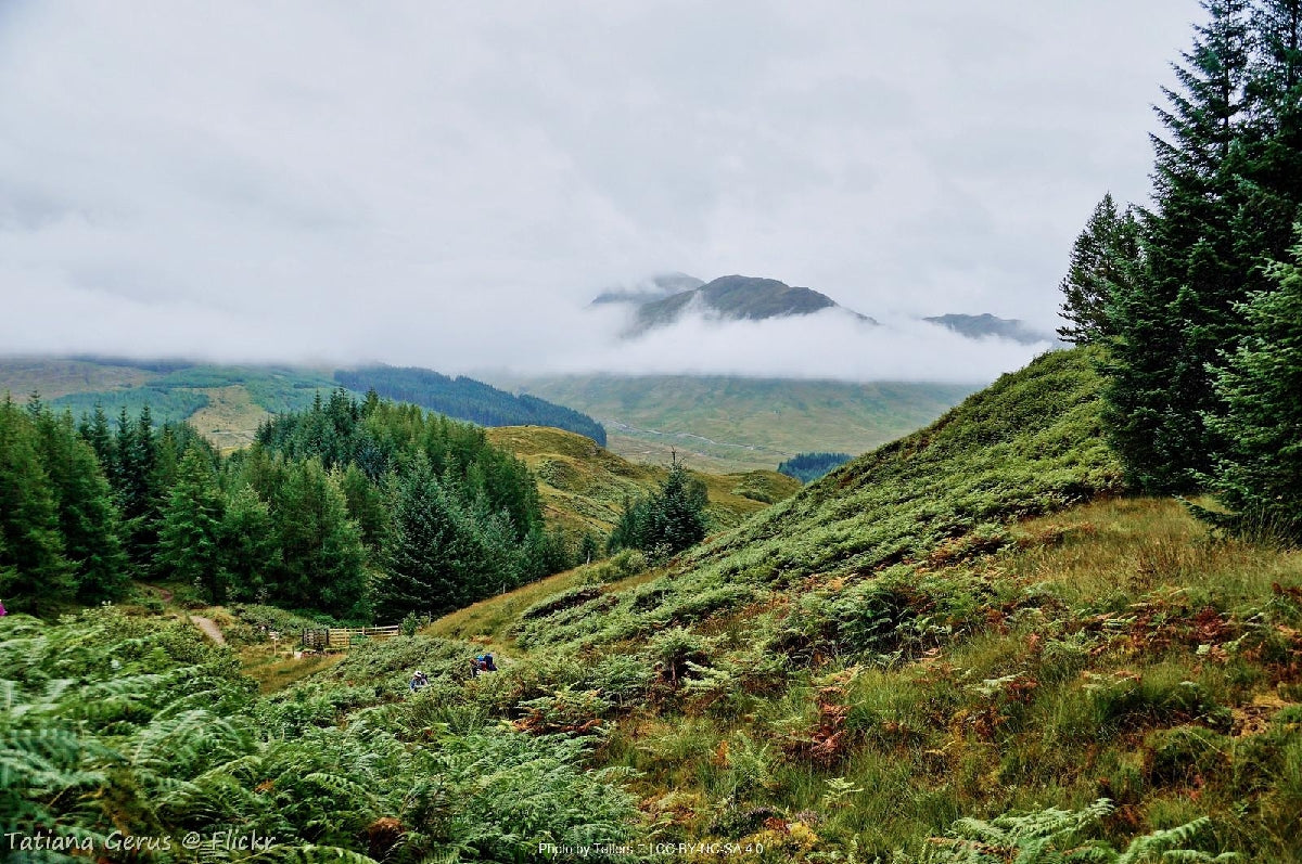
- Dramatic Highland scenery evolving daily
- Rich Scottish history alongside ancient paths
- Accessible yet wild adventure experience
The full West Highland Way stands as Scotland's first and most celebrated long-distance trail, spanning 154 kilometers through the stunning western Highlands. This iconic route traverses diverse landscapes from the pastoral lowlands around Glasgow northward into the ancient geological formations of the Scottish Highlands, culminating at the foot of Britain's highest mountain. The trail follows historic military roads, old drovers’ routes, and ancient footpaths that have connected Highland com... Read more
| Hilliness | |
| Start Point | Crianlarich |
| End Point | Fort William |
| Activity Type | Walking, Hiking, Trail Running |
| Distance | 80km | 50 miles |
| Ascent | 1,750m | 5,741ft |
| When to go | May to September (optimal: late May-June) |
| Baggage Transfer | Available |
Custom Adventure Plan: $141.00
Book Now
Not ready to book?
Call us on 0131 560 2740
or enquire by email
What's included?
-
Custom Adventure Plan
-
Accommodation options for you
-
Door‑to‑door GPX in our app
-
On‑trail support
-
Share with up to four people
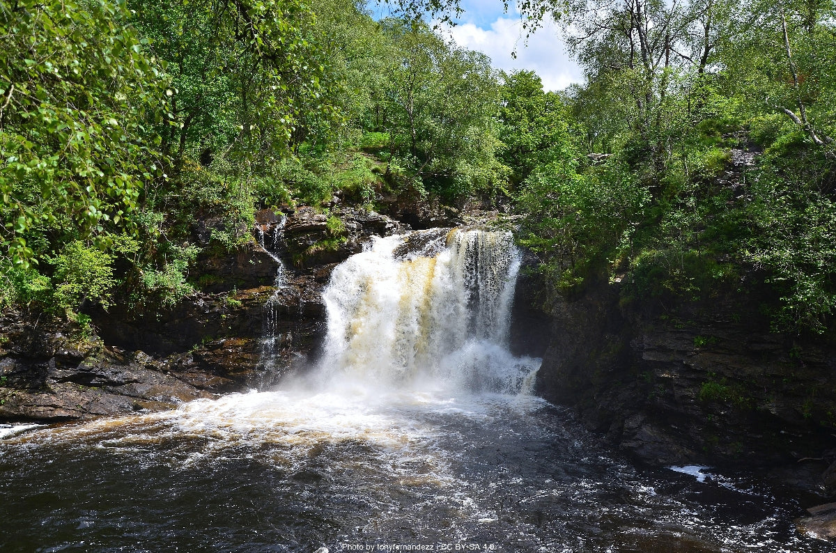
Gallery
Sample Itinerary
Here's what's on the trail. We'll split the stages to each day just right for your pace.
From Crianlarich, the path climbs through dense Sitka spruce forest before opening to views of Ben More, Stob Binnein, and the distinctive Beinn Dorain. It crosses the River Fillan near the ruins of St. Fillan’s Priory and follows the valley beside the West Highland Railway, passing under it twice. A short detour leads to Auchtertyre Farm for refreshments. Approaching Tyndrum, the route passes the Battle of Dalrigh site (1306), with cafés and shops nearby. Leaving Tyndrum, the trail follows an old military road through Glen Fillan, with easy terrain and ever-closer views of Beinn Dorain. It passes St. Fillan’s holy pool and the white bridge at Auch Estate, narrowing slightly along Beinn Odhar’s slopes. Occasional boggy patches and mountain streams mark the way before the path descends through Scots pine to Bridge of Orchy, where the historic 1751 bridge and hotel provide food, water, and supplies.
From Bridge of Orchy, the trail climbs through pine forest to open moorland, crossing Mam Carraigh with superb views back to Beinn Dorain and ahead to Loch Tulla and the Black Mount. A stone marker at the summit honors historic drovers who once used this route. The path then descends through heather to the remote Inveroran Hotel, a welcoming Victorian drovers’ inn offering food, drinks, and water refills beside the old military road.
Beyond Inveroran, the route follows the old drovers’ road across Rannoch Moor — a vast, wild expanse of peat bog, lochans, and heather. The well-maintained gravel track passes Ba Bridge over the River Ba, a good rest point amid sweeping wilderness views. Buachaille Etive Mor soon dominates the horizon as the trail descends toward the Kingshouse Hotel (1750s), offering full facilities and one of Scotland’s most iconic mountain vistas. Citylink buses and taxis connect Kingshouse to Glencoe village.
From Kingshouse, the trail follows the old military road beneath Buachaille Etive Mor, offering stunning views of this iconic peak. After crossing the River Etive, it climbs the Devil’s Staircase—a zigzagging ascent to 550m, the highest point on the West Highland Way. Named by 18th-century soldiers who struggled to build the route, the pass rewards walkers with sweeping views of the Mamores, Ben Nevis, and the Glencoe range. The descent is long and initially steep over loose gravel, easing onto a smoother track toward Kinlochleven. Near the village, the path passes large pipelines feeding the hydroelectric plant that powers the old aluminum smelter. The final steep section leads into Kinlochleven beside the Ice Factor climbing center, where refreshments are available. In the village, walkers will find pubs, cafés, and accommodation, including the Tailrace Inn and MacDonald Hotel, plus a Co-op supermarket and water refills at the Tourist Information Center.
The final stage begins with a steep climb from Kinlochleven through woodland, emerging into the remote Lairig Mor valley. The old military road winds through dramatic scenery, with the ruins of Tigh-na-sleubhaich offering a sheltered rest spot. The route continues beneath the Mamores ridge to the north, with glimpses of the Aonach Eagach to the south, crossing streams and varying terrain from rocky paths to forest tracks. After passing the Iron Age fort at Dun Deardail, the trail enters Nevis Forest and wider forestry tracks, with Ben Nevis (1,345m) dominating the northern skyline. The path gradually descends through the forest to Glen Nevis and Fort William. The West Highland Way officially ends at the “Sore Feet” statue in Gordon Square. Fort William offers water, refreshments, and celebratory meals at the Ben Nevis Hotel and Ben Nevis Inn.
How long will it take?
Everyone has a different approach to trails. Here are our suggested times for the Wee West Highland Way for different types of adventurers.
Here we have assumed that you will be out on the trail for around 8 hours per day, including regular breaks but not extended lunch stops.

4
Days
For walkers who love the journey as much as the destination.
You enjoy full days on the trail, moving steadily, soaking up the scenery — with plenty of time for food and drink stops along the way!

3
Days
For long-distance walkers who enjoy the challenge of a steady pace over varied terrain.
You’ve got the fitness to cover strong distances over several days — this is where most keen hikers will find themselves.

2
Days
The first of our faster categories — built for those who prioritise pace.
You move quickly with minimal stops, carry just the essentials, and have the fitness to handle long days and tough terrain.

2
Days
Our fastest pace – ideal for those used to ultramarathons.
You mix fast hiking with running on flats and descents, even over mountains. Speed and efficiency matter most, with minimal stops as you aim to complete each route as quickly as possible.
Essential Travel Information
The West Highland Way is best hiked between May and September, with late May through June offering optimal conditions – longer daylight hours, established good weather patterns, fewer midges (Scotland's notorious biting insects), and wildflowers in bloom.
Weather in the Scottish Highlands is notoriously changeable in all seasons. Summer temperatures typically range from 10-20°C (50-68°F), but prepared hikers should be equipped for potential temperature drops, especially on exposed sections like Rannoch Moor where conditions can change rapidly. Annual rainfall averages 2,000mm+ in the northern sections, with precipitation possible year-round.
Winter attempts (November-March) are recommended only for experienced winter hikers with proper equipment, as daylight hours are extremely limited (7-8 hours), snow can cover trail markers, and sections above 300m elevation frequently experience subzero temperatures and white-out conditions.
Seasonal hazards include:
- May-September: Highland midges (tiny biting insects) are most prevalent in still, humid conditions, particularly dawn and dusk
- October-April: Snow and ice on higher sections, particularly the Devil's Staircase and approaches to Kinlochleven
- Year-round: Flash flooding at stream crossings after heavy rain, particularly between Inversnaid and Inverarnan
Most facilities operate from April through October, with reduced services in shoulder seasons. Several hotels and hostels along the route close completely from November to March, making accommodation planning crucial for off-season attempts.
The West Highland Way offers diverse accommodation options to suit various budgets:
Hotels and Inns (£80-150/night):
- Available in all major stopping points (Drymen, Balmaha, Rowardennan, Inverarnan, Crianlarich, Tyndrum, Bridge of Orchy, Kings House, Kinlochleven, Fort William)
- Advance booking essential from June-August, recommended 4-6 months ahead
- Notable historic options include the Kings House Hotel (17th century drovers' inn) and the Drovers Inn at Inverarnan (1705)
B&Bs and Guesthouses (£50-90/night):
- Abundant in villages along the route
- Often include hearty Scottish breakfasts ideal for hikers
- Many offer packed lunch services for the following day
- Book 3-4 months ahead for summer season
Hostels (£25-35/night):
- SYHA hostels in Rowardennan, Crianlarich and Glen Nevis
- Independent hostels in Drymen, Balmaha, Inverarnan, Tyndrum, Kings House, and Kinlochleven
- Most offer private rooms and dormitory options
- Kitchen facilities for self-catering
- Booking 2-3 months ahead recommended in peak season
Bunkhouses (£20-30/night):
- Basic accommodation with shared facilities
- Available at Inversnaid, Inverarnan, Bridge of Orchy, and Kings House
- Generally no advance booking required except July-August
Camping (£7-12/night at formal sites, wild camping free):
- Formal campsites with facilities at Drymen, Balmaha, Rowardennan, Inverarnan, Tyndrum, and Glen Nevis
- Wild camping permitted under Scottish Land Access Code (except eastern shore of Loch Lomond between Drymen and Rowardennan where restrictions apply)
- Numerous natural water sources along route (treatment recommended)
Popular stopping configurations include:
- 7-day itinerary: Milngavie → Drymen → Rowardennan → Inverarnan → Tyndrum → Kings House → Kinlochleven → Fort William
- 8-day itinerary: Milngavie → Drymen → Balmaha → Rowardennan → Inverarnan → Tyndrum → Kings House → Kinlochleven → Fort William
- 5-day itinerary (experienced hikers): Milngavie → Balmaha → Inverarnan → Bridge of Orchy → Kinlochleven → Fort William
Several baggage transfer services operate along the route (approximately £9 per bag per stage), allowing hikers to walk with day packs only.
The West Highland Way benefits from excellent public transportation connections despite its remote nature:
Nearest Airports:
- Glasgow International Airport (approx 90 mins drive from Bridge of Orchy)
- Direct train connection from Glasgow Queen Street to Bridge of Orchy (approximately 2 hours 30 mins
- Return flights available from Glasgow to major European hubs and London
Trailhead Access:
- Bridge of Orchy is served by trains from Glasgow Queen Street station (2 hours 30 minutes)
End Point Transportation:
- Fort William has direct train service to Glasgow via the West Highland Line (one of Europe's most scenic railway journeys, approximately 4 hours)
- Citylink buses connect Fort William to Glasgow, Edinburgh, and Inverness (3-5 hours)
- The Jacobite Steam Train (May-October) offers a premium experience from Fort William to Mallaig
Emergency Access Points:
- Bridge of Orchy (Stage 5) - Train station and A82 road access
- Kings House (Stage 5/6) - A82 road access
- Kinlochleven (Stage 6/7) - B863 road connection to Fort William
Mobile Phone Coverage:
- Reliable coverage in all settlements
- Limited or no coverage on Rannoch Moor and some sections of Loch Lomond
- Emergency phones at Kings House
Accommodation Costs (8-night journey, per person):
- Budget option (camping/hostels): £160-240
- Mid-range option (mix of hostels/B&Bs): £280-400
- Premium option (hotels/inns): £500-800
Transportation Expenses:
- Return flights to Glasgow from European destinations: £80-200
- Train: Glasgow to Milngavie: £4-6
- Train: Fort William to Glasgow: £30-45
- Airport transfers in Glasgow: £12-18
- Baggage transfer services (optional): £60-80 per person for complete route
Food and Supplies:
- Self-catering budget: £15-25 per day
- Café/pub meals budget: £30-50 per day
- Trail snacks and packed lunches: £8-15 per day
- Water treatment tablets/filter: £20-40 (one-time purchase)
Additional Expenses:
- No permits required for the West Highland Way
- Guidebook and maps: £15-25
- Optional side trips (e.g., Glengoyne Distillery tour): £12-15
- Ben Nevis guided ascension (optional): £40-60 per person
- Scottish Youth Hostel Association membership (optional but provides discounts): £15 annual fee
Typical Total Budget Range (excluding flights):
- Budget hiker (camping, self-catering): £400-600
- Mid-range (mix of accommodations): £700-1,000
- Comfortable experience (hotels, eat out): £1,100-1,500
Let our app guide you
-

Our app for going off-grid
Know what to expect. Navigate with confidence. See all your details in one place.
-
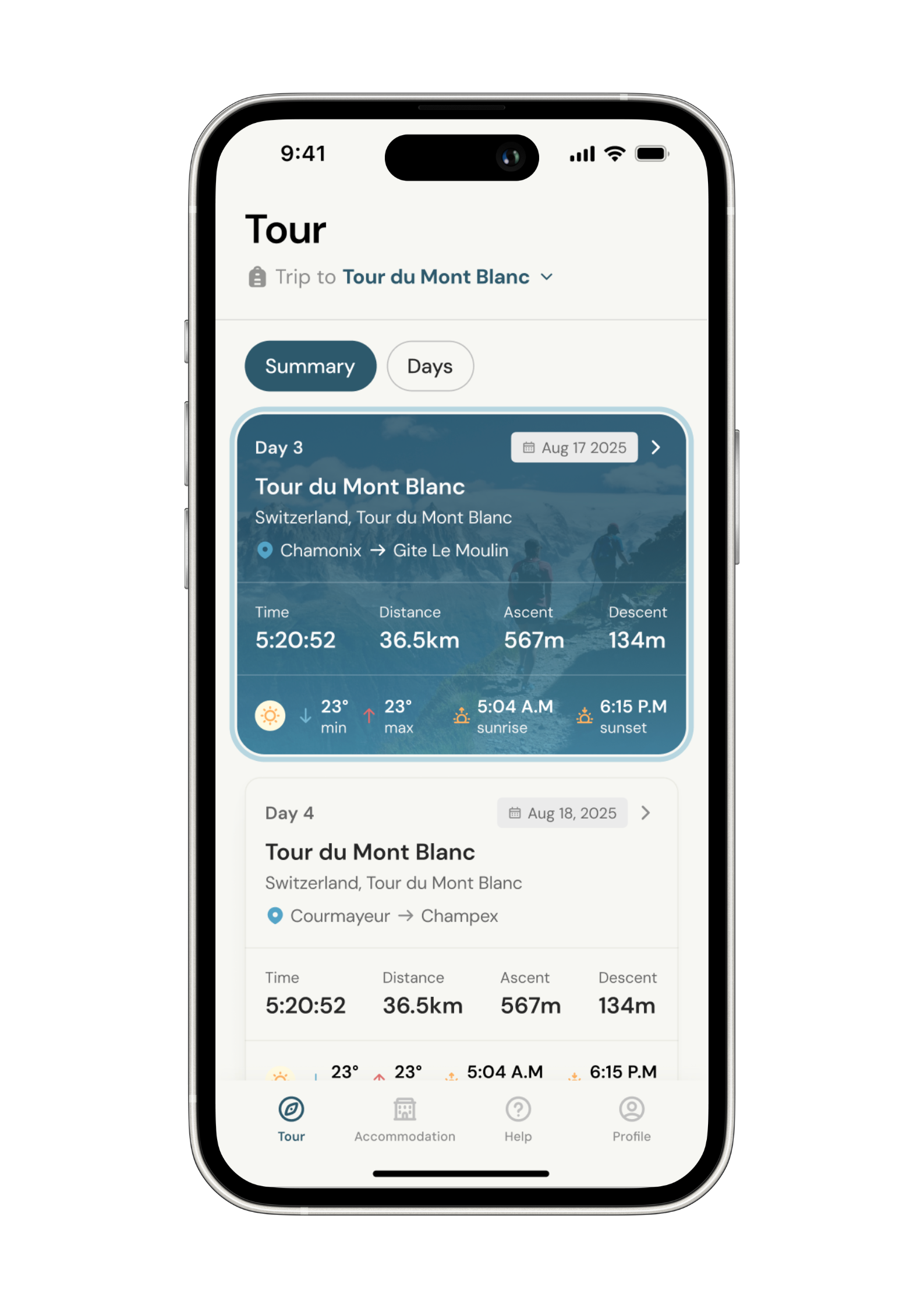
Know what to expect
See al the details of your adventure in one place so you can plan each stage with confidence.
- Distance
- Ascent & descent
- The time it will take you.
- The weather forecast for each day
-
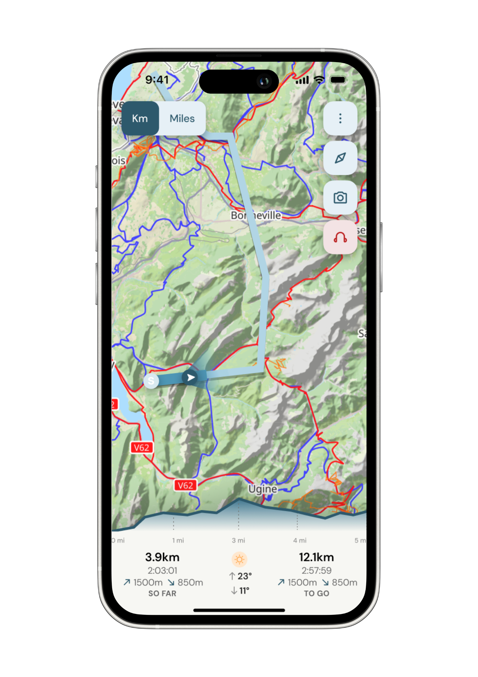
Navigate with confidence
Follow your trail on maps specifically chosen for walkers on the trail. Track your progress and get weather updates.
Need re-routing? Support is available at the click of a button.
-
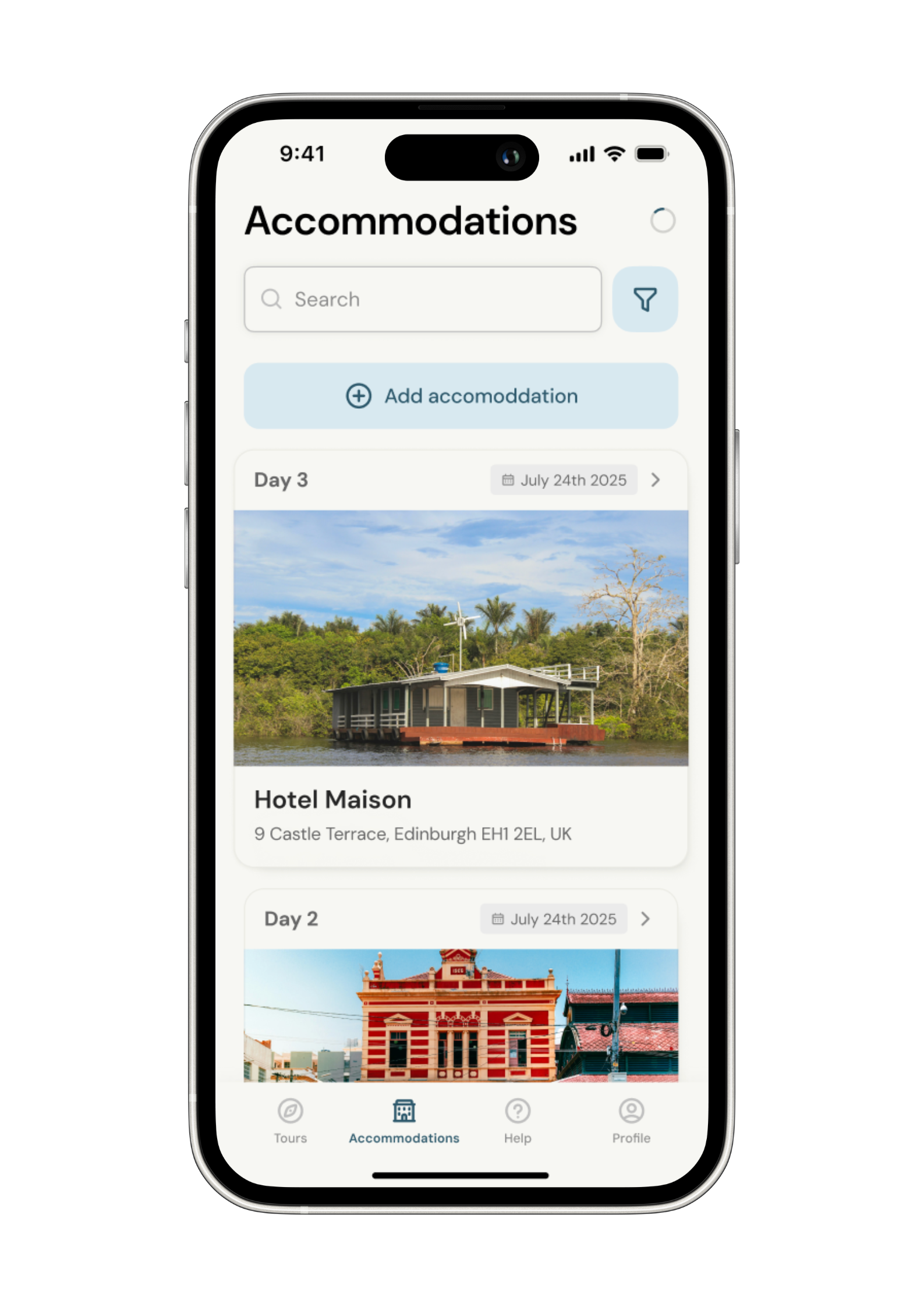
Admin. In once place.
Store all the details of your accommodation in the app alongside each stage of your adventure.
No signal, no problem. Everything is stored locally.