
Self-guided · Valais, Switzerland
A wild circuit
around the seven peaks
of the Valais Alps.
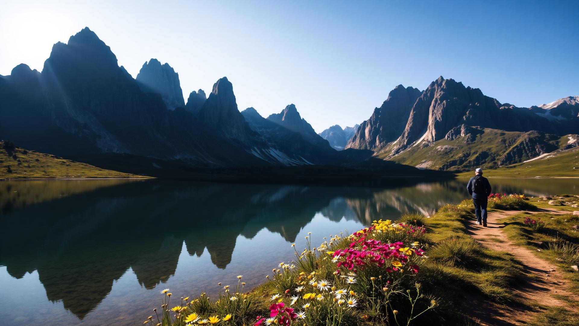
A legendary 5-day loop through the high, wild country of the Swiss Chablais — a world of limestone towers, lunar cols, and the 3,257-metre summit of the Haute Cime.
- Days
- 5
- Distance
- 47 km
- Ascent
- 2,850 m
- Grade
- Moderate to challenging
“An amazing and very memorable experience”Bhagyashree & Akhil · Tour du Mont Blanc
Read the reviewsTrip Essentials
The walk
The pioneer of
mountain trekking.
Rising from the Rhône Valley near the French border, the seven jagged peaks of the Dents du Midi are one of the most iconic sights in the Swiss Alps. This classic 5-day circuit was one of the first established trekking routes in the mountains, yet it remains surprisingly wild and authentic, far from the crowds of the more famous Alpine trails.
The route starts in the quiet village of Mex and climbs steadily into a world of high alpine pastures and dramatic rock formations. You'll traverse balcony paths with views across the North Face, navigate the chain-secured Pas d'Encel gorge, and cross the lunar landscape of the Col de Susanfe. For those with the legs for it, the optional ascent of the Haute Cime (3,257m) offers a panoramic reward that stretches from Lake Geneva to Mont Blanc.
Every night is spent in a mountain refuge or gîte, where a warm welcome and a hearty half-board meal await. This is a trek for those who love the high mountains—raw, spectacular, and deeply immersive.
The route, day by day.
A fixed self-guided package: every stage, every night's accommodation and every luggage transfer is arranged before you set off.
- 01
Mex → Chindonne
3.5 h · +750 m / −300 m · 9 kmStart from the village of Mex, climbing gently through forests and high mountain pastures. The path leads to the Chindonne inn, with an optional, more challenging variant via the Dent de Valerette for those wanting an early panoramic view.
- 02
Chindonne → Cabane d'Anthème
4 h · +700 m / −300 m · 12 kmA superb balcony walk beneath the North Face of the Dents du Midi. Traverse the valleys of the Val d'Illiez and the Chalin mountain pasture, keeping a lookout for chamois, before reaching the perched Anthème huts overlooking Champéry.
- 03
Cabane d'Anthème → Cabane de Susanfe
4 h · +700 m / −650 m · 9 kmHead for the Pas d'Encel, a narrow and impressive gorge navigated via a path secured by chains. Beyond lies the hidden Susanfe valley, a high-altitude sanctuary cut off from the world, where you'll stay in the hospitable Swiss Alpine Club refuge.
- 04
Cabane de Susanfe → Salanfe
3 h · +400 m / −600 m · 8 kmThe highest day of the tour. Climb to the lunar landscape of the Col de Susanfe. If conditions allow, leave your bags for the optional ascent of the Haute Cime (3,257m). Descend to the shores of the Salanfe reservoir for the night.
- 05
Salanfe → Mex
4 h · +300 m / −1100 m · 9 kmA final climb to the Col du Jorat for a wide panorama over the Rhône Valley. From here, begin the long, scenic descent back down to Mex, returning to the valley and completing your circuit of the massif.
Where you'll stay
A good bed at the end of every day.
Four nights in mountain refuges and gîtes. Accommodation is generally in small dormitories, though private rooms may be available at Mex and Salanfe (subject to availability). Showers are available on nights 1 and 4. These are authentic mountain stops—cosy, communal, and perfectly placed.
Getting there
Accessible by train from Geneva to Saint-Maurice, followed by a postal bus to Mex. Free parking is available in Mex for those arriving by car. We provide full travel details in your road-book.
What's included?
A fixed self-guided package — accommodation, luggage transfer and route notes all taken care of before you arrive.
Four nights half-board in mountain refuges and gîtes
Detailed road-book and IGN maps (one set per group)
Digital route files for navigation
Organisational costs and tourist taxes
All planning and support from Big Trail Adventures
Not included
- Picnic lunches (orderable at each refuge)
- Personal expenses and drinks
- Travel to and from the start point in Mex
- Cancellation and mountain rescue insurance
- Guiding — this is a self-guided tour
Reviews from walkers
What it's like to travel with us.
Every review here comes from someone who actually travelled with us — we only ask once the trip's over, and we don't edit what they say.
From walkers on our other trails.
Different routes, same team doing the planning, the bookings and the hand-holding — so these say a lot about what to expect here too.
“An amazing and very memorable experience”
We had a really wonderful experience and are very happy that we went ahead with the trek. It was challenging at times, but overall it was an amazing and very memorable experience. The scenery, the trails and the whole journey were absolutely beautiful. Bhagyashree did have some issues with her knee during the trek, which made a few sections difficult. We didn't let that stop us — we completed most of the trek and, wherever necessary, adapted our plans and took a bus or train for certain stretches rather than putting too much strain on her knee. Managing the trek despite the knee issue made the achievement feel even more special.
Thank you once again for all your help and guidance in planning the trek. Will definitely recommend Big Trail Adventures to all.
“Solo or in a group, I would do this again tomorrow!”
One of the best experiences I have had. I did this solo and felt supported all the way with the BigTrailAdventures team, especially in inclement weather. The vistas were incredible and overnight accommodation was faultlessly organised. Pushing myself during the day ( I ran rather than walked the trail), and then being fed and watered in a hotel in the evening was a treat.
The planning was exceptional and all details were covered.
There is a special time every day when you are overcome with the beauty of the nature that you are seeing, the sweeping vistas and the gratitude for being able to experience this. It rejuvenates your soul.
“Awesome support from start to finish”
The hike, which challenged me in different ways each day, was great. There was so much to see in every direction. The Highlands are simply stunning, clouds and all. The stays were good for the most part, some better than others (one night my room was above the kitchen so it was quite noisy until late into the night and the haunted Inn was a bit much for me :)). The Rowardennan Hotel and Craig Nevis guesthouse were my favorites. All of them offered great breakfasts and most had dinner options with good selections as well.
The planning was amazing. No glitches, except for one minor one at the start where the luggage van changed their drop off location without my knowledge. Thankfully Craig was there in the morning and quickly figured out where they were and even dropped off my luggage for me. Everything else was planned and executed perfectly; my itinerary for each day included great detail of what to expect. The app was awesome and my friends and family loved tracking me every day with the GPS. I had read that the West Highland Way is very popular in spring (when I initially had planned to go) and late summer. It took a lot of back and forth communication about potential dates but Craig very patiently worked it all out. All communication was prompt and thorough. I very much appreciate all the support I received prior and during my adventure!! Thank you Craig!
There are so many moments I will carry with me for a long time, like my first glimpse of the Highlands, all the water everywhere, the coos, day 2 along Loch Lomond when I wished I was a mountain goat and was grateful that it did not rain, arriving at Kingshouse after 19 miles, midges (haha), and so much more.
This route. These nights.
One clear price.
You are booking the itinerary above: your walking days, your overnight stays and the support that carries you between them.
Organising this trail for friends? Build a group trip with individual payments
- Free cancellation to 60 days
- Confirmation within 24 hrs
- ABTOT financially protected
We'll start planning your trip right away. Not happy with anything? We'll adjust it or refund you — no questions asked.

The Association of Bonded Travel Organisers Trust Limited (ABTOT) provides financial protection under The Package Travel and Linked Travel Arrangements Regulations 2018 for Big Trail Adventures (member 5690). Protection is provided for non-flight packages. Full details in our booking conditions.
Things walkers ask us.
How difficult is the Pas d'Encel?
It's a narrow gorge with some exposure, but the path is well-maintained and equipped with fixed chains for security. It's manageable for anyone with a steady head for heights and basic mountain experience.
Is the Haute Cime ascent mandatory?
No, it's an optional out-and-back from the Col de Susanfe. If you're feeling tired or the weather is poor, you can skip it and head straight down to Salanfe, saving about 4 hours of walking and 750m of ascent.
Do I need to carry all my gear?
Yes, this is a traditional mountain trek where you carry your own kit. However, as it's only 5 days and you're staying half-board, a 30-40 litre pack should be plenty.
When is the best time to go?
The season is short due to the altitude of the passes. July and August are prime time; by mid-September, snow can start to return to the higher sections.
Is there phone signal on the trail?
Signal is intermittent and non-existent in the Susanfe valley. It's a great opportunity to disconnect, but we recommend downloading offline maps or using the paper maps provided.
Is the Tour of the Dents du Midi tour self-guided?
Yes. This is a self-guided trip: you walk the 47 km route independently, with no guide and no group. Accommodation for all 4 nights is booked for you, route notes and maps are provided, and there is local support in the region if anything goes wrong.
Do I need a guide or can I walk it alone?
No guide is needed. The route is walked on marked paths with the notes and mapping supplied in your pack. You choose your own start date within the season (July to mid-September) and walk each day at your own pace.
Who arranges the accommodation?
We do. Four nights in mountain refuges and gîtes. Accommodation is generally in small dormitories, though private rooms may be available at Mex and Salanfe (subject to availability). Showers are available on nights 1 and 4. These are authentic mountain stops—cosy, communal, and perfectly placed.