South West Coast Path: St Ives to Falmouth Overview
- Land's End: mainland Britain's westernmost point
- Minack Theatre carved into granite cliffs
- England's southernmost point at Lizard Peninsula
The St Ives to Falmouth section spans 166 kilometers through Cornwall's most historically significant mining coastline, offering hikers a journey through industrial heritage and granite wilderness. This renowned route traverses the dramatic Penwith peninsula before following Mount's Bay to the sh... Read more
| Hilliness | |
| Start Point | St Ives, Cornwall |
| End Point | Falmouth, Cornwall |
| Activity Type | Walking, Hiking, Trail Running |
| Distance | 166km | 103 miles |
| Ascent | 2,830m | loss 2,829m |
| When to go | May to October |
| Baggage Transfer | Available |
Custom Adventure Plan: £114.00
Book NowWhat's included?
-
Custom Adventure Plan
-
Accommodation options for you
-
Door‑to‑door GPX in our app
-
On‑trail support
-
Share with up to four people
Gallery

What to Expect
Beginning at West Pier in St Ives, the path follows rugged coastline to Clodgy Point and Trevalgan Cliff, offering expansive views across St Ives Bay. A boardwalk crosses boggy terrain near Trevega Cliff before reaching Carn Nuan Point and Zennor Head, where panoramic views encompass Pendour Cove and the seal-dotted Carrack Rocks. A brief inland detour leads to Zennor village with its Neolithic burial chamber and historic pub.
Continuing west, the route grows increasingly remote and challenging. It skirts Porthglaze and Treen Coves, rounds Gurnard’s Head, and passes relics of Cornwall’s mining heritage at Porthmeor Cove and Bosigran Castle. Approaching Pendeen Watch lighthouse, walkers cross landscapes rich in prehistoric and industrial history.
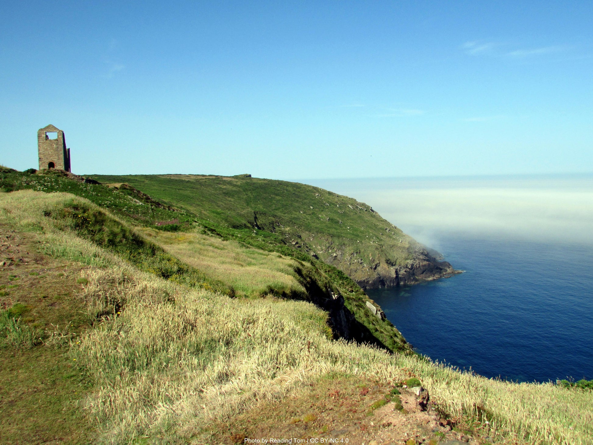
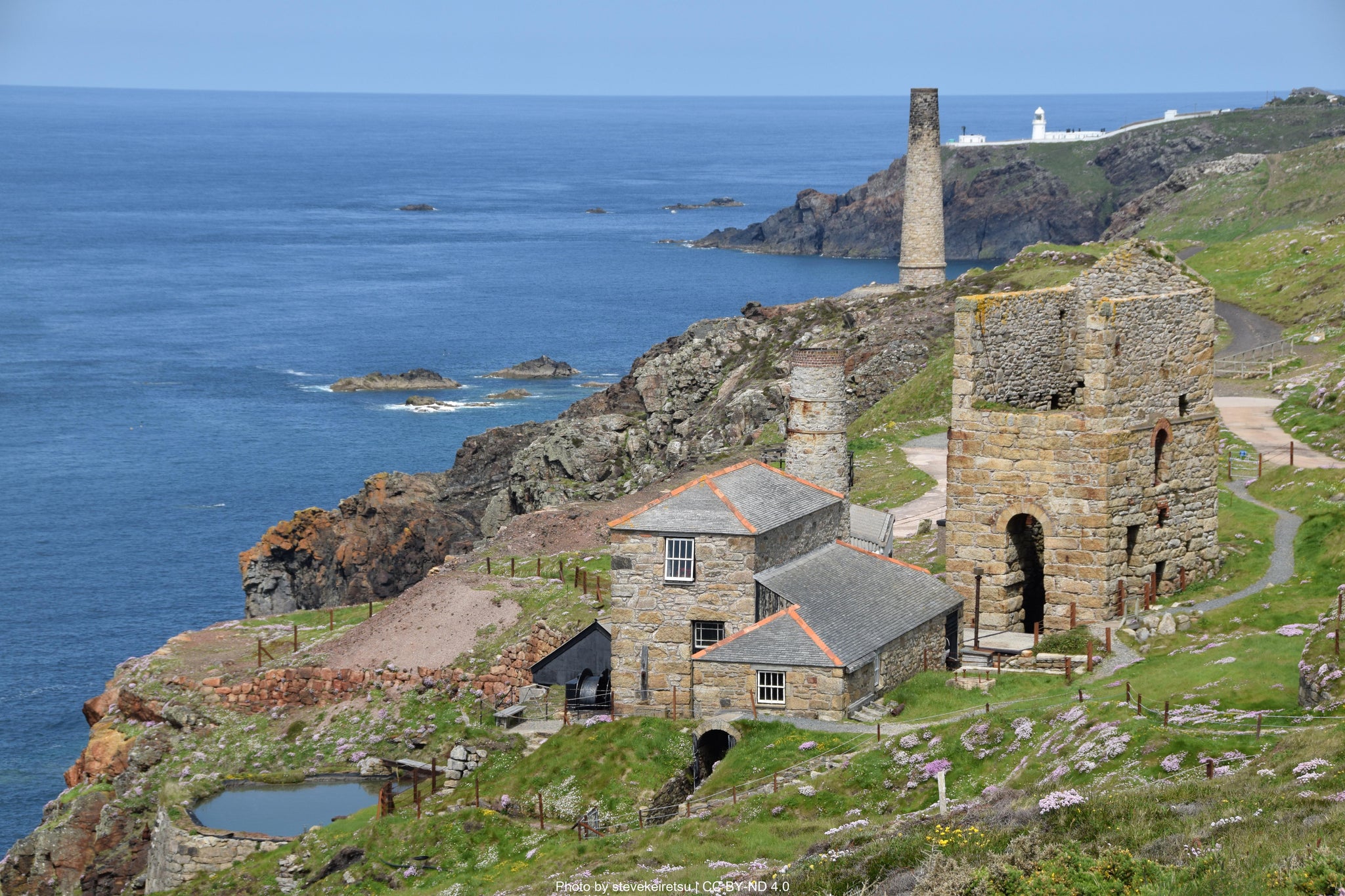
From Pendeen, the trail follows the coastline south past Geevor and Levant mines, reaching the iconic Botallack engine houses perched above the sea. At Cape Cornwall—the only true cape in England—spectacular views extend to the Brisons Rocks. The route then passes Bronze Age burial sites and Porth Nanven, famous for its smooth, rounded “dinosaur egg” stones, before arriving at Whitesand Bay and Sennen Cove, a lively surf village.
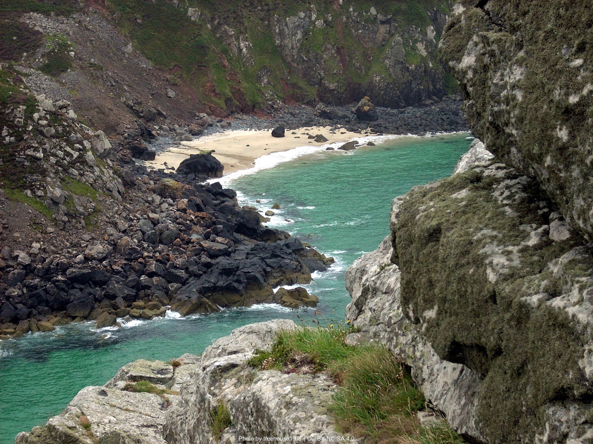
From Sennen, the path climbs to Land’s End, Britain’s southwestern tip, with dramatic views of Longships lighthouse and seabirds along the cliffs. It continues east past Enys Dodnan's sea arch and the secluded beach at Nanjizal, featuring striking rock formations.
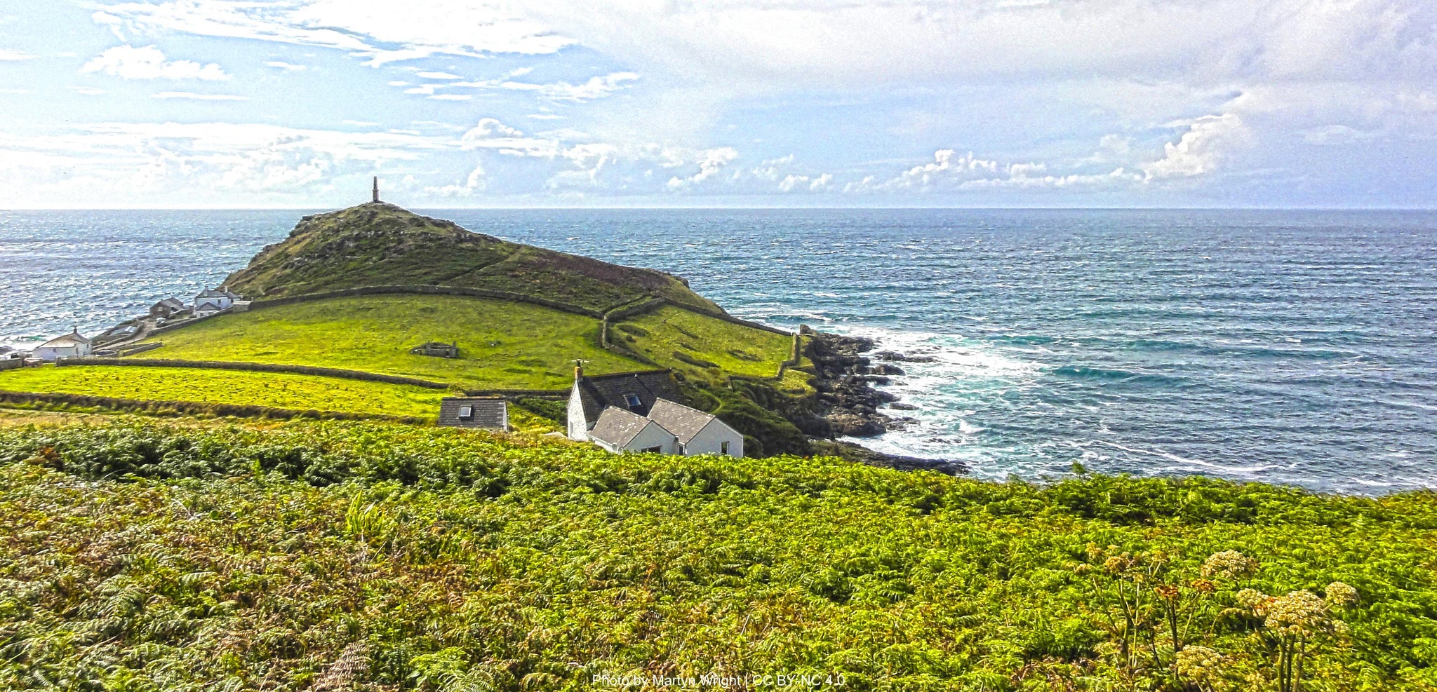
Traversing granite headlands and hidden coves, the trail reaches Porthgwarra and Porthcurno—home to the open-air Minack Theatre—before climbing to Logan Rock and descending into charming Penberth Cove. The path grows strenuous near Tater Du lighthouse, winding past quarries to Lamorna and historic Mousehole.
Following Mount’s Bay through Newlyn to Penzance and Marazion, the route flattens with scenic views of St Michael’s Mount. From there, it ascends again past Cudden Point and Prussia Cove to Praa Sands, then continues past cliff-top engine houses at Rinsey and Wheal Trewavas to Porthleven, a picturesque harbour town.
Beyond Porthleven, the trail crosses Loe Bar and continues to Gunwalloe with its beachside church. After passing Poldhu Cove, it climbs over serpentine cliffs toward Mullion Cove, Kynance Cove, and Lizard Point—the southernmost tip of mainland Britain. Lizard village has accommodation and pubs for refuelling.
From Lizard Point the trail continues along the cliff tops with sea views between gaps in the vegetation. It reaches Church Cove with its old lifeboat station building and continues to the dramatic Devil's Frying Pan sea cave. Cadgwith and the Poltesco Valley showcase traditional fishing and industrial heritage before reaching Kennack Sands and the village of Coverack.
The route then heads to Lowland Point, skirting Dean Quarry and Godrevy Cove before turning inland to Rosenithon. A detour to St Keverne reveals shipwreck history and local charm. The path rejoins the coast at Porthoustock and continues to Porthallow—official halfway point of the entire South West Coast Path - before passing Nare Cove and Nare Point and then turning inland at the mouth of the Helford River. There is an option to shortcut (by stepping stones at low tide or a ferry) or continue on the trail to Helford Village.
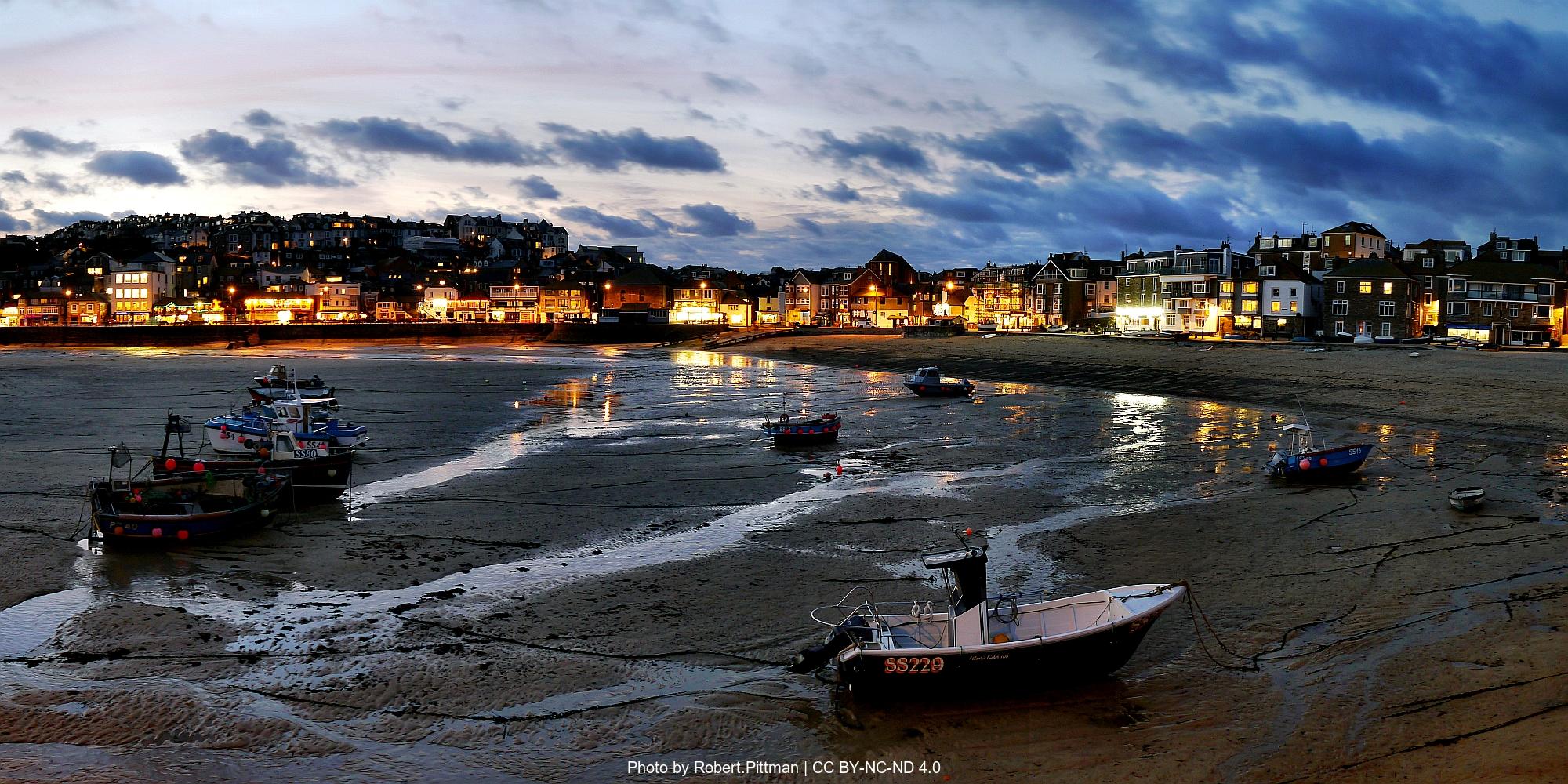
After crossing the Helford River by ferry the path follows the northern shore past Trebah, Port Saxon, and Rosemullion Head. It passes Maenporth and Swanpool beaches before concluding at Falmouth, with its historic harbour and Pendennis Castle overlooking the sea—marking the end of this dramatic and varied coastal stage.
How long will it take?
Everyone has a different approach to trails. Here are our suggested times for the South West Coast Path Stage 3: St Ives to Falmouth for different types of adventurers.
Here we have assumed that you will be out on the trail for around 8 hours per day, including regular breaks but not extended lunch stops.

8
Days
For walkers who love the journey as much as the destination.
You enjoy full days on the trail, moving steadily, soaking up the scenery — with plenty of time for food and drink stops along the way!

7
Days
For long-distance walkers who enjoy the challenge of a steady pace over varied terrain.
You’ve got the fitness to cover strong distances over several days — this is where most keen hikers will find themselves.

5
Days
The first of our faster categories — built for those who prioritise pace.
You move quickly with minimal stops, carry just the essentials, and have the fitness to handle long days and tough terrain.

4
Days
Our fastest pace – ideal for those used to ultramarathons.
You mix fast hiking with running on flats and descents, even over mountains. Speed and efficiency matter most, with minimal stops as you aim to complete each route as quickly as possible.
Essential Travel Information
Best hiking season: May through September provides optimal conditions, with May-June and September offering the best balance of good weather and manageable crowds. The coastal location moderates temperature extremes, but exposes walkers to Atlantic weather systems and strong winds.
Weather patterns and challenges: The southwest coast experiences a maritime climate with mild winters and moderate summers. Rainfall occurs throughout the year but is heaviest from October through March. Sea mists can develop rapidly, particularly in early morning and evening hours. Wind exposure is significant on clifftop sections, with prevailing southwesterly winds often creating challenging conditions.
Seasonal hazards include:
- Spring: Muddy paths after winter rain, unpredictable weather, limited daylight hours in early season
- Summer: Extreme heat on exposed clifftops, overcrowding at popular viewpoints, higher risk of dehydration
- Autumn: Shorter daylight hours, increasing storm frequency, wet and slippery rock surfaces
- Winter: Severe weather exposure, limited accommodation and transport, dangerous conditions on clifftop sections
Timing of facilities/refuge openings: Most coastal accommodations, cafes, and visitor facilities operate fully from Easter through October. Many establishments in remote coastal locations close completely from November through February, with reduced hours during shoulder seasons. Transport links, particularly rural bus services, operate on reduced winter timetables.
The South West Coast Path offers exceptional accommodation variety along its 630-mile length:
B&Bs/Guesthouses: £80-150 per night (double room), representing the most common and reliable option. Walker-friendly establishments typically offer packed lunch services, drying facilities, and early breakfast options.
Hotels: £120-300+ per night, available in larger coastal towns and cities including St Ives, Falmouth, Dartmouth, and Bath. Prices range from less than £10 for a camping pitch, to £300+ for a high end spa hotel.
Hostels: £18-40 per night (dormitory bed), strategically located at key points including Beer, Hartland, Tintagel, Land's End, and Exmouth. YHA properties offer excellent walker facilities and represent outstanding value.
Bunkhouses/Hostels: £25-45 per night, basic but clean dormitory-style accommodation popular with budget-conscious walkers and groups.
Camping: £10-25 per night at designated sites, with excellent coastal campsites throughout the route. Wild camping is not permitted along most of the path due to National Trust and private land ownership.
Booking requirements and timing: Advance booking is absolutely essential during peak season (June-September), particularly for weekend dates and in smaller coastal villages with limited options like Clovelly, Boscastle, and Port Isaac. Book at least 4-6 months ahead for summer trips, with some popular establishments filling up to a year in advance.
Popular stopover points: Key overnight locations include Minehead, Lynmouth, Clovelly, Bude, Tintagel, Port Isaac, Padstow, St Ives, Penzance, Falmouth, Fowey, Polperro, Plymouth, Salcombe, Dartmouth, Torbay, Sidmouth, Lyme Regis, Weymouth, and Poole.
Nearest airports/major cities:
- Newquay Airport (45 minutes to St Ives, 1 hour to Falmouth)
- Exeter Airport (2 hours to St Ives, 1.5 hours to Falmouth)
- Major cities: Truro (30 minutes to both St Ives and Falmouth)
Public transportation options:
- St Ives: Branch railway line from St Erth (mainline connection)
- Falmouth: Branch railway line from Truro (mainline connection)
- Regular bus services connect most coastal villages
- Land's End: Seasonal bus services from Penzance
Trailhead access:
- St Ives: Start from harbor area or Island
- Falmouth: Finish at Custom House Quay or town center
- Good parking availability outside peak season
Evacuation points and bail-out options:
- Penzance (major rail hub, 20-minute walk from path)
- Land's End (bus to Penzance, seasonal)
- Mousehole (bus to Penzance)
- Helston (bus connections to Falmouth and Truro)
- Coverack (limited bus services)
- Helford (seasonal ferry to Falmouth)
Accommodation costs for a complete 10 day trek:
- Mid-range option (B&Bs/guesthouses): £100-140 per night (£1,000-1,400 total)
- Mixed accommodation (hostels/B&Bs): £70-110 per night (£700-1,100 total)
- Budget option (camping/hostels): £35-65 per night (£350-650 total)
Transportation expenses:
- Return train fare to/from London: £150-280
- Local buses to accommodation off-route: £200-350
- Baggage transfer service (optional): £200 -250 for complete route
- Ferry crossings (Kingswear-Dartmouth, Salcombe, etc.): £30-50 total
Food and supplies:
- Breakfast (usually included in accommodation): £0-12 per day
- Packed lunch: £6-12 per day (£60-120 total)
- Evening meal: £18-35 per day (£180-350 total)
- Snacks and drinks: £12-20 per day (£120-200 total)
Additional expenses:
- Official guidebooks and maps: £35-60
- Equipment purchases/replacements: varies significantly
- Emergency fund: £300-400 recommended
- National Trust membership (optional but valuable): £60
Total estimated budget ranges:
- Comfort option (B&Bs, baggage transfer, restaurant meals): £2,000-2,500
- Standard option (mixed accommodation, some baggage transfer): £1,200-1,500
- Budget option (camping/hostels, carrying own pack): £700-900
The South West Coast Path stands as Britain's longest National Trail and most popular coastal walk, with approximately 300,000 people walking sections annually and roughly 1,000 completing the entire route each year.
Peak seasons and crowding: July and August see the highest traffic, with popular sections like Land's End to St Ives, the Jurassic Coast, and North Devon experiencing significant congestion. Accommodation fills months in advance during peak season, and popular clifftop viewpoints can become uncomfortably crowded.
Quieter alternatives for maximum solitude:
- Walking in May, early June, or September-October
- Hiking midweek rather than weekends
- Starting very early (6-7am) to avoid crowds at popular sections
- Choosing alternative inland routes where available
- Considering less famous but equally beautiful sections like Somerset and South Devon
Cultural considerations: The path passes through numerous fishing villages and coastal communities where tourism provides vital income while creating infrastructure pressures. Respect local communities by following the Countryside Code, supporting local businesses, booking accommodations well in advance, and being mindful of noise levels in small villages. The path crosses extensive National Trust land, private estates, and working farmland requiring careful adherence to designated routes.
Typical hiker demographics: The trail attracts a diverse international community with strong representation from Germany, Netherlands, Australia, and North America (approximately 25% international walkers). Age demographics skew toward mature walkers, with the 50-70 age bracket particularly well represented, though the trail attracts all ages during school holidays.
Opportunities for solitude: Despite its popularity, the path's 630-mile length provides numerous opportunities for peaceful walking, particularly on weekdays and during shoulder seasons. Early morning starts reward walkers with empty clifftops and stunning sunrise views. Remote sections in North Cornwall and North Devon offer extended periods of solitude even during busy periods.
The coastal pub culture creates natural gathering points where walkers share experiences, weather updates, and route advice. Many form lasting friendships after meeting on the path, with the shared challenge of Britain's longest trail creating a unique sense of community. Traditional celebrations often occur at journey's end, whether at Minehead, Poole Harbour, or any of the intermediate completion points chosen by section walkers.
Let our app guide you
-

Our app for going off-grid
Know what to expect. Navigate with confidence. See all your details in one place.
-
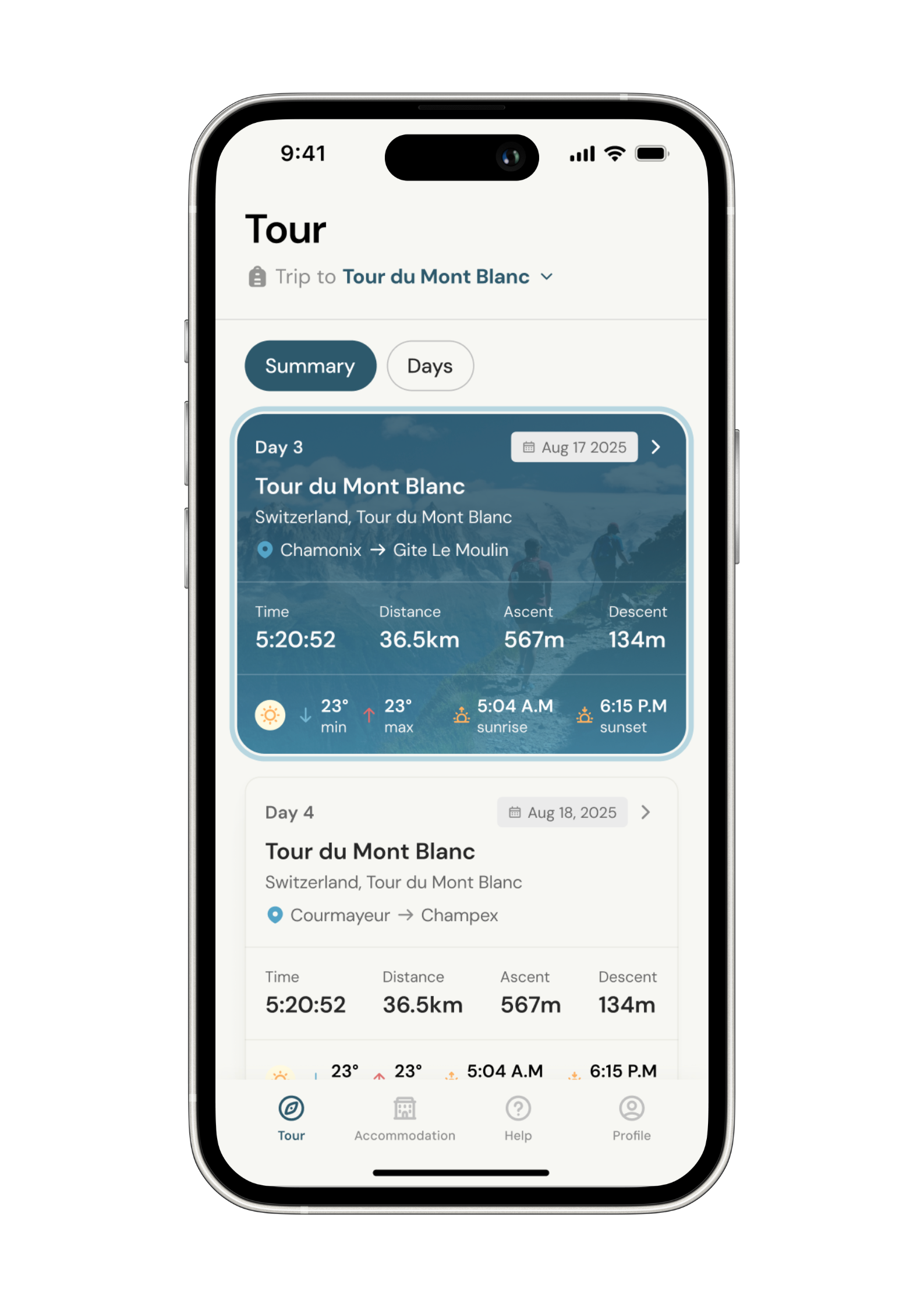
Know what to expect
See al the details of your adventure in one place so you can plan each stage with confidence.
- Distance
- Ascent & descent
- The time it will take you.
- The weather forecast for each day
-
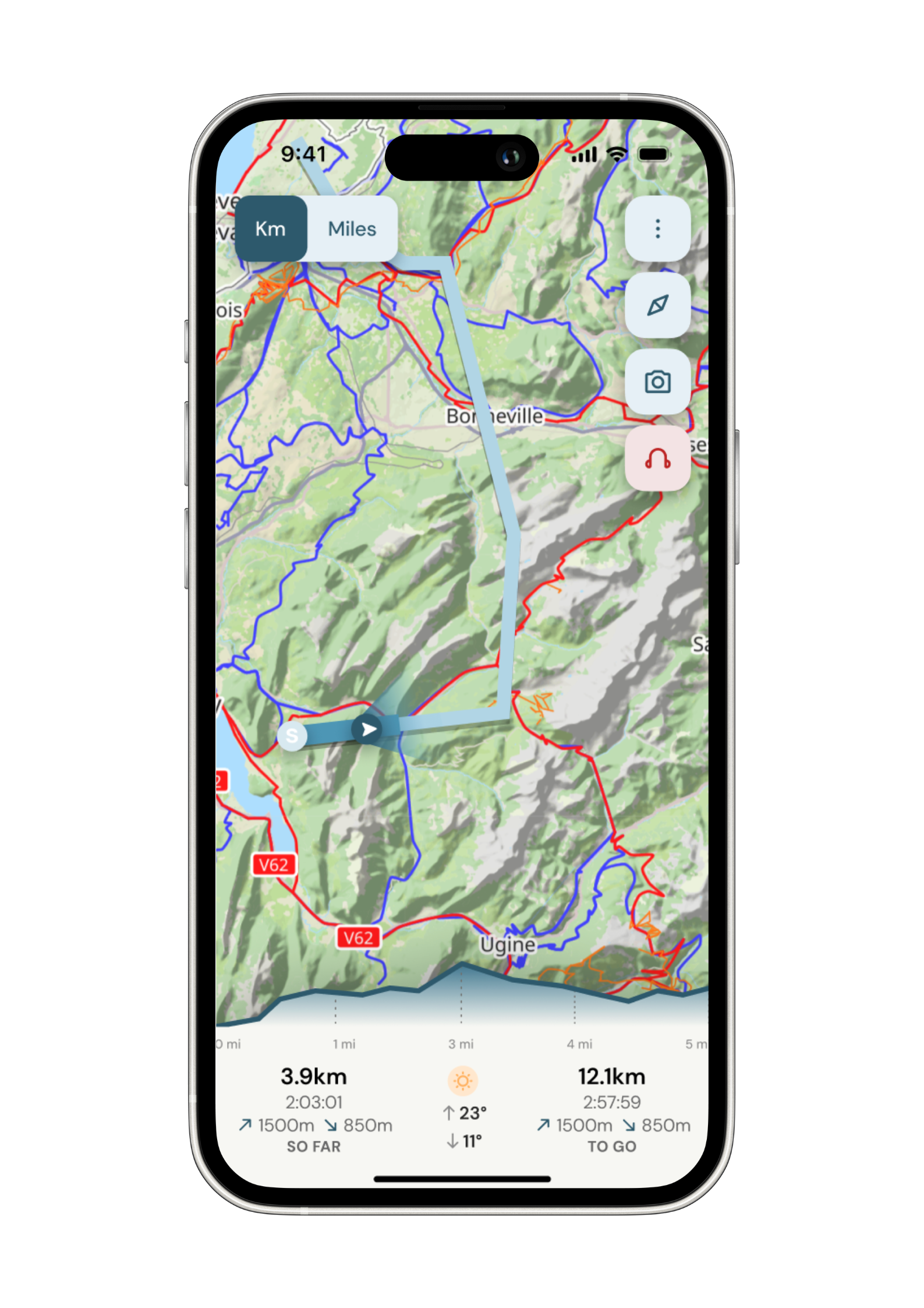
Navigate with confidence
Follow your trail on maps specifically chosen for walkers on the trail. Track your progress and get weather updates.
Need re-routing? Support is available at the click of a button.
-
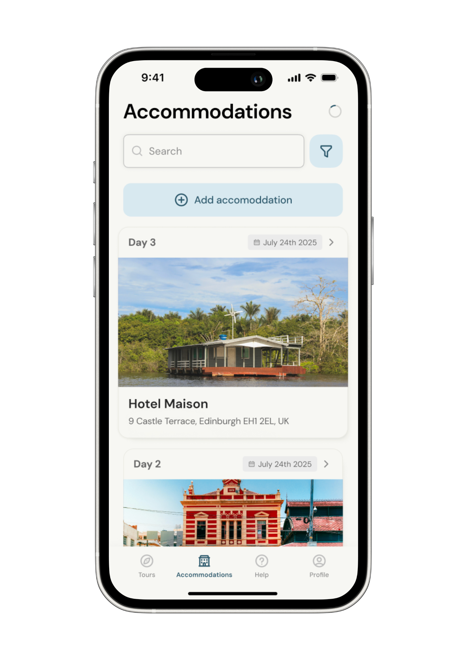
Admin. In once place.
Store all the details of your accommodation in the app alongside each stage of your adventure.
No signal, no problem. Everything is stored locally.