Alta Via 1 Overview
- Legendary trail through the spectacular Dolomites
- UNESCO World Heritage limestone peaks and valleys
- Traditional mountain huts with regional cuisine
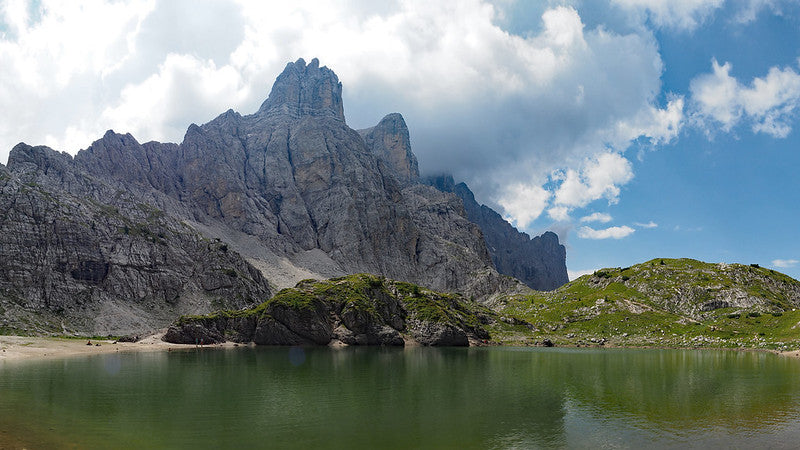
Alta Via 1 offers a superb 120-kilometer journey through the heart of the Dolomites, linking some of Italy's most beautiful mountain scenery. This well-established route takes you from Lago di Braies to La Pissa through varied and rewarding hiking terrain. The trail winds through diverse landscapes: peaceful lake shores, high alpine plateaus, and dramatic mountain passes. You'll cross the legendary Fanes plateau with its traditional wooden huts, enjoy excellent views of iconic peaks like Mon... Read more
| Hilliness | |
| Start Point | Lago di Braies, South Tyrol |
| End Point | Belluno, Veneto |
| Activity Type | Walking, Hiking, Trail Running |
| Distance | 108km | 67 miles |
| Ascent | 5,947m | 6,971m |
| When to go | Late June to mid-September |
| Baggage Transfer | No |
Custom Adventure Plan: £159.00
Book Now
Not ready to book?
Call us on 0131 560 2740
or enquire by email
Buy NOW to be front of the queue
What's included?
-
Custom Adventure Plan
-
Accommodation options for you
-
Door‑to‑door GPX in our app
-
On‑trail support
-
Share with up to four people
Gallery
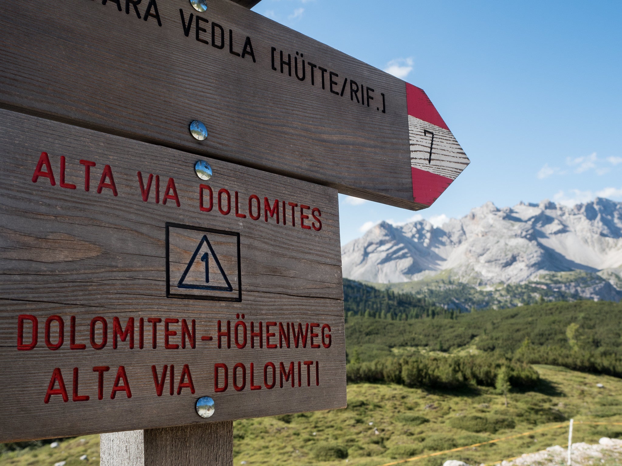
Sample Itinerary
The hike begins at stunning Lago di Braies (1,496m), following its western shore before path 1 climbs steeply through pine forests toward Croda del Becco. A viewpoint bench offers perfect lake panoramas before tackling rocky scrambles to Forcella sora Forno (2,388m), marked by a stone chapel. A brief descent leads to Rifugio Biella (2,327m), dramatically positioned beneath Croda del Becco's cliffs.
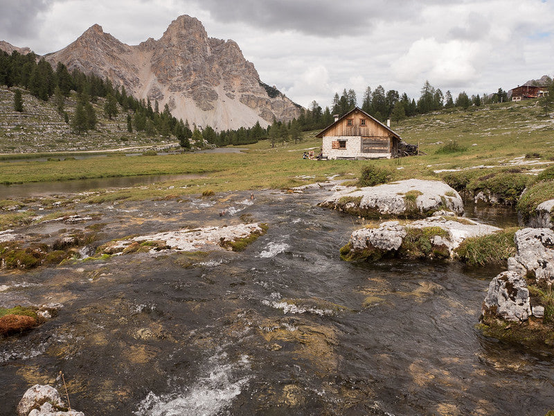
The route crosses the Sennes plateau's alpine meadows, passing traditional wooden huts with panoramic Dolomite views. An optional detour leads to Rifugio Munt de Sennes before reaching Rifugio Sennes (2,116m) in this serene high-altitude landscape.
Path 7 descends through flower-filled Pian della Lasta plateau before steep switchbacks (following WWI military roads) drop 570m to Rifugio Pederü (1,548m). This road-accessible refuge offers full facilities amid a bustling atmosphere, contrasting with the remote tranquility of the high alpine sections.
From Rifugio Pederü, path 7 climbs steeply through Val dai Tamersc, crossing the Rio San Vigilio and gaining 475m over rocky terrain. Emerging onto the Fanes plateau, marmots dart among alpine meadows dotted with traditional huts. The route passes rustic Ücia dles Muntagnoles before reaching Rifugio Fanes (2,060m).
Path 11 follows an old WWI road across the plateau, passing turquoise Lago di Limo (2,157m) - a perfect summer swim spot. The challenging ascent to Forcella di Lago (2,486m) involves scrambling over scree, followed by steep switchbacks down to Lago Lagazuoi (with optional detour to Rifugio Scotoni).
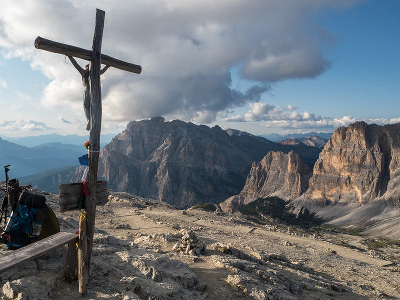
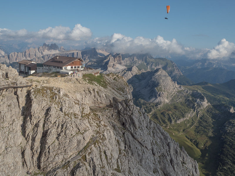
The final climb traverses moonlike terrain beneath Lagazuoi Grande's walls to Forcella Lagazuoi (2,573m), strewn with WWI ruins. A zig zag ascent leads to Rifugio Lagazuoi (2,752m), offering panoramic views, historical tunnels, and cable car access to Passo Falzarego. This dramatic section showcases the Fanes plateau's alpine beauty and the Dolomites' wartime history.
From Forcella Lagazuoi (2,507 m), the trail descends eastward along path 401 with dramatic views of Tofana di Rozes, before turning southwest on path 402 through rocky alpine terrain dotted with World War I remnants. Excellent vantage points reveal the Falzarego valley and Cinque Torri. The path reaches Passo Falzarego (2,105 m), a major hub with a cable car, restaurants, and bus connections. From here, path 441 climbs past Lago Limides toward Forcella Averau (2,435 m), offering sweeping views of Pelmo, Civetta, and the Pala Group. Nearby Rifugio Averau (2,413 m) provides food, lodging, and stunning panoramas.
The route continues on path 464 then 452 to Passo Giau (2,236 m), famous for flower-filled meadows and mountain views. Climbing steeply over Forcella Giau (2,370 m) and Forcella Ambrizzola (2,277 m), the trail traverses varied terrain before descending to Rifugio Città di Fiume beneath Monte Pelmo, a refuge offering traditional Ladin cuisine in a spectacular alpine setting.
The trail leaves Rifugio Città di Fiume descending beneath Monte Pelmo’s scree slopes, with superb views of its armchair-shaped summit. Crossing meadows, rocky terrain, and forest, the route heads west to Passo Staulanza (1,783 m), where Rifugio Passo Staulanza offers food and lodging. From here, the path climbs steeply through woodland toward Rifugio Coldai (2,132 m), sheltered behind a boulder with panoramic views dominated by Monte Pelmo.
A short ascent leads to Forcella Coldai (2,191 m) and the turquoise Lago Coldai below limestone cliffs. The trail continues over Forcella Col Negro di Coldai (2,248 m), revealing Monte Civetta’s famed northwest face, the “Wall of Walls,” with Torre Venezia and Torre Trieste looming nearby. Traversing rocky slopes, the path overlooks Lago di Alleghe before descending through alpine meadows and forest. Finally, Rifugio Mario Vazzoler (1,714 m) appears beneath Civetta’s spires, a welcoming refuge with traditional cuisine and a botanical garden.
From Rifugio Vazzoler the trail descends on a stony road before branching onto path 554 beneath Monte Moiazza’s towering walls. It crosses riverbeds and woodland before climbing steadily through boulders and scree, passing the dramatic Torri di Camp, whose spires rise like natural cathedrals. After Forcella dell’Orso (c.1,800 m), the path undulates beneath Moiazza’s vast cliffs, with challenging stretches of loose rock in a wild, remote setting.
The route climbs to Forcella del Camp (1,933 m), a spectacular pass overlooking Val Corpassa, the Civetta-Busazza massif, and the Dolomiti Bellunesi, including Monte Agner and Monti del Sole. From here, the trail descends through rocky ground and woodland clearings to reach Rifugio Bruto Carestiato (1,834 m), perched dramatically at the base of Moiazza’s southern walls.
Continuing on path 549, a wide track leads to Passo Duran (1,601 m), where two refuges - Rifugio Passo Duran Cesare Tomè and Rifugio San Sebastiano - provide full facilities and road access.
From Rifugio San Sebastiano at Passo Duran (1,601 m), the route follows the road for two kilometres before branching left on path 543. A steady climb through forest leads to Forcella Dagarei (1,642 m), then on through scree fields with views of Tamer Grande and the Schiara range. Malga Moschesin, with its old stone huts, makes a fine rest stop before the trail ascends to Forcella Moschesin (1,940 m), site of ruined World War I barracks clinging to the mountainside.
Beyond, the path traverses wild terrain along Schiara’s slopes, with Rifugio Sommariva al Pramperet (1,857 m) a short detour across high meadows. From here begins a relentless climb via path 543 to Forcella de Zita Sud (2,395 m), one of the Alta Via’s toughest sections. A final scramble reaches Cima de Zita Sud (2,450 m), with breathtaking views. The descent is steep, dropping into a glacial valley before reaching Rifugio Pian de Fontana (1,632 m).
From the refuge, the trail descends gently through forest, crosses a stream, then climbs to Forcella La Varetta (1,704m), offering stunning views of Talvena’s red crags and the Schiara range. The narrow, exposed path then traverses Val Vescovà, clinging to steep slopes with dramatic drop-offs.
At 1,500m, follow signs to Rifugio Bianchet via path 518, descending through woods into a grassy basin. After crossing a dry stream, the trail passes beech forests and ruins before reaching Rifugio Furio Bianchet (1,245m), nestled beneath the Schiara’s towering walls—a perfect spot for a celebratory meal.
The final descent winds through dense forest on steep, root-covered paths before joining a gravel track. After 5km, follow signs to "Fermata Autobus" for the last steep section to La Pissa, ending Alta Via 1.
Congratulations! You’ve journeyed through the Dolomites’ heart—crossing high passes, staying in historic rifugios, and soaking in UNESCO World Heritage landscapes. A truly unforgettable adventure.
How long will it take?
Everyone has a different approach to trails. Here are our suggested times for the Alta Via 1 2026 for different types of adventurers.
Here we have assumed that you will be out on the trail for around 8 hours per day, including regular breaks but not extended lunch stops.

9
Days
For walkers who love the journey as much as the destination.
You enjoy full days on the trail, moving steadily, soaking up the scenery — with plenty of time for food and drink stops along the way!

7
Days
For long-distance walkers who enjoy the challenge of a steady pace over varied terrain.
You’ve got the fitness to cover strong distances over several days — this is where most keen hikers will find themselves.

5
Days
The first of our faster categories — built for those who prioritise pace.
You move quickly with minimal stops, carry just the essentials, and have the fitness to handle long days and tough terrain.

3
Days
Our fastest pace – ideal for those used to ultramarathons.
You mix fast hiking with running on flats and descents, even over mountains. Speed and efficiency matter most, with minimal stops as you aim to complete each route as quickly as possible.
Essential Travel Information
The ideal window for hiking Alta Via 1 extends from late June through mid-September, with peak conditions typically occurring during July and August. Late June offers the advantage of fewer crowds and spectacular wildflower displays, though some high passes may retain snow patches and weather conditions can be more variable. July and August provide the most stable weather patterns and longest daylight hours, but represent the busiest period with refuges often fully booked weeks in advance.
Early September presents excellent hiking conditions with stable weather, fewer crowds, and spectacular autumn colors, though daylight hours begin decreasing and early season storms become more likely. The shoulder seasons of early June and late September require careful monitoring of weather conditions and refuge operating schedules, as many facilities operate reduced services or close entirely during these periods.
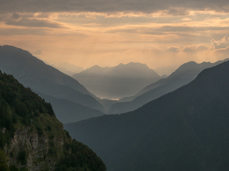
Weather patterns in the Dolomites can change rapidly, with afternoon thunderstorms common during summer months. Morning starts are essential to avoid dangerous lightning conditions on exposed ridges and passes. Temperature variations can be extreme, with summit temperatures often 15-20 degrees Celsius lower than valley conditions.
The Alta Via 1 benefits from an exceptional network of mountain refuges (rifugi) providing comfortable accommodation and excellent meals throughout the route. These facilities typically offer both dormitory-style accommodations (€40-80 per person) and private rooms (€80-120 per room), with most including breakfast and offering optional dinner service. Advance reservations are essential and bookings should be made as soon as the refuges open for booking (some take bookings as early as June for the following year, most open bookings between October and December).
Most refuges provide full evening meals featuring traditional alpine cuisine, with many specializing in local Ladin and South Tyrolean dishes. Vegetarian options are increasingly available, though advance notice is recommended. Many refuges offer half-board packages combining accommodation, breakfast, and dinner at attractive rates.
Wild camping is prohibited throughout most of the route, which passes through natural parks and protected areas. Emergency bivouacking is permitted above certain elevations, but should only be undertaken in genuine emergency situations. Several stages offer alternative accommodation in valley towns accessible via side trails, providing hotel options for those preferring more luxury.
Nearest airports/major cities:
- Venice Marco Polo Airport (150km)
- Munich Airport (200k)
- Innsbruck Airport (150k)
- Major cities: Venice offers the most direct connections to Cortina d'Ampezzo
Public transportation options:
- Venice: railway via Belluno to Cortina d'Ampezzo
- Dobbiaco or Cortina: public bus service to Lago di Braies (lake access is restricted during peak season so requires careful planning)
- Belluno: direct rail connections to Venice and other major Italian cities, with regular bus services to regional centres.
Trailhead access:
- Lago di Braies: Start from this iconic lake
- Belluno: Finish at this historic city
- Good public transport eliminates car dependency
Evacuation points and bail-out options:
- Cortina d'Ampezzo (bus and trail links)
- Lyme Regis (bus connections to Axminster station)
- Arabba (bus services)
- Alleghe (bus services)
Accommodation costs for a complete 9 day trek:
- Private rooms in refuges: €80-120 per night (€720-1,080 total)
- Dormitory accommodation in refuges: €40-80 per night (€360-720 total)
Transportation expenses:
Transportation costs vary significantly based on origin point and advance booking, with regional transport passes offering good value for multiple journeys. The South Tyrol Guest Pass, often included with accommodation bookings, provides free public transport throughout the region.Food and supplies:
- Breakfast (usually included in accommodation): €15-20 per day otherwise
- Evening meal (usually included in accommodation on half board basis): €25-30 per day otherwise
- Snacks and drinks: €12-20 per day (€108-180 total)
Additional expenses:
- Official guidebooks and maps: £35-60
- Equipment purchases/replacements: varies significantly
- Emergency fund: €300-400 recommended
Total estimated budget ranges:
- Comfort option (private rooms): €1,200-1,500
- Standard option (dormitory accommodation): €800-1500
Alta Via 1 ranks among Europe's most popular long-distance trails, attracting thousands of hikers annually from across the globe. Peak season weekends can see significant crowding at popular refuges and viewpoints, particularly around the Tre Cime area and major passes. The international hiking community creates a vibrant social atmosphere, with opportunities to meet fellow adventurers from numerous countries.
The trail attracts a diverse demographic, from experienced mountaineers to enthusiastic beginners, with ages ranging from teenagers to active seniors in their 70s and beyond. Group sizes vary from solo adventurers to organized tours, with most hikers traveling in pairs or small groups. The excellent refuge system and clear trail marking make it accessible to relatively inexperienced hikers willing to undertake proper preparation.
Cultural interactions: local communities provide enriching experiences, particularly in the German-speaking South Tyrol region and Ladin-speaking valleys. Refuge hosts often share stories of local history, traditions, and mountain culture, enhancing the cultural dimensions of the trek.
Quieter alternatives for maximum solitude:
Let our app guide you
-
Our app for going off-grid
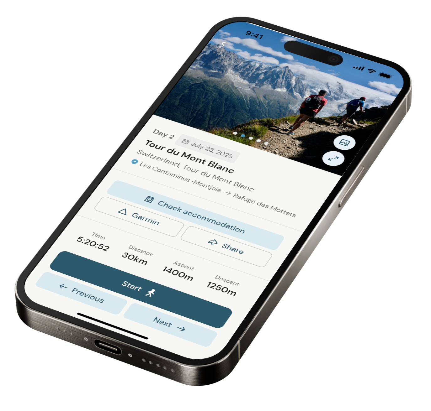
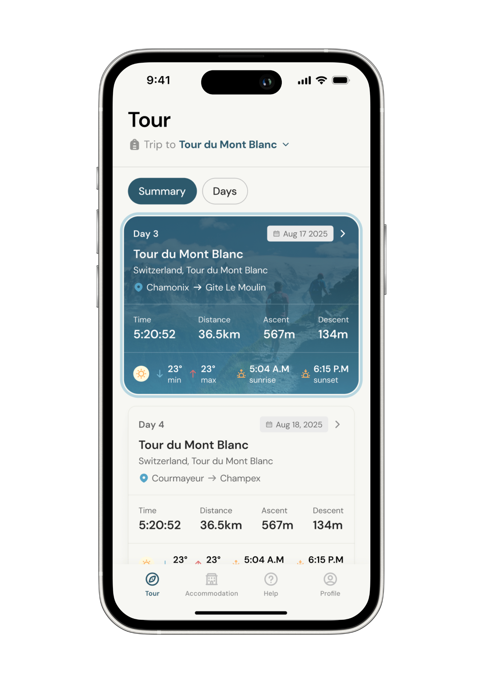
Know what to expect. Navigate with confidence. See all your details in one place.
-
Know what to expect
See al the details of your adventure in one place so you can plan each stage with confidence.
- Distance
- Ascent & descent
- The time it will take you.
- The weather forecast for each day
-
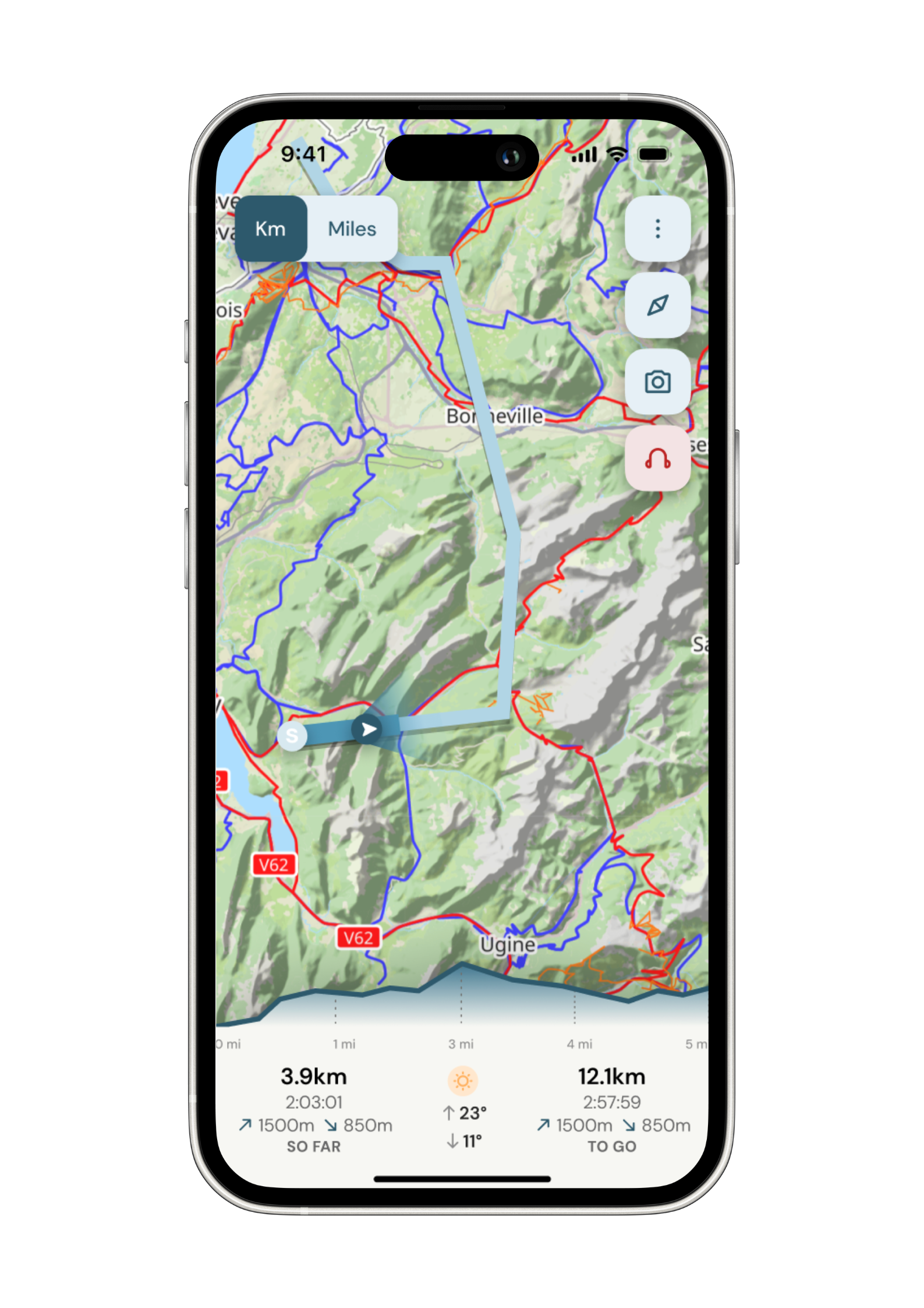
Navigate with confidence
Follow your trail on maps specifically chosen for walkers on the trail. Track your progress and get weather updates.
Need re-routing? Support is available at the click of a button.
-
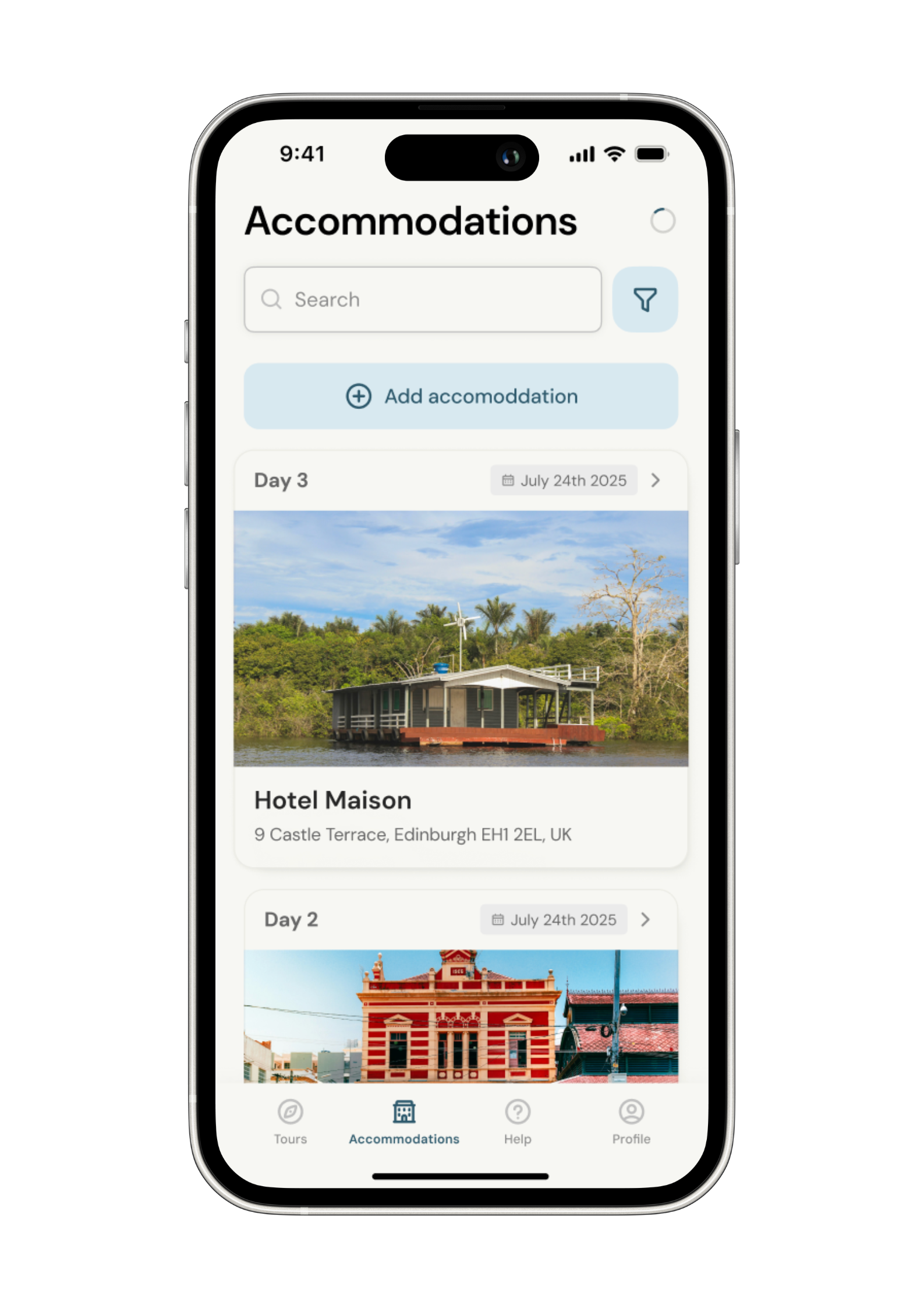
Admin. In once place.
Store all the details of your accommodation in the app alongside each stage of your adventure.
No signal, no problem. Everything is stored locally.