No video has been set for this product.
Pembrokeshire Coast Path Stage 2: Pembroke to St Davids Overview
- Stunning coastal cliffs and sea views
- Rich history with castles and chapels
- Charming villages like Solva and Freshwater East
The Pembrokeshire Coast Path, a renowned National Trail in Wales, is celebrated for its breathtaking coastal scenery, rich biodiversity, and historical significance. The section between Pembroke and St Davids is particularly special, offering a stunning mix of rugged cliffs, golden beaches, and tranquil estuaries. As part of the only coastal national park in the UK, this trail is a haven for walkers seeking dramatic landscapes and unspoiled natural beauty. Spanning 103km, this se...
| Hilliness | |
| Start Point | Pembroke |
| End Point | St Davids |
| Activity Type | Walking, Hiking, Trail Running |
| Distance | 103km | 63 miles |
| Ascent | 1,655m | 1,591m |
| When to go | May to September |
| Baggage Transfer | Yes |
Custom Adventure Plan: £79.00
Book Now
Not ready to book?
Call us on 0131 560 2740
or enquire by email
What's included?
-
Custom Adventure Plan
-
Accommodation options for you
-
Door‑to‑door GPX in our app
-
On‑trail support
-
Share with up to four people
Gallery
Sample Itinerary
Here's what's on the trail. We'll split the stages to each day just right for your pace.
The trail begins at Pembroke Castle, crossing riverside paths with castle views before heading through fields to Pembroke Dock. Here, it passes Wales’ only Royal Dockyard (est. 1814), featuring a Martello Tower and the Heritage Centre in a restored chapel. The route then climbs the Cleddau Bridge, offering stunning estuary views, before descending to Neyland, where Brunel’s statue marks his railway legacy. Passing Llanstadwell’s cottages and Hazelbeach’s Ferry House Inn, the path continues through farmland with glimpses of Pembroke and the bridge. Industrial contrasts emerge near Milford Haven’s oil refineries, blending nature and working port scenery. Finally, the trail reaches Milford Haven’s lively marina, with eateries, shops, and the Maritime Museum in the town’s oldest building. A mix of history, industry, and coastal beauty defines this walk.
The trail passes Europe’s largest LNG terminal, South Hook, before reaching Sandy Haven Estuary and a campsite. It climbs through farmland to Herbrandston, then follows roads (no pavements) to Rickeston Bridge, crossing Sandy Haven Pill’s marshes. After a descent, it rejoins the coast at Sandy Haven village.
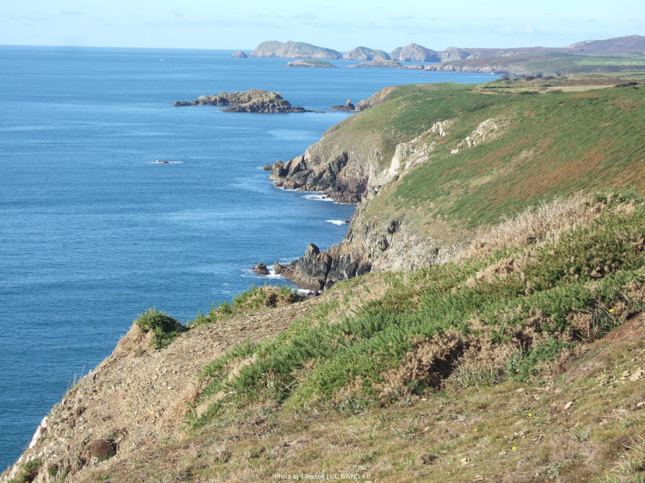
The path then traces clifftops past Iron Age hillforts at Little and Great Castle Head, offering sea views. It passes Lindsway Bay—a sandy beach visited by Queen Elizabeth II in 1955—accessible via steep steps. Further west lies Monk Haven, a sheltered stone beach with a Victorian folly tower, before dropping to Musselwick Sands.
Inland, the route mixes farmland paths and roads to reach Dale village, featuring restored limekilns, The Griffin Inn, and facilities. Finally, it continues by road toward Dale Point, blending coastal beauty with historic and industrial glimpses.
From Dale Fort, the trail traces the Dale Peninsula’s dramatic cliffs, passing Watwick Bay’s shipwrecks and West Blockhouse Point’s Victorian beacons. At Mill Bay, a plaque marks Henry Tudor’s 1485 landing before his march to Bosworth. The path then climbs past St Ann’s Head lighthouse, offering sweeping views of Milford Haven.
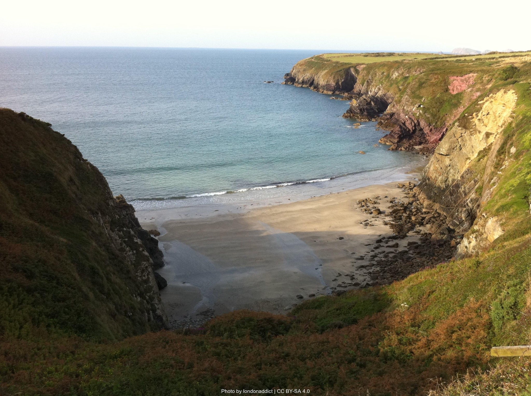
Wild, remote terrain leads to Hooper’s Point, revealing Marloes Sands—a golden beach featured in Snow White and the Huntsman. Detours offer cafés and Marloes village’s pubs. The route continues past Raggle Rocks and Gateholm Island, a tidal isle with ancient ruins, before reaching Wooltack Point—the peninsula’s western tip with panoramic coastal views.
Descending to Martin’s Haven, boats depart for Skomer Island, famous for its puffin colonies. The trail then follows gentler cliffs toward Musselwick Sands, with an optional detour to Marloes village. A mix of history, rugged scenery, and wildlife defines this spectacular stretch.
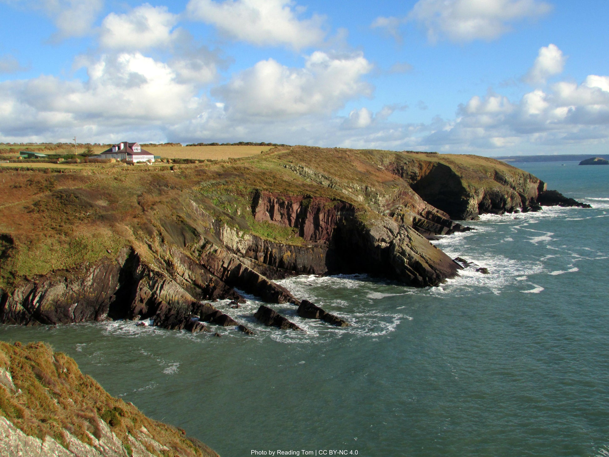
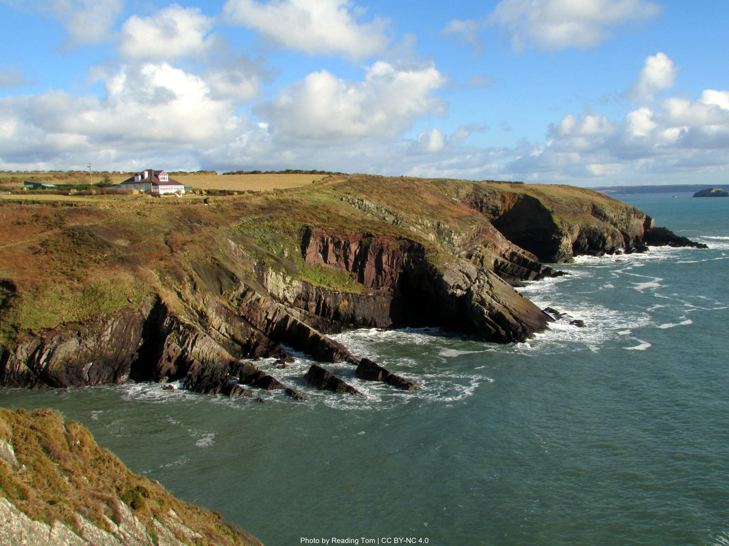
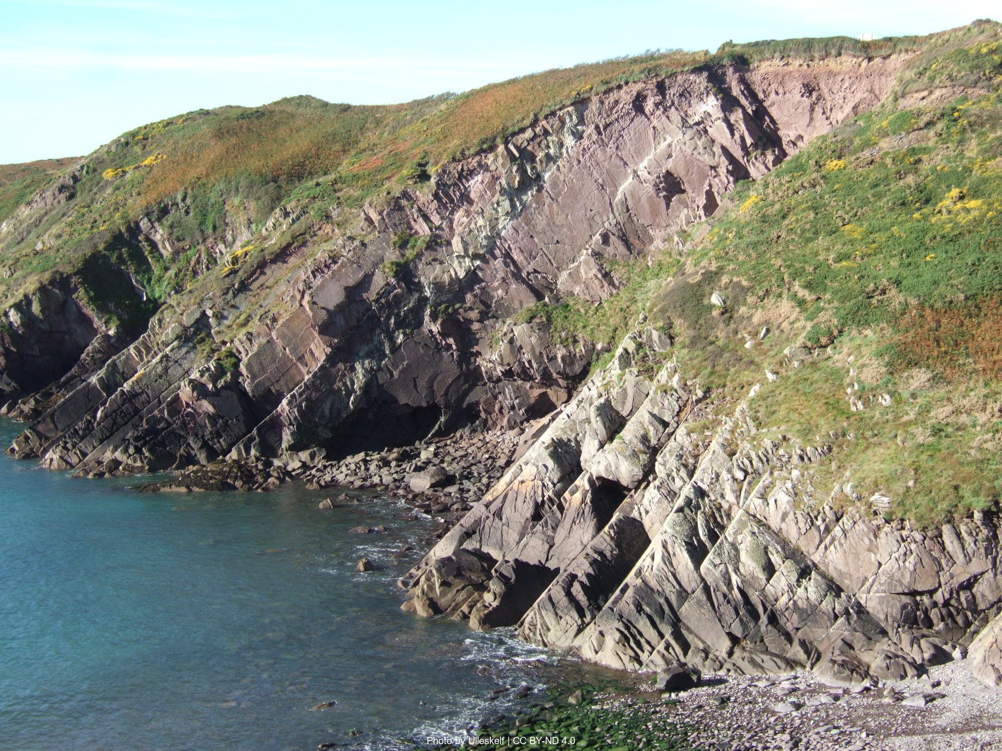
From Musselwick Sands, the trail follows clifftop grasslands past ancient sites like Tower Point’s Iron Age fort and The Nab Head’s Mesolithic remains. The route grows more dramatic as it winds around deep zawns—sheer gullies with algae-streaked red sandstone cliffs contrasting against blue waters.
St Brides Haven offers a sandy beach and restored Victorian pump house, while Mill Haven blends modern sculptures with an old lime kiln. Passing Dutch Gin and Brandy Bay, a rare beech woodland leads to charming Little Haven, home to cozy pubs like The Castle.
A steep climb to Strawberry Hill reveals sweeping St Brides Bay views before descending to Broad Haven’s sandy beach. Northward, the path traverses eroding shale cliffs, passing Sleek Stone’s tilted slab and Den’s Door’s natural arch. Above Druidston Haven, the "Teletubby house" (Malator) peeks from the hillside—a quirky finale to this mix of history, geology, and coastal drama.
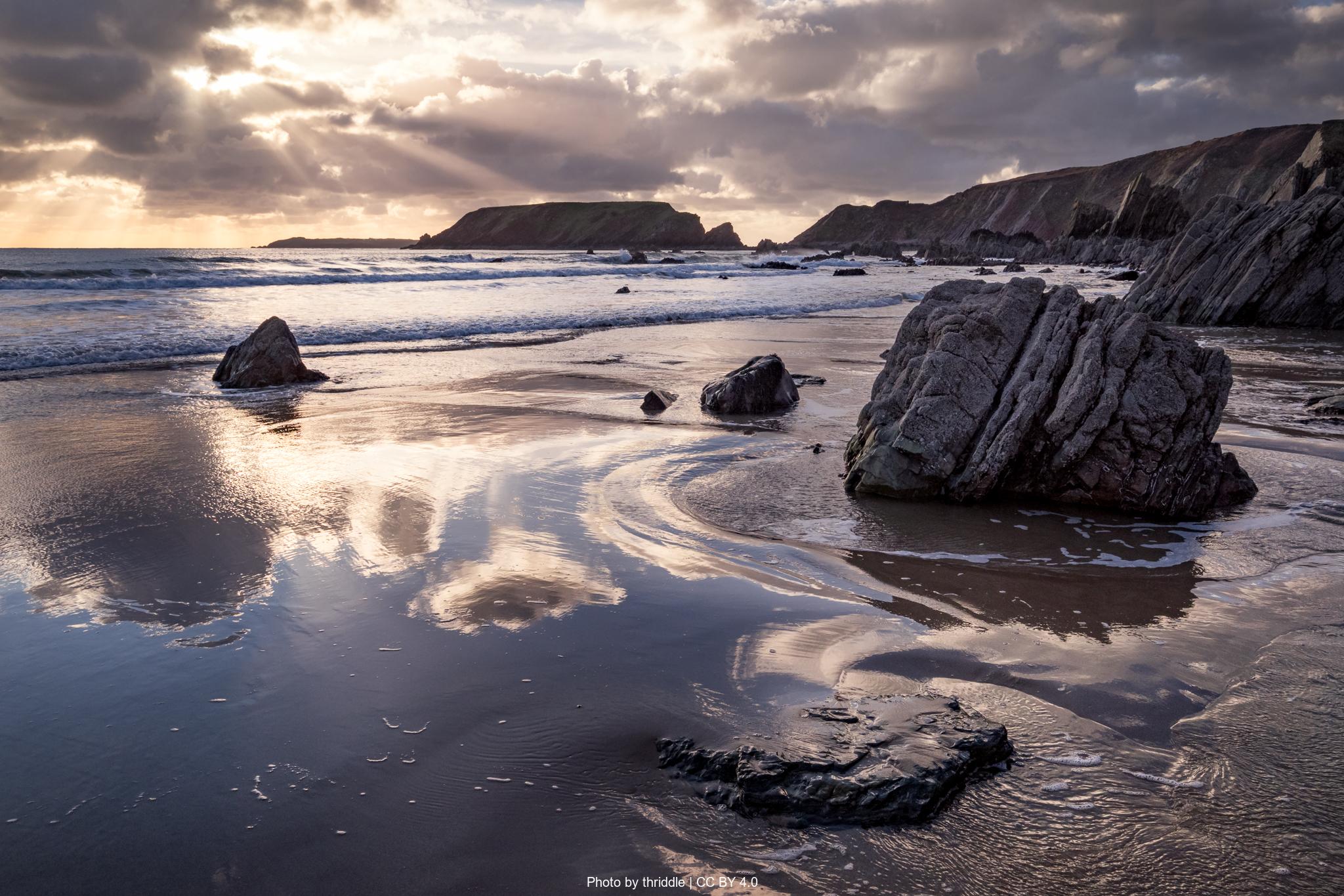
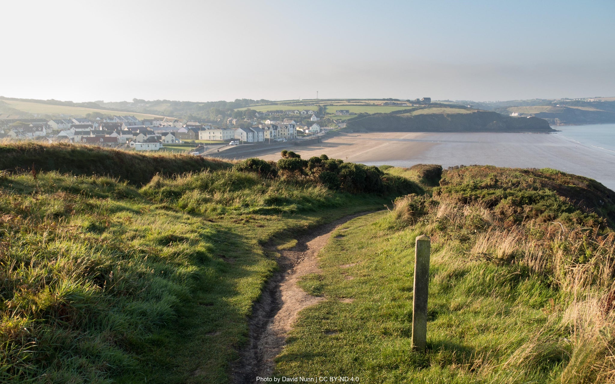
From Druidston Haven, the trail winds to Nolton Haven’s sandy beach and Mariners Inn, then climbs past Rickets Head’s sea pinnacle and a lone colliery chimney (1905). The breathtaking two-mile stretch of Newgale Sands appears—a surfer’s paradise with beachside cafés.
Beyond, the path grows wilder, descending to Porthmynawyd, often called Pembrokeshire’s most beautiful beach. A rollercoaster route leads past Dinas Fawr’s Iron Age fort and a Neolithic tomb before dropping into Solva’s picturesque harbor, packed with pubs and cafés.
Climbing west, the trail offers sweeping St Brides Bay views before reaching Caer Bwdy and Caerfai Bays, where purple sandstone cliffs—quarried for St David’s Cathedral—frame the coast. A final inland lane leads to St David’s, Britain’s smallest city, where the cathedral and Bishop’s Palace crown a journey through Pembrokeshire’s finest landscapes: golden beaches, rugged cliffs, and centuries of history.
How long will it take?
Everyone has a different approach to trails. Here are our suggested times for the Pembrokeshire Coast Path Stage 2: Pembroke to St David's for different types of adventurers.
Here we have assumed that you will be out on the trail for around 8 hours per day, including regular breaks but not extended lunch stops.

5
Days
For walkers who love the journey as much as the destination.
You enjoy full days on the trail, moving steadily, soaking up the scenery — with plenty of time for food and drink stops along the way!

4
Days
For long-distance walkers who enjoy the challenge of a steady pace over varied terrain.
You’ve got the fitness to cover strong distances over several days — this is where most keen hikers will find themselves.

3
Days
The first of our faster categories — built for those who prioritise pace.
You move quickly with minimal stops, carry just the essentials, and have the fitness to handle long days and tough terrain.

2
Days
Our fastest pace – ideal for those used to ultramarathons.
You mix fast hiking with running on flats and descents, even over mountains. Speed and efficiency matter most, with minimal stops as you aim to complete each route as quickly as possible.
Essential Travel Information
Best hiking season: May through September provides optimal conditions, with May-June and September offering the best balance of good weather and manageable crowds. The coastal location moderates temperature extremes, but exposes walkers to weather systems and strong winds.
Weather patterns and challenges: The Pembrokeshire coast experiences a maritime climate with mild winters and moderate summers. Rainfall occurs throughout the year but can be heavy, even in summer. Sea mists can develop rapidly, particularly in early morning and evening hours. Wind exposure is significant on clifftop sections.
Seasonal hazards include:
- Muddy and slippery paths after rain, particularly on exposed cliffside sections.
- Temporary closures of sections of path due to erosion or conservation work.
- Tidal crossings can affect some areas, though detours do exist.
Timing of facilities/refuge openings: Most coastal accommodations, cafes, and visitor facilities operate fully from Easter through October but smaller hostels and campsites may close from late autumn through to early spring. Plan accordingly.
The Pembrokeshire Coast Path offers exceptional accommodation variety along its length:
B&Bs/Guesthouses: £60-120 per night (double room), representing the most common and reliable option. Walker-friendly establishments typically offer packed lunch services, drying facilities, and early breakfast options.
Hotels: £120-200+ per night, available in larger coastal towns like Tenby, Milford Haven, Pembroke and St David's.
Bunkhouses/hostels: £18-40 per night (dormitory bed), strategically located at key points including Broad Haven, St Davids and Manorbier. YHA properties offer excellent walker facilities and represent outstanding value.
Bunkhouses/Hostels: £25-45 per night, basic but clean dormitory-style accommodation popular with budget-conscious walkers and groups.
Booking requirements and timing: Advance booking is absolutely essential during peak season (June-September), particularly for weekend dates and in smaller coastal villages with limited options. Book at least 4-6 months ahead for summer trips, with some popular establishments filling up to a year in advance.
Popular stopover points: Key overnight locations include Tenby, Manorbier, Pembroke, Solva, St Davids, Fishguard and St Dogmaels.
Nearest airports/major cities:
- Cardiff Airport (2 - 2.5 hours to Amroth or Pembroke)
- Bristol Airport (3 hours to Amroth or Pembroke
- Major cities: Cardiff, Bristol, Swansea (1 - 1.5 hours to Amroth or Pembroke)
Public transportation options:
- Swansea: direct service to Pembroke (frequent services)
- Cardiff: direct service to Pembroke
- Excellent bus network connects all coastal towns
Trailhead access:
- Amroth: Start from the sandy beach
- Pembroke: Finish at Pembroke town centre
- Outstanding public transport eliminates car dependency
Evacuation points and bail-out options:
- Saundersfoot (bus links)
- Tenby (train station and bus links)
- Manorbier (bus links)
- Freshwater East (bus links)
Accommodation costs for a complete 4 day trek:
- Mid-range option (B&Bs/guesthouses): £80-140 per night (£320-560 total)
- Mixed accommodation (hostels/B&Bs): £60-110 per night (£240-440 total)
- Budget option (camping/hostels): £35-65 per night (£140-260 total)
Transportation expenses:
- Return train fare to/from London: £80-150
- Local buses to accommodation off-route up to £9 per day for a pass: £36
- Baggage transfer service (optional): £100 - 150 for complete route
Food and supplies:
- Breakfast (usually included in accommodation): £0-12 per day
- Packed lunch: £6-12 per day (£24-48 total)
- Evening meal: £18-35 per day (£72-140 total)
- Snacks and drinks: £12-20 per day (£48-80 total)
Additional expenses:
- Official guidebooks and maps: £35-60
- Equipment purchases/replacements: varies significantly
- Emergency fund: £200-300 recommended
Total estimated budget ranges:
- Comfort option (B&Bs, baggage transfer, restaurant meals): £600-800
- Standard option (mixed accommodation, some baggage transfer): £400-500
- Budget option (camping/hostels, carrying own pack): £250-350
The Pembrokeshire Coast Path sees moderate to high foot traffic in summer, especially near hotspots like Tenby and St Davids. Despite its popularity, much of the path retains a peaceful, uncrowded atmosphere, especially in the northern sections or during shoulder seasons..
Quieter alternatives for maximum solitude:
- Walking in late Spring, or early Autumn
- Hiking midweek rather than weekends
- Starting very early (6-7am) to avoid crowds at popular sections
- Choosing alternative inland routes where available
- Focussing on less-touristed areas like the northern coast beyond Newport
Cultural considerations: The trail passes through Welsh-speaking communities, especially in the north. While English is widely spoken, respectful engagement with the local Welsh culture and language adds to the experience.
Typical hiker demographics: Typical hikers include UK-based walkers, solo travelers, and international nature enthusiasts. While camaraderie among trekkers is common in busier months, the trail offers ample opportunity for solitude and reflection, especially during early morning or off-peak periods.
Let our app guide you
-

Our app for going off-grid
Know what to expect. Navigate with confidence. See all your details in one place.
-

Know what to expect
See al the details of your adventure in one place so you can plan each stage with confidence.
- Distance
- Ascent & descent
- The time it will take you.
- The weather forecast for each day
-
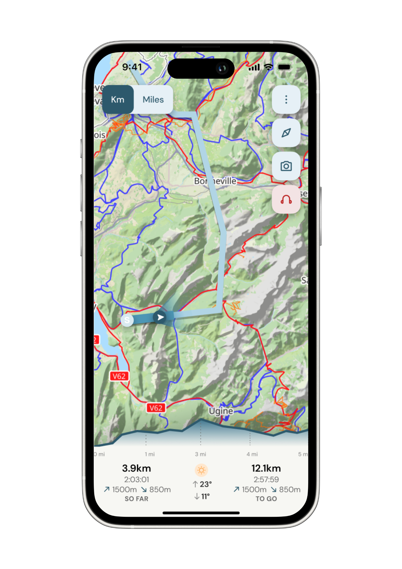
Navigate with confidence
Follow your trail on maps specifically chosen for walkers on the trail. Track your progress and get weather updates.
Need re-routing? Support is available at the click of a button.
-
Admin. In once place.
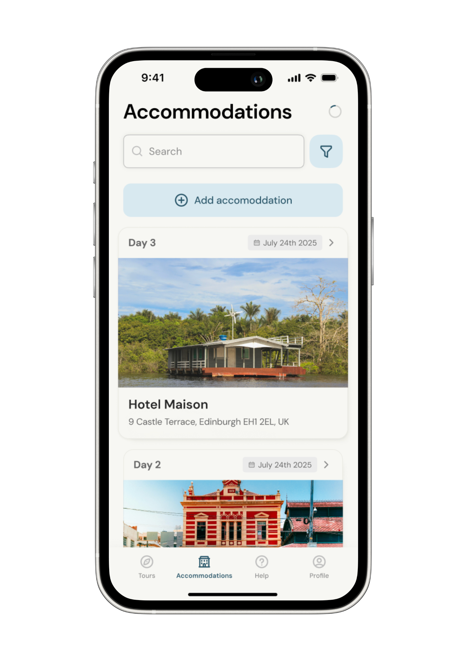
Store all the details of your accommodation in the app alongside each stage of your adventure.
No signal, no problem. Everything is stored locally.