Around Anglesey Coastal Path Overview
- Stunning coastal landscapes with diverse geology
- Rich cultural heritage spanning millennia
- Wildlife encounters along dramatic shorelines
The Anglesey Coastal Path (now part of the Wales Coast Path) traces the entirety of Anglesey's shoreline, offering one of Britain's most diverse coastal walking experiences. This 200-kilometer circuit around Wales' largest island provides an immersive journey through dramatic sea cliffs, sheltered coves, expansive beaches, and historic ports. Located off the northwest coast of mainland Wales, Anglesey (Ynys Môn in Welsh) features relatively modest elevation changes but presents challenges thr... Read more
| Hilliness | |
| Start Point | Holyhead (circular route) |
| End Point | Holyhead (circular route) |
| Activity Type | Walking, Hiking, Trail Running |
| Distance | 200km | 124 miles |
| Ascent | 4,174m | 13,694ft (cumulative) |
| When to go | May to September |
| Baggage Transfer | Available |
From £832.00
Based on a Standard Package for two people.
Build Your Adventure
Not ready to book?
Call us on 0131 560 2740
or enquire by email
What's included?
-
Custom Adventure Plan
-
Accommodation options for you
-
Door‑to‑door GPX in our app
-
On‑trail support
-
Share with up to four people
Sample Itinerary
Here's what's on the trail. We'll split the stages to each day just right for your pace.
Key Features: South Stack Lighthouse, North Stack, Holyhead Mountain
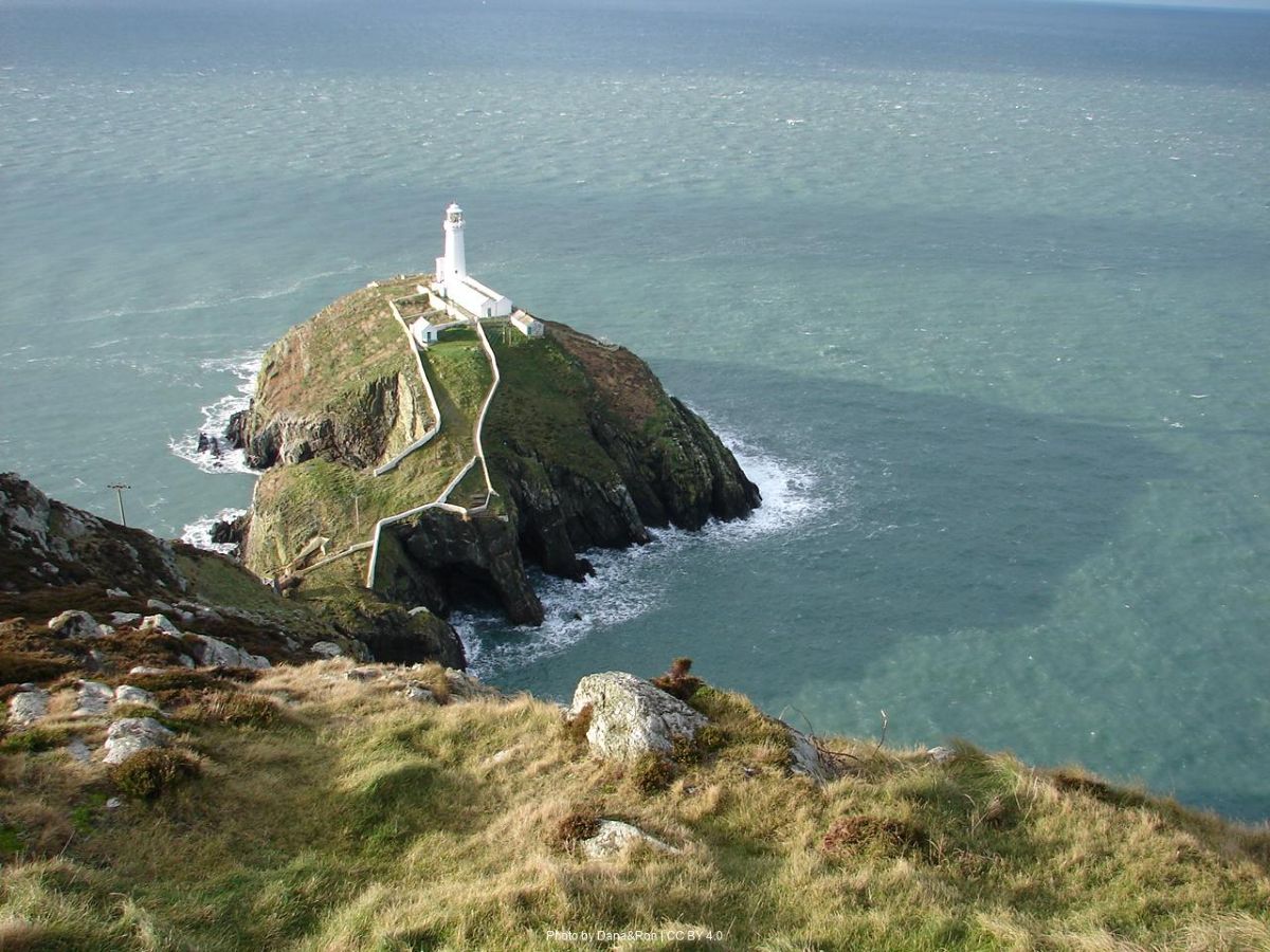
Beginning in Holyhead, Wales's second-largest port, this challenging first stage immediately immerses you in the island's rugged western coastline. The path climbs to Holyhead Mountain (220m), offering expansive views across the Irish Sea on clear days. South Stack Lighthouse, perched dramatically on its rocky islet, provides a photographer's paradise with its iconic cliff-side position. The RSPB reserve here hosts numerous seabird colonies including puffins, guillemots, and razorbills from April to July.
The terrain alternates between well-maintained coastal paths and rougher sections requiring careful footing along clifftops. After North Stack, the path follows more moderate gradients past Porth Dafarch beach before reaching the picturesque fishing village of Church Bay (Porth Swtan). Here you'll find the last remaining thatched cottage on Anglesey, now preserved as a folk museum displaying traditional island life. Water is available at South Stack visitor center and in Church Bay village, where The Lobster Pot restaurant offers renowned seafood if you're not carrying provisions.
Key Features: Cemlyn Bay Nature Reserve, Wylfa Head, Porth Padrig
From Church Bay, the path provides consistent coastal views as it winds eastward past remote bays. The highlight of this stage is Cemlyn Bay Nature Reserve, recognized for its spectacular curved shingle beach and lagoon. Between May and July, the reserve hosts one of the UK's largest breeding colonies of Sandwich terns, with Arctic and common terns also present. The distinctive rattling calls create an impressive natural soundtrack as you traverse this protected landscape.
Beyond Cemlyn, you'll skirt around Wylfa Head with views of the decommissioned nuclear power station – an industrial contrast to the natural surroundings. The path then alternates between field-edge paths and rocky shoreline until reaching the charming village of Cemaes Bay, Anglesey's most northerly settlement. The sheltered harbor offers a welcome rest point with several cafés and pubs. St Patrick's Cave near Porth Padrig marks where the patron saint of Ireland supposedly landed after being shipwrecked. Water and supplies are available in Cemaes Bay, which features a small supermarket, public toilets, and accommodation options including The Harbour Hotel and several B&Bs.
Key Features: Bull Bay, Porth Wen Brickworks, Llanlleiana Head
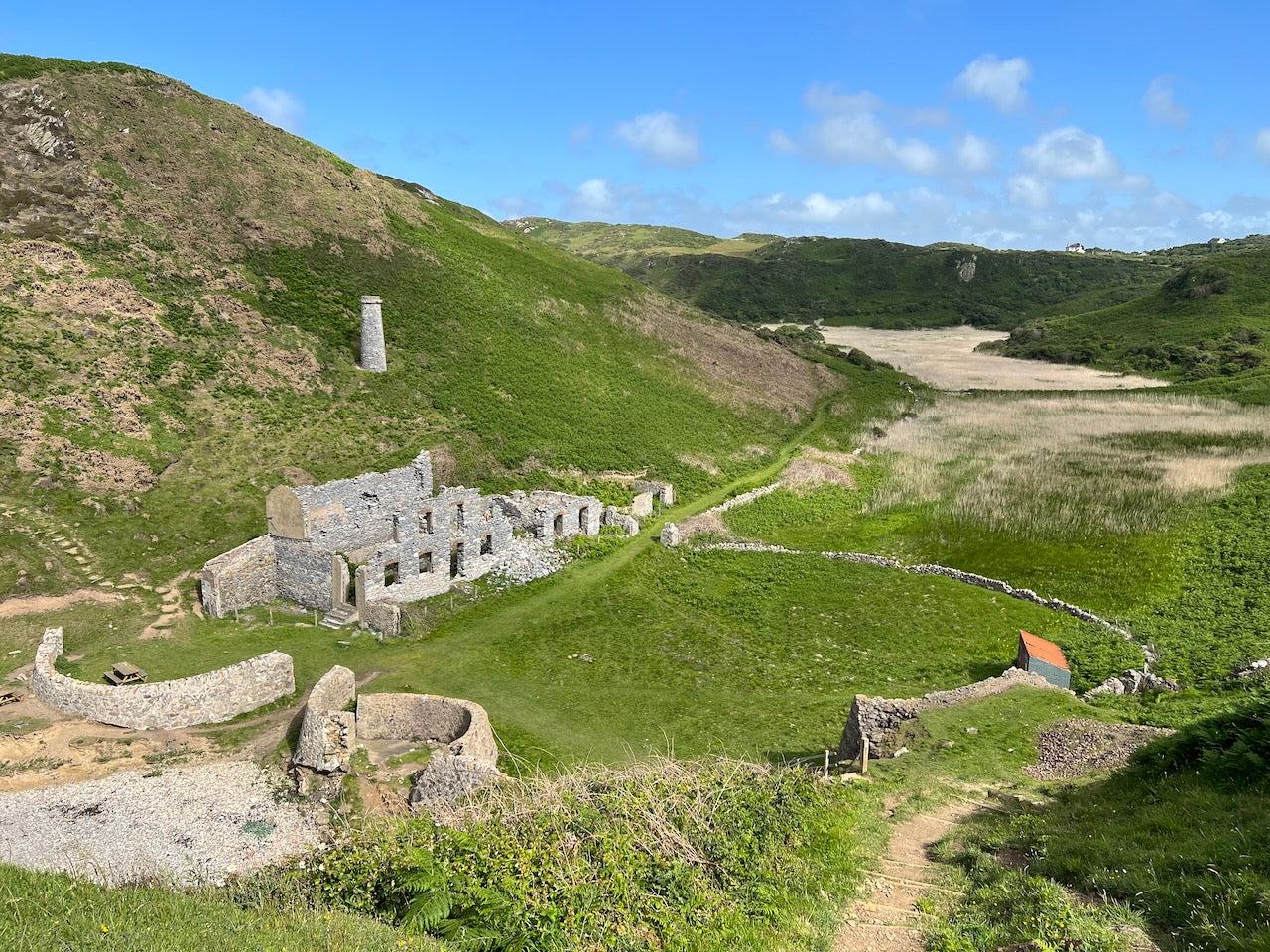
This section traverses Anglesey's more remote northern coastline, characterized by dramatic cliff formations and industrial heritage. Leaving Cemaes, the path climbs steadily to provide spectacular views across Bull Bay (Porth Llechog) before descending to this small fishing community. The terrain becomes increasingly challenging as you approach Porth Wen, where the abandoned Victorian brickworks stands as a hauntingly beautiful industrial ruin. The distinctive beehive kilns and harbor remain remarkably intact, offering fascinating exploration and photography opportunities.
Continuing east, you'll reach Llanlleiana Head, Anglesey's northernmost point, marked by an old porcelain works. The coastal landscape here features some of the island's most dramatic geology, with folded rock formations displaying vivid colors. After navigating several steep ascents and descents, the route brings you to the historic port town of Amlwch, once the world's largest copper-producing center. The Copper Kingdom visitor center provides insight into this industrial past. Water and supplies are readily available in Amlwch, which offers several pubs, shops, and accommodation options including The Liverpool Arms and various guest houses.
Key Features: Point Lynas Lighthouse, Dulas Bay, Traeth Lligwy
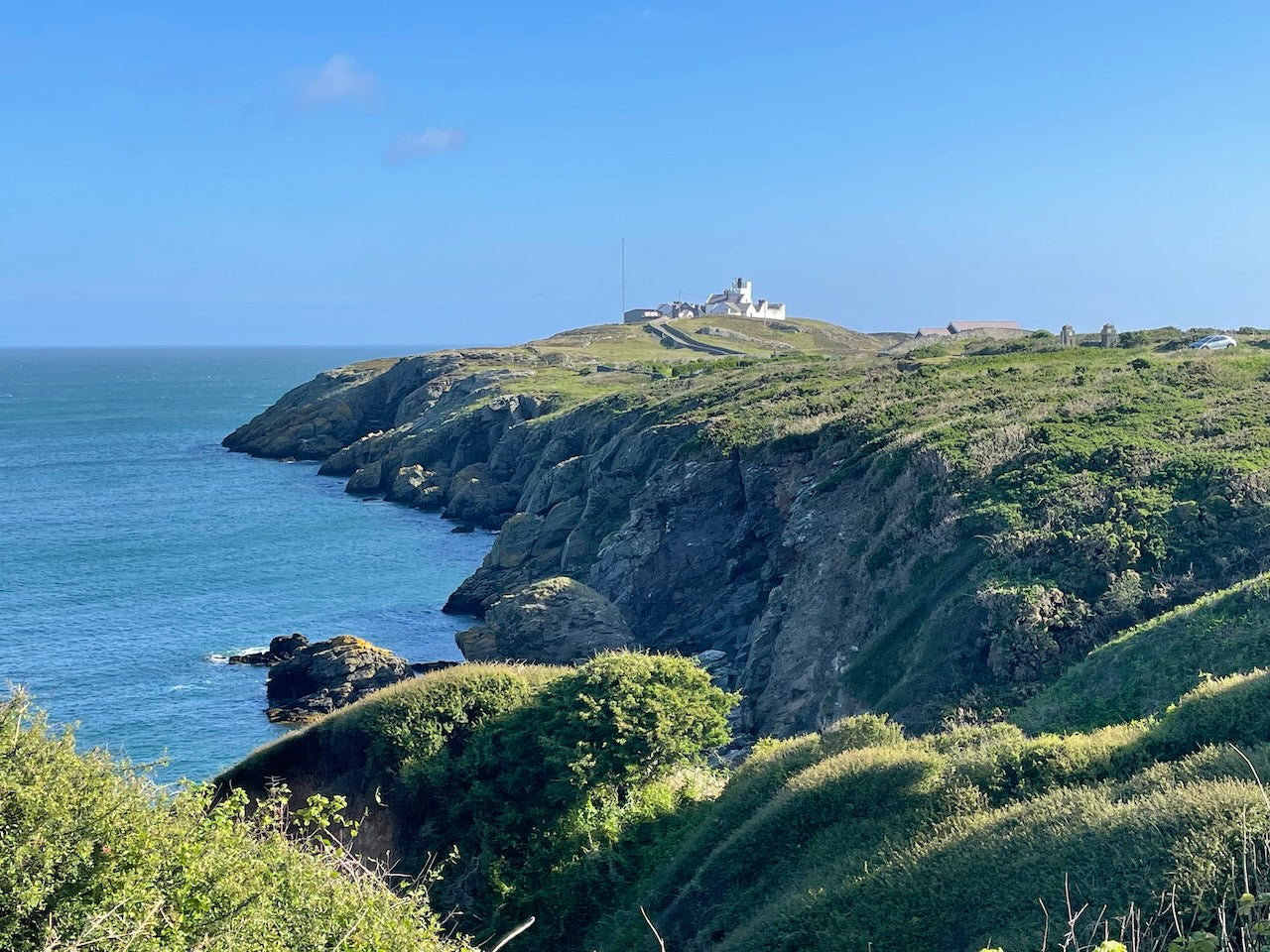
Departing Amlwch, this stage begins with a rugged coastal section leading to Point Lynas Lighthouse, an active navigation aid offering spectacular panoramic views. The path then follows more moderate terrain with alternating cliff-top walking and field-edge paths as it traces the northeast coastline. At Dulas Bay, notice the distinctive red-painted hut on a small island – originally built as cholera hospital and later used as a refuge for shipwrecked sailors, highlighting the treacherous maritime history of this coast.
The route then passes the expansive sandy beach of Traeth Lligwy, a popular spot for families and water sports enthusiasts. Archaeological enthusiasts will appreciate the proximity to Din Lligwy Ancient Settlement, a short detour inland offering remains of a late Roman-era enclosed village. The path continues to the picturesque fishing village of Moelfre, renowned for its seafaring heritage and heroic lifeboat rescues. The Seawatch Centre details the famous 1859 Royal Charter storm disaster and subsequent rescues. Water and refreshments are available at The Kinmel Arms pub and Ann's Pantry café, with several B&Bs and self-catering cottages offering overnight accommodation.
Key Features: Red Wharf Bay, Traeth Bychan, Coastal Woodlands
This more gentle stage showcases Anglesey's eastern beaches and bays with relatively moderate terrain. From Moelfre, the path follows clifftops offering views towards Puffin Island and the Great Orme before descending to the peaceful cove of Traeth Bychan. The route then traverses a rare section of coastal woodland providing welcome shade on summer days, with seasonal wildflowers including bluebells in spring and red campion through summer.
The highlight of this stage is the vast expanse of Red Wharf Bay (Traeth Coch), where at low tide over 10 square kilometers of sand are exposed. This dramatic tidal range creates an ever-changing landscape and has historically been the site of numerous shipwrecks. The bay's rich mudflats attract abundant birdlife, particularly waders and wildfowl during migration periods. The path skirts the bay's northern edge before reaching Benllech, one of Anglesey's most popular seaside resorts with its broad, sandy beach. Numerous facilities are available here, including supermarkets, pharmacies, restaurants, and various accommodation options from the Breeze Hill Hotel to holiday apartments and campsites. This stage offers frequent water access points and refreshment opportunities.
Key Features: Penmon Point, Penmon Priory, Puffin Island views
Leaving Benllech, this varied stage initially follows easy terrain past sandy beaches before becoming more challenging as it rounds the island's eastern peninsula. After passing through Llanddona with its expansive beach, the path climbs significantly to headlands offering spectacular views across the Menai Strait towards the mountains of Snowdonia. On clear days, the panorama extends from Conwy Castle to Bardsey Island.
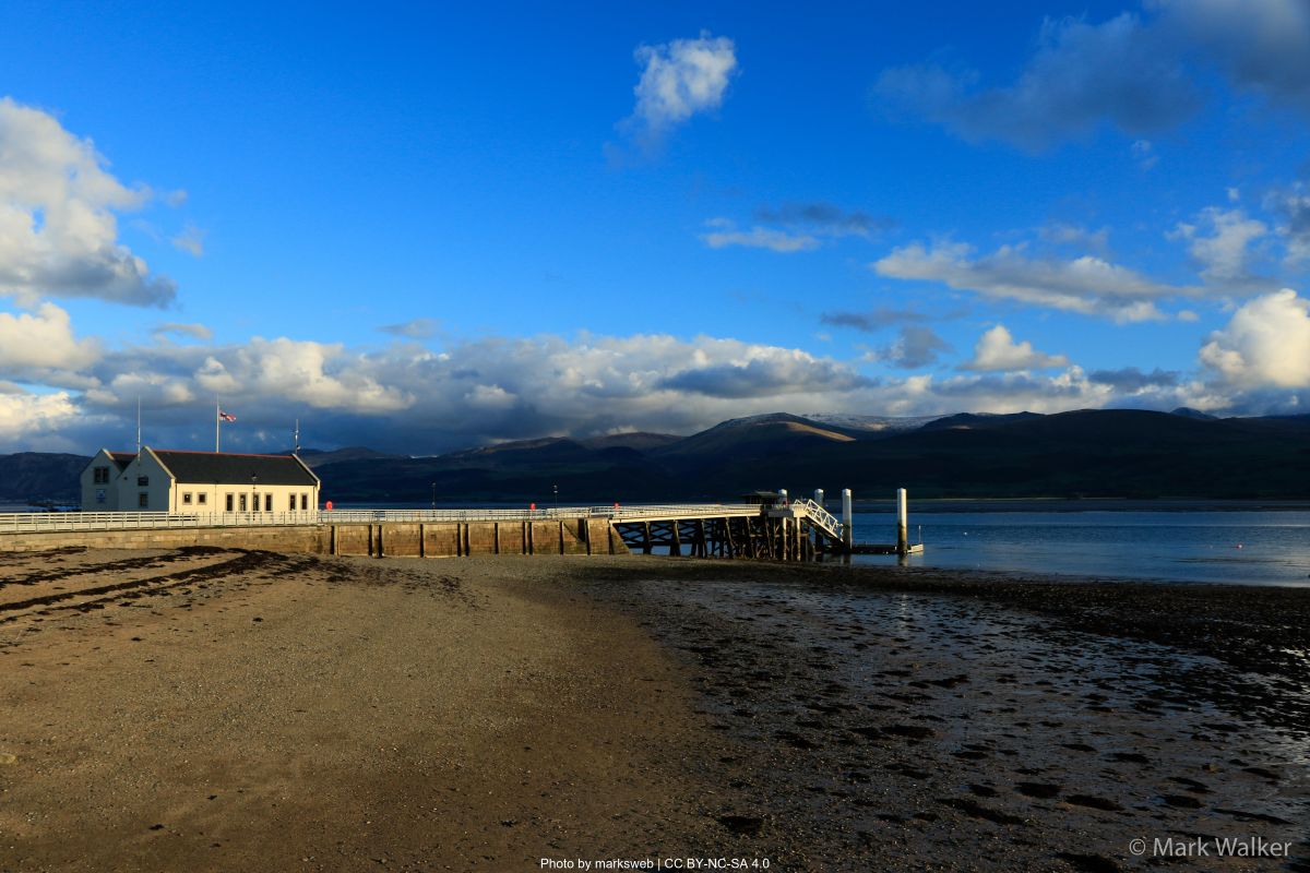
The historical highlight is Penmon Point, where you'll find the photogenic medieval Penmon Priory with its 13th-century church and ancient holy well. The striped Trwyn Du Lighthouse stands guard between the mainland and Puffin Island (Ynys Seiriol), an important seabird sanctuary where Atlantic puffins nest alongside guillemots, razorbills, cormorants, and a colony of grey seals. The final stretch follows the Menai Strait to Beaumaris, a handsome town dominated by its unfinished but impressive 13th-century castle, a UNESCO World Heritage Site. Water and supplies are available at the Pilot House café at Penmon Point and extensively in Beaumaris, which offers numerous accommodation options from the historic Bull's Head Inn and Bulkeley Hotel to guest houses and self-catering options.
Key Features: Menai Strait, Church Island, Menai Suspension Bridge
This stage showcases the Menai Strait, the narrow channel separating Anglesey from mainland Wales, with its strong tidal currents and historic crossings. From Beaumaris, the path follows the shoreline closely, providing continuous views across to Snowdonia. The relatively flat terrain makes for easier walking, although sections through woodland can become muddy after rain. At low tide, extensive mudflats attract wading birds including curlews, oystercatchers, and redshanks.
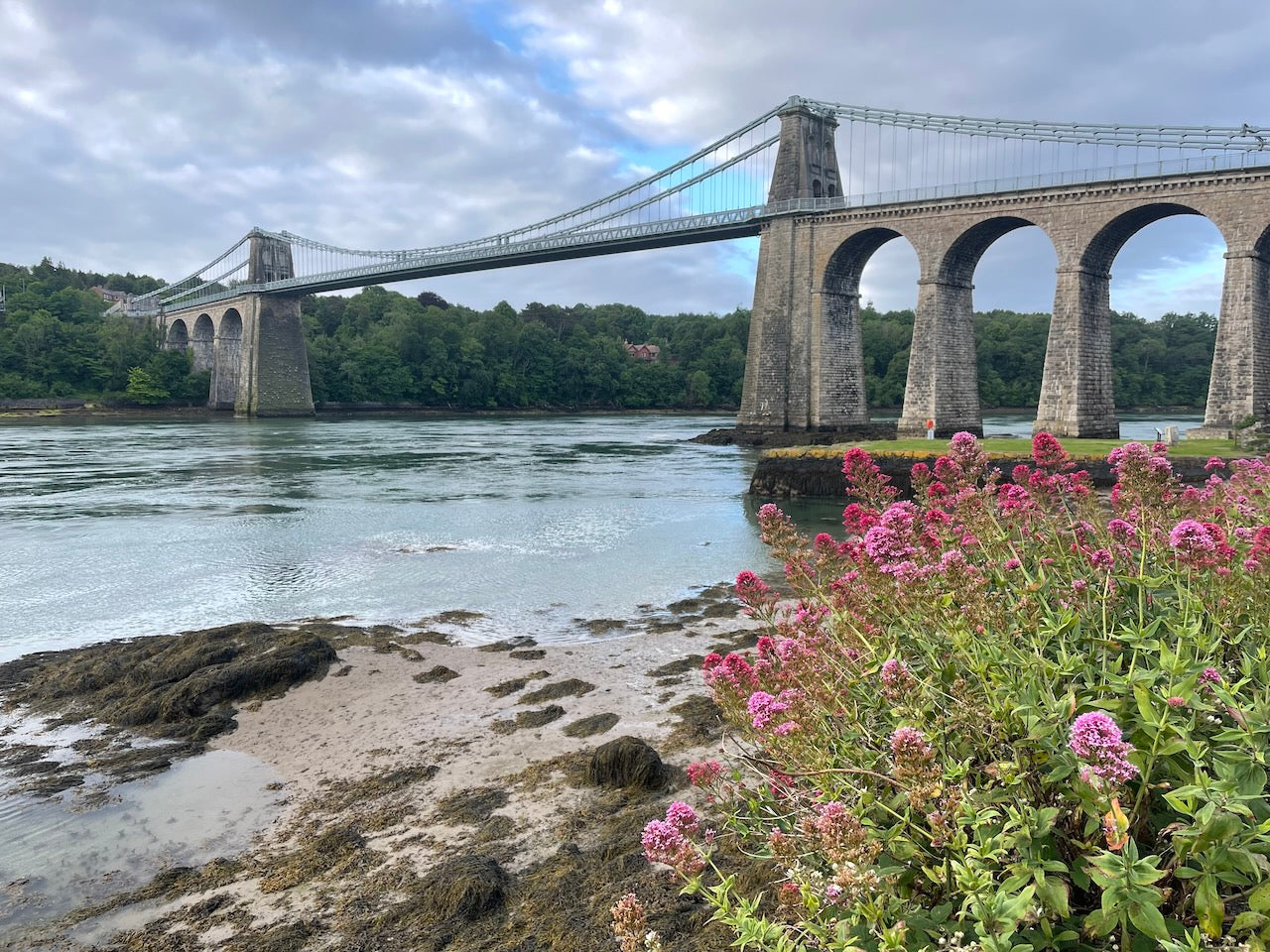
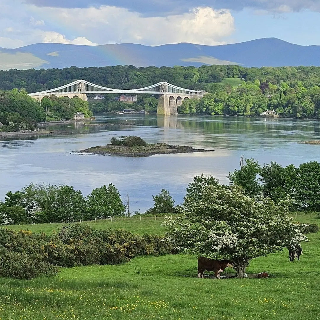
Approaching Menai Bridge town, you'll encounter Church Island, accessible via causeway, featuring the 6th-century St Tysilio's Church in a tranquil setting overlooking the water. The route then passes beneath Thomas Telford's magnificent Menai Suspension Bridge, completed in 1826 as the world's first modern suspension bridge. Take time to appreciate this engineering marvel from various vantage points along the shore. The town of Menai Bridge offers numerous amenities including cafés, restaurants, and shops. Accommodation options include the Anglesey Arms Hotel and various B&Bs. Water and refreshments are readily available throughout this stage at regular intervals, with several shoreline pubs including the popular Liverpool Arms offering meals with waterfront views.
Key Features: Bryn Celli Ddu, Newborough Forest, Llanddwyn Island
This longer stage transitions from the Menai Strait to Anglesey's southwestern shores, offering diverse landscapes. After passing beneath the impressive Britannia Bridge, the path temporarily heads inland through pastoral countryside before rejoining the coast at the Anglesey Sea Zoo. A worthwhile short detour brings you to Bryn Celli Ddu, one of Britain's best-preserved Neolithic passage tombs dating from around 3000 BCE, with a chamber aligned to capture the midsummer sunrise.
The route continues through Newborough Forest, planted in the 1950s to stabilize sand dunes. This mixed woodland hosts red squirrels, one of few places in Wales where these native mammals thrive. Emerging onto Newborough Beach reveals a vast expanse of sand leading to Llanddwyn Island (accessible except at highest tides), featuring a ruined chapel dedicated to St Dwynwen, the Welsh patron saint of lovers. The iconic lighthouse and pilot cottages here offer superb views towards Snowdonia across Caernarfon Bay. Water is available at the Marram Grass café near Newborough village and at the forest car park (seasonal). Accommodation options are limited to The Outbuildings boutique rooms near Llangaffo and camping at Awelfryn Caravan Park, making advance planning essential for this section.
Key Features: Aberffraw Dunes, RAF Valley, Broad sandy beaches
This stage showcases Anglesey's southwestern coastline with its extensive dune systems and broad beaches. From Newborough, the path follows the edge of Malltraeth Marsh, an important wetland habitat for waterfowl, before crossing the river via a sluice gate bridge. Reaching the historic village of Aberffraw, once a seat of Welsh princes, you'll traverse one of Wales' largest dune systems with its fragile ecosystem of rare plants including marsh helleborine orchids and dune gentian.
The route passes RAF Valley air base, where you might witness training flights of Hawk jets. After rounding Rhoscolyn Head with its distinctive white beacon, the terrain becomes more challenging with several rocky headlands before reaching the popular resort of Rhosneigr. Known for watersports, particularly windsurfing and kitesurfing, the village offers excellent beaches flanking its central area. Water and supplies are available in Aberffraw (The Crown Inn and village shop) and extensively in Rhosneigr, which features several cafés, restaurants, and shops. Accommodation options include The Oyster Catcher restaurant with rooms, Chapels self-catering cottages, and various B&Bs. This stage requires attention to tide times, particularly around Aberffraw estuary.
Key Features: Holy Island, Trearddur Bay, Holyhead Mountain views
The final stage completes the circuit, with sections along Holy Island offering some of the path's most dramatic coastal scenery. From Rhosneigr, the route initially follows sandy terrain past RAF Valley before crossing the Stanley Embankment onto Holy Island. The path becomes increasingly rugged as it approaches the popular resort of Trearddur Bay with its golden sand beaches and rocky inlets.
Beyond Trearddur, the coastal scenery grows more dramatic with the terrain becoming significantly more challenging as you traverse rocky headlands with substantial ascents and descents. At Penrhyn Mawr, powerful tidal currents create impressive whirlpools and standing waves popular with expert sea kayakers. The route offers continuous views of South Stack lighthouse and Holyhead Mountain before finally returning to Holyhead through the RSPB reserve, where you can celebrate completing the full circuit. Water and supplies are available at Trearddur Bay (The Sea Shanty café, village shop) and in Holyhead town, which offers numerous accommodation options including The Boathouse Hotel, ferry terminal hotels, and guest houses. This challenging final stage rewards with some of the most spectacular scenery of the entire route.
How long will it take?
Everyone has a different approach to trails. Here are our suggested times for the Round Anglesey Coastal Path for different types of adventurers.
Here we have assumed that you will be out on the trail for around 8 hours per day, including regular breaks but not extended lunch stops.

11
Days
For walkers who love the journey as much as the destination.
You enjoy full days on the trail, moving steadily, soaking up the scenery — with plenty of time for food and drink stops along the way!

9
Days
For long-distance walkers who enjoy the challenge of a steady pace over varied terrain.
You’ve got the fitness to cover strong distances over several days — this is where most keen hikers will find themselves.

6
Days
The first of our faster categories — built for those who prioritise pace.
You move quickly with minimal stops, carry just the essentials, and have the fitness to handle long days and tough terrain.

4
Days
Our fastest pace – ideal for those used to ultramarathons.
You mix fast hiking with running on flats and descents, even over mountains. Speed and efficiency matter most, with minimal stops as you aim to complete each route as quickly as possible.
Build Your Adventure
Book by phone
Essential Travel Information
The Anglesey Coast Path offers year-round hiking possibilities, but the optimal window falls between May and September when daylight hours are longest and weather conditions most favorable. Spring (May-June) brings wildflower displays including coastal thrift and orchids, while avoiding peak summer crowds. July and August offer warmest temperatures (averaging 15-20°C/59-68°F) but coincide with school holidays when popular beaches become crowded.
Weather patterns can change rapidly on this exposed coastal route, with prevailing southwesterly winds bringing frequent rain showers even in summer. Winter hiking (November-February) is possible for experienced walkers but presents challenges including shorter daylight hours, stronger winds (occasionally gale-force), and reduced service availability. The path remains relatively snow-free compared to mainland mountains but can become treacherously muddy in sections.
Key seasonal hazards include summer adder (snake) presence in heathland areas, though bites are extremely rare, and autumn storms that can make exposed headlands dangerous. Tidal sections require careful planning year-round, particularly around Llanddwyn Island, Aberffraw estuary, and sections near Penmon Point.
Most visitor facilities operate from Easter through October, with reduced winter operations. The RSPB South Stack visitor center typically opens daily April-September but has weekend-only winter openings.
The Anglesey Coast Path offers diverse accommodation, though pre-booking is essential during summer months. The route passes through towns and villages at regular intervals, with few sections requiring more than 25km between accommodation options.
Types available:
- Hotels: Primarily in larger settlements (Holyhead, Beaumaris, Menai Bridge) ranging from 3-4 star establishments
- B&Bs/Guesthouses: The most prevalent option, available in most coastal villages
- Self-catering cottages: Abundant but typically require minimum 3-night stays
- Campsites: Well-distributed around the island, ranging from basic farmer's fields to fully-serviced sites
- Bunkhouses: Limited options include Anglesey Outdoors near Holyhead
Booking requirements:
- Advance booking is strongly recommended, especially for:
- July-August period: Book 3-6 months ahead
- Weekends May-September: Book 1-3 months ahead
- Off-season accommodations: Book 2-4 weeks ahead when possible
Price ranges (2025 estimates):
- Budget: £25-35 per person for camping/bunkhouses
- Mid-range: £65-95 per night for B&Bs and guesthouses
- Premium: £100-180 per night for hotels and quality self-catering
Popular stopover points:
- The following locations offer the best combination of accommodation options and services:
- Holyhead: All types, wide price range
- Trearddur Bay: Family-focused accommodations, mid-range pricing
- Cemaes Bay: Several B&Bs and self-catering options, moderate prices
- Amlwch: Limited but adequate options including The Sail Loft and Liverpool Arms
- Moelfre: Smaller B&Bs with maritime themes, mid-range pricing
- Benllech: Family-oriented accommodations, higher summer pricing
- Beaumaris: Historic coaching inns to boutique B&Bs, premium pricing
- Menai Bridge: Mid-range options with strait views
- Rhosneigr: Water sports-oriented accommodations, premium summer pricing
Anglesey is well-connected to the UK transportation network despite its island location, with several access options available.
Nearest major transportation hubs:
- Holyhead Ferry Port: Direct ferries to Dublin (Ireland)
- Bangor Train Station (mainland): Direct services to London (3.5 hours), Manchester (2 hours), and Cardiff (4 hours)
- Manchester Airport: Nearest major international airport (2-hour drive)
- Liverpool Airport: Alternative international option (2.5-hour drive)
Public transportation options:
- Trains: The North Wales Coast Line serves Holyhead, Valley, Rhosneigr, and Bodorgan stations
- Buses: Anglesey maintains a reasonable bus network with services connecting major coastal settlements via routes 4, 42, 43, 53, and 62
- Taxis: Available in larger towns but best pre-booked, especially for rural areas
Trailhead access:
As a circular route, Holyhead makes the most practical starting point due to its excellent transportation connections. Alternative starting points with public transport access include:
- Amlwch (bus routes 42/62)
- Beaumaris (bus route 53/X4)
- Menai Bridge (bus routes 42/53/X4)
- Rhosneigr (train station)
Evacuation points and bail-out options:
The coastal nature of the path provides regular access points to roads and settlements, making emergency evacuation relatively straightforward. Key bail-out locations include:
- Valley (train station, 5km from Four Mile Bridge)
- Benllech (regular buses to Bangor)
- Beaumaris (frequent buses to Bangor)
- Newborough (bus connections to Llangefni, then onward to Bangor)
- Multiple road access points for taxi evacuation
A 10-day circuit of the Anglesey Coast Path represents a relatively affordable long-distance walking option compared to premium European routes.
Accommodation costs (daily averages):
- Budget approach (camping/hostels where available): £25-40 per person
- Standard approach (mix of B&Bs/guesthouses): £70-90 per person
- Premium approach (hotels/quality guesthouses): £110-150 per person
Transportation expenses:
- UK rail travel to/from Holyhead: £30-120 depending on advance booking
- Local buses for resupply detours: £2-4 per journey
- Taxi services for baggage transfers: £15-25 per stage
Food and supplies:
- Self-catering/picnic approach: £15-25 daily
- Café lunches with evening pub meals: £30-45 daily
- Restaurant dining: £45-70 daily
- Water: Freely available at regular intervals
Additional fees:
- Baggage transfer services: £8-12 per bag per stage
- Attractions (optional):
- Beaumaris Castle: £9.50
- Penmon Priory: £3 (parking charge)
- South Stack Lighthouse tours: £6.50
Total 10-day budget estimates:
- Budget approach: £550-750 per person
- Standard approach: £950-1,250 per person
- Premium approach: £1,400-1,900 per person
The Anglesey Coast Path experiences varying levels of foot traffic throughout the year, with distinct patterns worth noting for planning purposes.
Peak seasons and crowding:
- Late July through August sees heaviest trail use, particularly around popular beaches (Trearddur Bay, Benllech, Newborough)
- Bank holiday weekends (May and August) bring significant day-walker numbers to accessible sections
- The western sections (South Stack area) receive highest visitor numbers year-round due to proximity to Holyhead
Quieter alternatives:
- Mid-week hiking outside school holidays ensures minimal trail congestion
- The northern sections between Bull Bay and Amlwch remain relatively quiet even in peak season
- Early May and late September offer excellent weather possibilities with significantly reduced visitor numbers
Cultural considerations:
- Anglesey maintains strong Welsh cultural identity with approximately 57% of residents speaking Welsh
- Learning basic Welsh phrases is appreciated by locals, particularly in northern villages
- Rural communities maintain traditional farming practices; respect by sticking to paths and closing gates
- Maritime heritage remains important, with active RNLI lifeboat stations in several communities
Typical hiker demographics:
- The full circuit attracts primarily experienced hikers aged 35-65
- Popular day sections see diverse use including families and casual walkers
- International visitors comprise approximately 15% of long-distance hikers, primarily from Germany, Netherlands, and USA
- The path sees increasing numbers of trail runners completing the circuit in 3-5 days
Opportunities for solitude:
- The northeastern coastline between Point Lynas and Moelfre offers the most consistent solitude
- Early morning starts (before 8am) provide peaceful walking even in popular sections
- Winter hiking outside holiday periods virtually guarantees solitary walking
- The tidal mudflats around Malltraeth and Red Wharf Bay offer surprisingly meditative walking experiences away from the main path

